Category:Churbashskaya
Jump to navigation
Jump to search
| Object location | | View all coordinates using: OpenStreetMap |
|---|
Русский: ru:Чурбашская
Українська: uk:Чюрюбаш (річка)
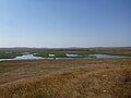
arroyo in Crimea  | |||||
| Upload media | |||||
| Instance of | |||||
|---|---|---|---|---|---|
| Location | |||||
| Length |
| ||||
| Mouth of the watercourse | |||||
 | |||||
Media in category "Churbashskaya"
The following 8 files are in this category, out of 8 total.
-
 Churbash 1.jpg 2,560 × 1,920; 2.76 MB
-
 Churbash 2.jpg 2,560 × 1,920; 2.78 MB
-
 Churbashskaya 1.jpg 4,160 × 3,120; 4.64 MB
-
 Churbashskaya 2.jpg 4,160 × 3,120; 4.96 MB
-
 ВерхнийМихайловский пруд 1.jpg 2,560 × 1,920; 2.76 MB
-
 ВерхнийМихайловский пруд 2.jpg 2,560 × 1,920; 2.83 MB
-
 ВерхнийМихайловский пруд 3.jpg 2,560 × 1,920; 2.8 MB
-
 ВерхнийМихайловский пруд 4.jpg 2,560 × 1,920; 2.8 MB


