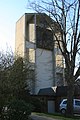
Category:Christkönig (Hemer)
Jump to navigation
Jump to search
| Object location | | View all coordinates using: OpenStreetMap |
|---|
church  | |||||
| Upload media | |||||
| Instance of | |||||
|---|---|---|---|---|---|
| Named after | |||||
| Location | Hemer, Märkischer Kreis, Arnsberg Government Region, North Rhine-Westphalia, Germany | ||||
| Architect |
| ||||
| Inception |
| ||||
 | |||||
Media in category "Christkönig (Hemer)"
The following 4 files are in this category, out of 4 total.
-
 Christ Koenig Church Hemer.JPG 2,592 × 3,888; 4.53 MB
-
 Christ König Church - panoramio.jpg 1,296 × 1,944; 864 KB
-
 Hemer-Christkoenig1-Asio.JPG 1,858 × 2,516; 1.06 MB
-
 Hemer-Christkönig1-Asio.jpg 3,271 × 2,472; 1.39 MB


