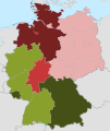
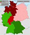
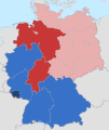
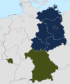
Category:Christian distribution maps of Germany
Jump to navigation
Jump to search
Subcategories
This category has only the following subcategory.
Media in category "Christian distribution maps of Germany"
The following 17 files are in this category, out of 17 total.
-
HolyRomanEmpire 1618 russian.png 4,005 × 3,967; 3.41 MB
-
HolyRomanEmpire 1618.png 4,005 × 3,964; 3.69 MB
-
Verbreitung der Konfessionen im deutschen Reich.jpg 3,160 × 2,547; 6.69 MB
-
Lange diercke sachsen deutschland bekenntnisse.jpg 1,256 × 1,054; 506 KB
-
Konfessionen-in-Deutschland.svg 1,343 × 1,591; 641 KB
-
Religion map germany 2008 k.png 1,405 × 1,845; 395 KB
-
Konfessionen-in-deutschland.png 1,000 × 1,184; 183 KB
-
Konfessionen Deutschland Zensus 2011.png 2,480 × 3,543; 558 KB
-
Konfessionen Deutschland Zensus 2022.png 2,480 × 3,543; 2.06 MB
-
Atlas des Deutschen Reichs - Ravenstein - 1883, page 53.jpg 5,994 × 4,792; 40.98 MB
-
Konfessionen-in-Deutschland-2020.svg 1,343 × 1,591; 642 KB
-
Konfessionen-in-Deutschland-detail.svg 1,343 × 1,591; 643 KB
-
Religionskarte des Herzogtums Nassau 1815.png 1,411 × 1,882; 1.05 MB
-
Ostfriesland.png 1,279 × 1,384; 596 KB
-
Meyers b4 s0817a (Eic).jpg 544 × 377; 212 KB
-
XkDE-wt religion 1820.svg 1,219 × 1,828; 157 KB
-
Physikalisch-statistischer Atlas des Deutschen Reichs 1878 (131438695).jpg 12,091 × 9,462; 50.59 MB


