Category:Choorstraat 28, Utrecht
Jump to navigation
Jump to search
| Object location | | View all coordinates using: OpenStreetMap |
|---|
building in Utrecht, Netherlands  | |||||
| Upload media | |||||
| Instance of | |||||
|---|---|---|---|---|---|
| Location | Utrecht, Netherlands | ||||
| Street address |
| ||||
| Heritage designation |
| ||||
 | |||||
|
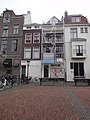
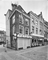
This is a category about rijksmonument number 36057
|
| Address |
|
Media in category "Choorstraat 28, Utrecht"
The following 8 files are in this category, out of 8 total.
-
 Choorstraat 28 - achtergevel.JPG 711 × 1,703; 581 KB
-
 Choorstraat 28.JPG 3,456 × 5,184; 6.39 MB
-
 Choorstraat 30-achtergevel.JPG 1,944 × 2,592; 2.2 MB
-
 Exterieur VOORGEVELS - Utrecht - 20314833 - RCE.jpg 960 × 1,200; 263 KB
-
 Exterieur VOORGEVELS - Utrecht - 20314834 - RCE.jpg 953 × 1,200; 246 KB
-
 Voorgevel - Utrecht - 20235559 - RCE.jpg 1,192 × 1,200; 339 KB
-
 Voorgevels - Utrecht - 20235556 - RCE.jpg 815 × 1,200; 179 KB
-


