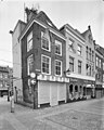
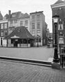
Category:Choorstraat 22, Utrecht
Jump to navigation
Jump to search
| Object location | | View all coordinates using: OpenStreetMap |
|---|
 | |||||
| Upload media | |||||
| Instance of |
| ||||
|---|---|---|---|---|---|
| Location | Utrecht, Netherlands | ||||
| Street address |
| ||||
| Heritage designation |
| ||||
 | |||||
|
This is a category about rijksmonument number 36056
|
| Address |
|
Media in category "Choorstraat 22, Utrecht"
The following 8 files are in this category, out of 8 total.
-
 13-06-27-utrecht-by-RalfR-16.jpg 2,848 × 4,288; 6.11 MB
-
 Choorstraat 22-2.JPG 2,001 × 2,896; 2.64 MB
-
 Choorstraat 22.JPG 3,456 × 5,184; 7.54 MB
-
 Exterieur VOORGEVELS - Utrecht - 20314833 - RCE.jpg 2,480 × 3,100; 3.18 MB
-
 Overzicht - Utrecht - 20235554 - RCE.jpg 2,316 × 2,868; 1.32 MB
-
 Overzicht - Utrecht - 20235555 - RCE.jpg 2,298 × 2,886; 1.46 MB
-
 Voorgevel - Utrecht - 20235553 - RCE.jpg 2,223 × 3,326; 1.02 MB
-
 Voorgevels - Utrecht - 20235556 - RCE.jpg 2,218 × 3,262; 1.5 MB


