Category:Chollerton
Jump to navigation
Jump to search
village and civil parish in Northumberland, England, UK _(geograph_3403939).jpg) | |||||
| Upload media | |||||
| Instance of | |||||
|---|---|---|---|---|---|
| Location | Northumberland, North East England, England | ||||
| Population |
| ||||
| Said to be the same as | Chollerton (Wikimedia duplicated page, civil parish) | ||||
 | |||||
English: Chollerton is a village in Northumberland, in England. It is situated on the A6079 road, about to the north of Hexham, on the River North Tyne. Nearby villages include Low Brunton and Humshaugh. The village has a fine example of a Mounting block standing at the churchyard gate.
Subcategories
This category has the following 8 subcategories, out of 8 total.
C
- Chapel at Chipchase Castle (5 F)
- Chipchase Castle (28 F)
- Chollerton War Memorial (2 F)
- Chollerton Windmill (4 F)
- Colt Crag Reservoir (39 F)
G
L
S
Media in category "Chollerton"
The following 200 files are in this category, out of 769 total.
(previous page) (next page)-
 'Switchback' on the A68 - geograph.org.uk - 1409562.jpg 640 × 480; 101 KB
-

-
 A lonely road junction - geograph.org.uk - 6489518.jpg 640 × 435; 56 KB
-
 A view of Long Crag - geograph.org.uk - 4761880.jpg 4,000 × 3,000; 3.32 MB
-
 A6079 junction with A68 - geograph.org.uk - 2948802.jpg 1,707 × 745; 377 KB
-
 A6079 towards Acomb - geograph.org.uk - 4611408.jpg 640 × 480; 94 KB
-
 A68 - geograph.org.uk - 2564680.jpg 3,619 × 2,021; 1.18 MB
-
 A68 - geograph.org.uk - 2741473.jpg 3,131 × 2,563; 935 KB
-
 A68 Dere Street - geograph.org.uk - 4047621.jpg 3,456 × 5,184; 3.72 MB
-
 A68 Dere Street near Erring Bridge - geograph.org.uk - 5846489.jpg 1,024 × 755; 86 KB
-
 A68 nears A6079-B6342 junction - geograph.org.uk - 5845704.jpg 1,024 × 733; 139 KB
-
 A68 north of The Tone Inn - geograph.org.uk - 5845633.jpg 1,024 × 786; 178 KB
-
 A68 North Towards Jedburgh - geograph.org.uk - 2947335.jpg 2,560 × 1,920; 2.2 MB
-
 A68 northbound near Folly Moss - geograph.org.uk - 6053172.jpg 640 × 480; 261 KB
-
 A68 south of Todd Ridge - geograph.org.uk - 5846476.jpg 1,024 × 782; 107 KB
-
 A68 southbound at Colwell turn - geograph.org.uk - 5845692.jpg 1,024 × 695; 212 KB
-
 A68 southbound near Folly Moss - geograph.org.uk - 5845671.jpg 1,024 × 716; 100 KB
-
 A68 west of Swineburn Quarry - geograph.org.uk - 5845682.jpg 1,024 × 749; 100 KB
-

-
 Access road from Barrasford Quarry - geograph.org.uk - 6053161.jpg 640 × 480; 246 KB
-
 Across the Dry Burn - geograph.org.uk - 6314240.jpg 1,024 × 576; 195 KB
-
 Approaching the A68 - geograph.org.uk - 4611405.jpg 640 × 480; 63 KB
-
 Approaching the A68 - geograph.org.uk - 5529809.jpg 1,600 × 958; 249 KB
-
 Autumn Beech by the North Tyne below Chollerton - geograph.org.uk - 2150502.jpg 4,000 × 3,200; 1.9 MB
-
 B6342 northbound - geograph.org.uk - 4727234.jpg 640 × 480; 124 KB
-
 B6342 towards Colwell - geograph.org.uk - 4611391.jpg 640 × 480; 73 KB
-
 B6342 towards Colwell - geograph.org.uk - 4611393.jpg 640 × 480; 85 KB
-
 B6342 towards the A68 - geograph.org.uk - 4611399.jpg 640 × 480; 98 KB
-

-
 Bales on Threpwood Hill - geograph.org.uk - 4697765.jpg 1,500 × 880; 1.19 MB
-
 Barley near Nightfold Ridge - geograph.org.uk - 6314265.jpg 1,024 × 576; 234 KB
-
 Barn near Little Swinburne - geograph.org.uk - 4606780.jpg 640 × 480; 67 KB
-
 Barn next to Carrier's Way - geograph.org.uk - 3009014.jpg 600 × 450; 97 KB
-
 Barns at Tone Hall - geograph.org.uk - 3275087.jpg 640 × 480; 57 KB
-
 Barns at Wheathill - geograph.org.uk - 4694768.jpg 1,500 × 751; 1.05 MB
-
 Barrasford Green - geograph.org.uk - 1273044.jpg 640 × 425; 119 KB
-
 Barrasford Park Caravan Site - geograph.org.uk - 6053097.jpg 640 × 480; 316 KB
-
 Beaumont House - geograph.org.uk - 2742068.jpg 3,405 × 2,543; 1.34 MB
-
 Blackhill Farm - geograph.org.uk - 3818273.jpg 640 × 480; 116 KB
-
 Blind summit A68 Dere Street - geograph.org.uk - 4065042.jpg 1,200 × 1,492; 894 KB
-
 Bogcotton - geograph.org.uk - 4991642.jpg 1,024 × 768; 264 KB
-
 Border Counties Railway - geograph.org.uk - 1273008.jpg 640 × 409; 104 KB
-

-
 Bridge near Wark - geograph.org.uk - 2355477.jpg 640 × 476; 273 KB
-
-

-

-
 Bridge over Coal Burn near The Hermitage - geograph.org.uk - 3796311.jpg 640 × 480; 120 KB
-
 Bridge over the Coal Burn - geograph.org.uk - 6059786.jpg 640 × 480; 364 KB
-
 Bridge over the Dry Burn - geograph.org.uk - 6489782.jpg 640 × 480; 81 KB
-

-

-

-

-

-

-

-

-
 Bridleway and View towards North Tyne Valley - geograph.org.uk - 4357871.jpg 1,066 × 800; 252 KB
-
 Bridleway towards Gunnerton - geograph.org.uk - 4357876.jpg 1,066 × 800; 212 KB
-
 Byway at Hallington Reservoir - geograph.org.uk - 3008996.jpg 600 × 450; 104 KB
-
 Byway towards Hallington Reservoir - geograph.org.uk - 3009003.jpg 600 × 450; 109 KB
-
 Byway towards Hallington Reservoir - geograph.org.uk - 3009008.jpg 600 × 450; 96 KB
-
 Camp Hill - geograph.org.uk - 4308257.jpg 640 × 480; 68 KB
-
 Carrier's Lane - geograph.org.uk - 2572433.jpg 3,234 × 2,106; 1.03 MB
-

-
 Carrier's Way towards the B6079 - geograph.org.uk - 3009022.jpg 600 × 450; 112 KB
-
 Carry Burn - geograph.org.uk - 2159663.jpg 3,072 × 2,304; 2.06 MB
-
 Carry Burn - geograph.org.uk - 4270904.jpg 640 × 480; 111 KB
-
 Carrycoats - geograph.org.uk - 4991684.jpg 1,024 × 768; 334 KB
-
 Cattle grid near the Tone Inn - geograph.org.uk - 3275095.jpg 640 × 480; 88 KB
-

-

-

-

-

-
 Chipchase Strothers Farm - geograph.org.uk - 3275787.jpg 600 × 450; 69 KB
-
 Chollerton - geograph.org.uk - 1273098.jpg 640 × 307; 75 KB
-
 Chollerton - Minor Road - geograph.org.uk - 5354744.jpg 4,608 × 3,456; 5.72 MB
-
 Chollerton Edge Plantation - geograph.org.uk - 3577962.jpg 480 × 640; 156 KB
-
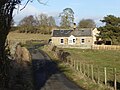
 Chollerton Farm - geograph.org.uk - 3403932.jpg 640 × 480; 91 KB
-
 Chollerton station site geograph-3304608-by-Ben-Brooksbank.jpg 2,424 × 1,453; 3.85 MB
-
 Clump of trees on rough grazing - geograph.org.uk - 4645073.jpg 1,500 × 1,125; 1.28 MB
-
 Coal Burn - geograph.org.uk - 1818968.jpg 480 × 640; 139 KB
-
 Coal Burn - geograph.org.uk - 1818974.jpg 480 × 640; 97 KB
-
 Coal Burn near The Hermitage - geograph.org.uk - 3798469.jpg 640 × 480; 123 KB
-
 Colwell - geograph.org.uk - 2564567.jpg 3,883 × 2,464; 1.74 MB
-
 Colwell - geograph.org.uk - 2572456.jpg 3,859 × 2,374; 1.38 MB
-
 Colwell lime kiln (2) - geograph.org.uk - 4271952.jpg 640 × 480; 100 KB
-
 Colwell lime kiln (3) - geograph.org.uk - 4271964.jpg 640 × 480; 112 KB
-
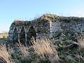 Colwell lime kiln - geograph.org.uk - 4271947.jpg 640 × 480; 97 KB
-
 Colwell lime kiln- arch - geograph.org.uk - 4271960.jpg 480 × 640; 131 KB
-
 Concrete objects - geograph.org.uk - 6059785.jpg 640 × 480; 413 KB
-
 Copse by Dere Street (A68) - geograph.org.uk - 3574973.jpg 640 × 480; 92 KB
-
 Cottage by the River North Tyne - geograph.org.uk - 4818227.jpg 1,897 × 771; 352 KB
-
 Cottage near Reavercrag - geograph.org.uk - 6053085.jpg 640 × 480; 260 KB
-
 Cottage on Chishill Way - geograph.org.uk - 6053081.jpg 640 × 480; 290 KB
-
 Cottages at Colwell - geograph.org.uk - 6053199.jpg 640 × 480; 271 KB
-
 Country road - geograph.org.uk - 4727230.jpg 640 × 480; 32 KB
-
 Country road leading to the Tone Inn - geograph.org.uk - 3275094.jpg 640 × 480; 136 KB
-
 Country road near Wark (5) - geograph.org.uk - 2431093.jpg 640 × 480; 301 KB
-
 Cowden - geograph.org.uk - 4282333.jpg 640 × 480; 68 KB
-
 Cowden Burn - geograph.org.uk - 4278037.jpg 640 × 480; 84 KB
-
 Crags near Gunnerton - geograph.org.uk - 4357857.jpg 1,066 × 800; 211 KB
-
 Crags near Gunnerton - geograph.org.uk - 4357864.jpg 1,066 × 800; 240 KB
-
 Crags near Little Swinburn - geograph.org.uk - 6067936.jpg 5,184 × 3,888; 544 KB
-
 Crop field and hedgerow - geograph.org.uk - 4611415.jpg 640 × 480; 69 KB
-
 Crop field near Colwell - geograph.org.uk - 4606859.jpg 640 × 480; 71 KB
-
 Crop field near the Erring Burn - geograph.org.uk - 4606878.jpg 640 × 480; 56 KB
-

-

-
 Crop field off the A6079 - geograph.org.uk - 4606863.jpg 640 × 480; 64 KB
-
 Crossing Mallow Burn - geograph.org.uk - 1353330.jpg 640 × 480; 146 KB
-
 Crossing point of Gunnerton Burn - geograph.org.uk - 1353327.jpg 640 × 480; 136 KB
-
 Crossing the Dry Burn - geograph.org.uk - 6314238.jpg 1,024 × 576; 209 KB
-

-

-

-

-

-

-

-

-
-
 Cycle path near Check Gate - geograph.org.uk - 4280068.jpg 640 × 480; 84 KB
-
 Cycling club on the A6079 - geograph.org.uk - 6059359.jpg 640 × 480; 296 KB
-
 Dam on the Colt Crag Reservoir - geograph.org.uk - 6489787.jpg 640 × 480; 90 KB
-
 Dam, Hallington Reservoir West - geograph.org.uk - 5765951.jpg 640 × 480; 297 KB
-
 Dam, Hallington Reservoir West - geograph.org.uk - 5765969.jpg 640 × 480; 395 KB
-
 Delaval's Gate Plantation - geograph.org.uk - 3757189.jpg 600 × 450; 308 KB
-
 Dere Street (A68) - geograph.org.uk - 1998099.jpg 1,024 × 768; 109 KB
-
 Dere Street (A68) - geograph.org.uk - 4606869.jpg 640 × 480; 61 KB
-
 Dere Street (A68) - geograph.org.uk - 4606876.jpg 640 × 480; 90 KB
-
 Dere Street Roman Road (A68) - geograph.org.uk - 4611417.jpg 640 × 480; 70 KB
-
 Dere Street Roman Road (A68) - geograph.org.uk - 4611423.jpg 640 × 480; 60 KB
-
 Derelict Cottage Beside The Erring Burn - geograph.org.uk - 5429077.jpg 4,608 × 3,456; 3.1 MB
-

-
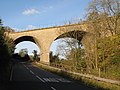
 Disused Railway Bridge at Chollerton - geograph.org.uk - 5429065.jpg 4,608 × 3,456; 3.39 MB
-
 Dry Burn - geograph.org.uk - 1179860.jpg 640 × 480; 96 KB
-
 Dry Burn - geograph.org.uk - 1236533.jpg 640 × 370; 81 KB
-
 Dunkirk - geograph.org.uk - 959929.jpg 640 × 480; 76 KB
-
 Ellwood House - geograph.org.uk - 1272597.jpg 640 × 379; 84 KB
-

-
 Entrance to Barrasford Quarry - geograph.org.uk - 1390081.jpg 640 × 381; 41 KB
-
 Entrance to Colwell - geograph.org.uk - 2694435.jpg 640 × 480; 41 KB
-
 Entrance to Colwell - geograph.org.uk - 4011739.jpg 640 × 480; 50 KB
-
 Erring Burn - geograph.org.uk - 4606877.jpg 640 × 480; 101 KB
-
 Erring Burn - geograph.org.uk - 5429072.jpg 4,608 × 3,456; 3.43 MB
-
 Fallen tree at Tone Thrasher - geograph.org.uk - 4278048.jpg 640 × 480; 116 KB
-
 Farm buildings at Edge House Farm - geograph.org.uk - 6053072.jpg 640 × 480; 258 KB
-
 Farm buildings at Short Knowes - geograph.org.uk - 1008433.jpg 600 × 450; 107 KB
-
 Farm buildings at Short Moor - geograph.org.uk - 847405.jpg 640 × 480; 126 KB
-
 Farm road near Barrasford - geograph.org.uk - 6053052.jpg 640 × 480; 307 KB
-
 Farm road near Little Swinburne - geograph.org.uk - 4606778.jpg 640 × 480; 54 KB
-
 Farm road near Little Swinburne - geograph.org.uk - 4606782.jpg 640 × 480; 74 KB
-
 Farm road rising towards plantation - geograph.org.uk - 4696827.jpg 1,500 × 1,125; 1.5 MB
-

-

-

-

-

-

-

-

-
-
 Farmland and Oxhill Plantation - geograph.org.uk - 4316975.jpg 640 × 480; 82 KB
-
 Farmland and Oxhill Plantation - geograph.org.uk - 4317009.jpg 640 × 480; 67 KB
-
 Farmland and Peaslands Plantation - geograph.org.uk - 4315349.jpg 640 × 481; 78 KB
-

-

-

-

-

-

-

-

-

-

-
-

-

-

-

-

-
 Farmland and Ripleyhill Plantation - geograph.org.uk - 4271894.jpg 640 × 480; 69 KB
-

-

-

-

-

-
 Farmland and woodland at Barrasford Park - geograph.org.uk - 4313684.jpg 640 × 480; 111 KB
-

-

-

-

-

-

-

-

-


_-_geograph.org.uk_-_1066911.jpg)

_-_geograph.org.uk_-_3798467.jpg)


_-_geograph.org.uk_-_3801813.jpg)


_-_geograph.org.uk_-_4271952.jpg)
_-_geograph.org.uk_-_4271964.jpg)


_-_geograph.org.uk_-_3574973.jpg)


_-_geograph.org.uk_-_2431093.jpg)


_-_geograph.org.uk_-_1998099.jpg)
_-_geograph.org.uk_-_4606869.jpg)
_-_geograph.org.uk_-_4606876.jpg)
_-_geograph.org.uk_-_4611417.jpg)
_-_geograph.org.uk_-_4611423.jpg)


_-_geograph.org.uk_-_3574995.jpg)

_-_geograph.org.uk_-_3574975.jpg)


_-_geograph.org.uk_-_3817530.jpg)

_-_geograph.org.uk_-_3822181.jpg)
_-_geograph.org.uk_-_3822188.jpg)


_-_geograph.org.uk_-_4314400.jpg)


