Category:Chichagof Island
Jump to navigation
Jump to search
island in the United States of America   | |||||
| Upload media | |||||
| Instance of | |||||
|---|---|---|---|---|---|
| Part of | |||||
| Named after | |||||
| Location |
| ||||
| Located in or next to body of water | |||||
| Width |
| ||||
| Length |
| ||||
| Population |
| ||||
| Area |
| ||||
| Elevation above sea level |
| ||||
 | |||||
Media in category "Chichagof Island"
The following 21 files are in this category, out of 21 total.
-
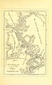
 1926 Canada-Alaska 1903 boundary-map.png 429 × 418; 433 KB
-
-

-

-
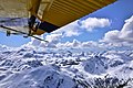 Chichagof Island (5671094336).jpg 2,816 × 1,880; 2.58 MB
-
 FMIB 40798 Sketch of Kook Lake and Stream (Basket) Chichagof Island, Alaska.jpeg 1,068 × 837; 135 KB
-
-
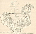
 FMIB 40803 Sketch of Sitkoh Bay, Stream, and Lake, Chichagof Island, Alaska.jpeg 1,355 × 1,041; 140 KB
-

-
 FMIB 44619 Geo T Myers & Co Cannery, Sitkoh Bay, Alaska.jpeg 1,598 × 409; 270 KB
-

-
 FMIB 49046 Cannery at Sitkoh Bay.jpeg 1,052 × 605; 155 KB
-
 Idaho Inlet 4315.png 1,519 × 576; 1.17 MB
-

-
 Murder Cove.png 562 × 773; 981 KB
-
 Native house, Chichagof, Alaska, 1916 (AL+CA 1182).jpg 768 × 488; 50 KB
-
 Peril Strait 093 02.jpg 2,860 × 1,724; 1.03 MB
-

-
 Sunset over Chicagof Island (4983776305).jpg 3,168 × 2,112; 2.44 MB
-
 Tenakee Inlet to Port Frederick portage.jpg 4,320 × 2,880; 5.26 MB
-
 Waterfront view of Chichagof, Alaska, 1916 (AL+CA 1064).jpg 381 × 600; 34 KB

.jpg)
_(14597164908).jpg)
_(14597293807).jpg)
.jpg)
_Chichagof_Island,_Alaska.jpeg)


.jpg)

.jpg)

.jpg)
.jpg)

.jpg)