Category:Cheung Fai Road
Jump to navigation
Jump to search
| Object location | | View all coordinates using: OpenStreetMap |
|---|
road in Tsing Yi  | |||||
| Upload media | |||||
| Instance of | |||||
|---|---|---|---|---|---|
| Location | Kwai Tsing District, Hong Kong, PRC | ||||
 | |||||
中文:長輝路
Subcategories
This category has the following 3 subcategories, out of 3 total.
C
T
Media in category "Cheung Fai Road"
The following 3 files are in this category, out of 3 total.
-
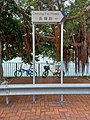 Cheung Fai Road Road sign in September 2021.jpg 3,000 × 4,000; 3.9 MB
-
 Tsing Yi Bridge and Kwai Tsing Bridge.jpg 2,560 × 1,920; 880 KB
-
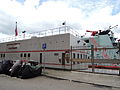 Tsing Yi Fireboat Fire Station (Hong Kong).jpg 3,264 × 2,448; 2.65 MB

.jpg)