Category:Chesterton, Shropshire
Jump to navigation
Jump to search
English: Chesterton is a hamlet in the civil parish of Worfield, in the Shropshire district, in the ceremonial county of Shropshire, England.
hamlet in Worfield, Shropshire, England  | |||||
| Upload media | |||||
| Instance of | |||||
|---|---|---|---|---|---|
| Location | Worfield, Shropshire, West Midlands, England | ||||
 | |||||
Media in category "Chesterton, Shropshire"
The following 69 files are in this category, out of 69 total.
-

-

-

-

-
 B4176 to Telford, Shropshire - geograph.org.uk - 4708803.jpg 1,280 × 922; 771 KB
-
 B4176 to Telford, Shropshire - geograph.org.uk - 4709777.jpg 1,024 × 1,024; 851 KB
-
 Bench, Letter-box, Phone and Thermometer. - geograph.org.uk - 766811.jpg 640 × 480; 113 KB
-
 Birch woods near Chesterton, Shropshire - geograph.org.uk - 1302295.jpg 640 × 480; 142 KB
-

-
 Bridleway to Rudge - geograph.org.uk - 391774.jpg 600 × 474; 328 KB
-

-
 Chesterton Bridleway - geograph.org.uk - 1875533.jpg 800 × 600; 112 KB
-
 Chesterton Farm View - geograph.org.uk - 1875512.jpg 640 × 480; 105 KB
-
 Chesterton Footpath - geograph.org.uk - 1875552.jpg 640 × 480; 156 KB
-
 Chesterton House - geograph.org.uk - 403046.jpg 600 × 450; 173 KB
-
 Chesterton House, Shropshire - geograph.org.uk - 1302977.jpg 640 × 459; 149 KB
-
 Chesterton Junction - geograph.org.uk - 1875555.jpg 640 × 480; 89 KB
-
 Chesterton Road Crossroad - geograph.org.uk - 3047661.jpg 800 × 600; 153 KB
-
 Chesterton Scene - geograph.org.uk - 1875560.jpg 640 × 480; 97 KB
-
 Chesterton Sign - geograph.org.uk - 1875483.jpg 800 × 600; 152 KB
-
 Chesterton Valley - geograph.org.uk - 1875490.jpg 640 × 480; 131 KB
-
 Chesterton View - geograph.org.uk - 1875220.jpg 600 × 800; 134 KB
-
 Climbing away from Chesterton - geograph.org.uk - 3505057.jpg 640 × 480; 69 KB
-

-

-

-

-
 Crop field south of Chesterton, Shropshire - geograph.org.uk - 4716429.jpg 1,280 × 893; 585 KB
-
 Crop field south of Chesterton, Shropshire - geograph.org.uk - 4716463.jpg 1,280 × 858; 671 KB
-
 Crop field south of Chesterton, Shropshire - geograph.org.uk - 4717839.jpg 1,280 × 849; 933 KB
-
 Down the bridleway towards Chesterton - geograph.org.uk - 2545068.jpg 1,024 × 768; 292 KB
-
 Farm land south of Chesterton, Shropshire - geograph.org.uk - 4717845.jpg 1,280 × 841; 641 KB
-
 Farm land south of Chesterton, Shropshire - geograph.org.uk - 4717850.jpg 1,280 × 924; 840 KB
-
 Farmland south of Chesterton, Shropshire - geograph.org.uk - 4718311.jpg 768 × 1,024; 631 KB
-
 Farmland south of Chesterton, Shropshire - geograph.org.uk - 4718321.jpg 1,024 × 710; 602 KB
-

-
 Footbridge south-east of Chesterton, Shropshire - geograph.org.uk - 4708705.jpg 1,024 × 768; 639 KB
-
 Footbridge south-east of Chesterton, Shropshire - geograph.org.uk - 4708715.jpg 1,024 × 768; 722 KB
-

-

-
 Footpath on The Walls near Chesterton, Shropshire - geograph.org.uk - 4716441.jpg 1,024 × 1,024; 880 KB
-
 Footpath on The Walls near Chesterton, Shropshire - geograph.org.uk - 4716444.jpg 1,280 × 909; 1,008 KB
-

-

-
 Grazing horses south of Chesterton, Shropshire - geograph.org.uk - 4715873.jpg 1,280 × 768; 570 KB
-
 Lane at Chesterton, Shropshire - geograph.org.uk - 1303005.jpg 640 × 465; 132 KB
-
 Marindin House, Chesterton, Shropshire - geograph.org.uk - 1305421.jpg 640 × 489; 141 KB
-
 Pasture and woodland near Littlegain, Shropshire - geograph.org.uk - 4716472.jpg 1,024 × 1,024; 853 KB
-
 Pasture south of Chesterton, Shropshire - geograph.org.uk - 4715879.jpg 1,024 × 684; 334 KB
-
 Pasture south of Chesterton, Shropshire - geograph.org.uk - 4715887.jpg 1,280 × 853; 793 KB
-
 Pasture south of Chesterton, Shropshire - geograph.org.uk - 4715889.jpg 1,024 × 674; 371 KB
-

-
 Public footpath to Chesterton, Shropshire - geograph.org.uk - 4715968.jpg 1,024 × 750; 711 KB
-
 Public footpath to Chesterton, Shropshire - geograph.org.uk - 4715987.jpg 768 × 1,024; 789 KB
-
 Public footpath to Chesterton, Shropshire - geograph.org.uk - 4715996.jpg 768 × 1,024; 726 KB
-
 Public footpath to Chesterton, Shropshire - geograph.org.uk - 4715998.jpg 1,024 × 768; 759 KB
-
 Road Junction at Chesterton, Shropshire - geograph.org.uk - 1302748.jpg 640 × 427; 123 KB
-
 Rusty workshop near Chesterton, Shropshire - geograph.org.uk - 4708693.jpg 1,280 × 960; 896 KB
-
 Shropshire fields near Chesterton - geograph.org.uk - 1299153.jpg 640 × 441; 151 KB
-

-

-
 Unpeeled barn roof at Chesterton Farm - geograph.org.uk - 403026.jpg 600 × 432; 183 KB
-
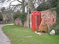
 Village phonebox - geograph.org.uk - 403032.jpg 600 × 450; 290 KB
-

-

-

-

-

-


