Category:Chester District
Jump to navigation
Jump to search
English: Chester was a district in the county of Cheshire in England.
non-metropolitan local government district of Cheshire, England | |||||
| Upload media | |||||
| Instance of | |||||
|---|---|---|---|---|---|
| Location | Cheshire, North West England, England | ||||
| Inception |
| ||||
| Dissolved, abolished or demolished date |
| ||||
| Replaces |
| ||||
| Replaced by | |||||
 | |||||
Media in category "Chester District"
The following 111 files are in this category, out of 111 total.
-
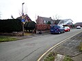
 1 Overleigh Road, Chester - geograph.org.uk - 6671212.jpg 1,024 × 789; 431 KB
-
 20 - 24, Bridge St - geograph.org.uk - 6761569.jpg 1,024 × 673; 159 KB
-
 35 Eastgate Street, Chester - geograph.org.uk - 6783227.jpg 6,000 × 4,000; 1.88 MB
-
 37 Eastgate Street, Chester - geograph.org.uk - 6782341.jpg 4,062 × 5,837; 2.72 MB
-
 39 Eastgate Street, Chester - geograph.org.uk - 6780442.jpg 4,144 × 6,095; 3.01 MB
-
 41 Eastgate Street, Chester - geograph.org.uk - 6782353.jpg 4,069 × 6,046; 2.07 MB
-
 43 Eastgate Street, Chester - geograph.org.uk - 6783107.jpg 4,045 × 6,030; 1.69 MB
-
 45 Eastgate Street, Chester - geograph.org.uk - 6783123.jpg 4,000 × 6,000; 1.7 MB
-
 52, Bridge St - geograph.org.uk - 6761566.jpg 1,024 × 684; 173 KB
-
 65-67 Eaton Road, Chester - geograph.org.uk - 6671214.jpg 1,024 × 711; 253 KB
-
 70, Foregate St - geograph.org.uk - 6768807.jpg 1,024 × 685; 196 KB
-
 70, Foregate St - geograph.org.uk - 6768808.jpg 1,024 × 721; 159 KB
-
 Albion Mews - geograph.org.uk - 6761559.jpg 1,024 × 684; 116 KB
-
 All Bar One - geograph.org.uk - 6761560.jpg 1,024 × 684; 177 KB
-
 Andrew Crescent, Handbridge - geograph.org.uk - 6060017.jpg 4,000 × 3,000; 2.61 MB
-
 Bandstand - geograph.org.uk - 6754873.jpg 1,024 × 684; 205 KB
-
 Bench mark in Queens Park Road, Handbridge - 2019 - geograph.org.uk - 6046570.jpg 1,200 × 1,600; 709 KB
-
 Boats moored on the River Dee - geograph.org.uk - 6754880.jpg 1,024 × 684; 129 KB
-
 Bridge Cottages - geograph.org.uk - 6735162.jpg 1,024 × 684; 154 KB
-
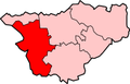 CheshireChester.png 200 × 129; 11 KB
-
 Chester Cathedral - geograph.org.uk - 6768797.jpg 1,024 × 684; 160 KB
-
 Chester Cross - geograph.org.uk - 6761581.jpg 684 × 1,024; 173 KB
-
 Chester Cross - geograph.org.uk - 6761584.jpg 685 × 1,024; 161 KB
-
 Chester Travelodge - geograph.org.uk - 6754818.jpg 1,024 × 684; 160 KB
-
 Church of St John the Baptist - geograph.org.uk - 6754901.jpg 684 × 1,024; 199 KB
-
 Church of St John the Baptist - geograph.org.uk - 6754902.jpg 1,024 × 684; 185 KB
-
 Church of St John the Baptist - geograph.org.uk - 6754904.jpg 1,024 × 684; 196 KB
-
 Church of St John the Baptist - geograph.org.uk - 6754905.jpg 1,024 × 684; 186 KB
-
 Church of St John the Baptist - geograph.org.uk - 6754907.jpg 684 × 1,024; 156 KB
-
 Church of St John the Baptist - geograph.org.uk - 6754912.jpg 1,024 × 684; 206 KB
-
 Church of St John the Baptist - geograph.org.uk - 6761380.jpg 1,024 × 684; 138 KB
-
 Church of St John the Baptist ruins - geograph.org.uk - 6754896.jpg 684 × 1,024; 201 KB
-
 Church of St John the Baptist ruins - geograph.org.uk - 6754898.jpg 684 × 1,024; 153 KB
-
 Church of St John the Baptist ruins - geograph.org.uk - 6754899.jpg 1,024 × 684; 211 KB
-
 Church of St Michael (former) - geograph.org.uk - 6761565.jpg 684 × 1,024; 136 KB
-
 Church of St Peter - geograph.org.uk - 6761573.jpg 548 × 1,024; 123 KB
-
 Church of St Peter - geograph.org.uk - 6761574.jpg 684 × 1,024; 133 KB
-
 Church of St Peter - geograph.org.uk - 6761579.jpg 1,024 × 684; 168 KB
-
 City Walls - geograph.org.uk - 6754811.jpg 1,024 × 684; 238 KB
-
 City Walls - geograph.org.uk - 6754854.jpg 1,024 × 684; 190 KB
-
 Commonhall St - geograph.org.uk - 6761570.jpg 1,024 × 684; 159 KB
-
 Dee Bridge - geograph.org.uk - 6428548.jpg 4,032 × 1,960; 3.34 MB
-
 Ducks and other wildlife exempt - geograph.org.uk - 6784268.jpg 6,000 × 4,000; 1.92 MB
-
 Eastgate St - geograph.org.uk - 6761586.jpg 1,024 × 684; 210 KB
-
 Eastgate Street - geograph.org.uk - 6768805.jpg 1,024 × 685; 170 KB
-
 Eastgate Street - geograph.org.uk - 6781151.jpg 1,200 × 800; 1.03 MB
-
 Edgar's Field Park - geograph.org.uk - 6735144.jpg 1,024 × 684; 209 KB
-
 Edgar's Field Park, Chester. - geograph.org.uk - 6012326.jpg 2,100 × 3,413; 2.24 MB
-
 Falcon Inn - geograph.org.uk - 6754762.jpg 1,024 × 685; 130 KB
-
 Firejacks - geograph.org.uk - 6754764.jpg 1,024 × 685; 114 KB
-
 First Park ^ Ride - geograph.org.uk - 6757717.jpg 1,280 × 1,163; 1.2 MB
-
 Footpath from Queens Park Road, Handbridge - geograph.org.uk - 6046597.jpg 1,600 × 1,199; 617 KB
-
 Foregate Street - geograph.org.uk - 6768806.jpg 1,024 × 670; 177 KB
-
 Fresco, Church of St John the Baptist - geograph.org.uk - 6754909.jpg 685 × 1,024; 134 KB
-
 Grosvenor Park gates - geograph.org.uk - 6754892.jpg 1,024 × 684; 234 KB
-
 Handbridge - geograph.org.uk - 6653800.jpg 1,024 × 683; 481 KB
-
 Love St - geograph.org.uk - 6768810.jpg 1,024 × 684; 144 KB
-
 Minerva - geograph.org.uk - 6735151.jpg 685 × 1,024; 212 KB
-
 Minerva Shrine, Edgar's Field (rear view) - geograph.org.uk - 6735154.jpg 1,024 × 684; 169 KB
-
 Minerva Shrine, Edgar's Field - geograph.org.uk - 6735147.jpg 1,024 × 684; 194 KB
-
 Minerva Shrine, Edgar's Field - geograph.org.uk - 6735153.jpg 1,024 × 684; 233 KB
-
 Northgate Row - geograph.org.uk - 6761590.jpg 684 × 1,024; 181 KB
-
 Northgate Row - geograph.org.uk - 6761592.jpg 712 × 1,024; 163 KB
-
 Old Palace Chester - geograph.org.uk - 6754863.jpg 1,024 × 684; 175 KB
-
 Old Queens Head - geograph.org.uk - 6768812.jpg 684 × 1,024; 162 KB
-
 Opera - geograph.org.uk - 6754767.jpg 1,024 × 685; 87 KB
-
 Opera - geograph.org.uk - 6754769.jpg 1,024 × 685; 114 KB
-
 Organ, Church of St John the Baptist - geograph.org.uk - 6761378.jpg 1,024 × 689; 143 KB
-
 Queens Park Bridge - geograph.org.uk - 6754865.jpg 1,024 × 684; 130 KB
-
 Queens Park Bridge - geograph.org.uk - 6754883.jpg 1,024 × 684; 149 KB
-
 Queens Park Bridge - geograph.org.uk - 6754884.jpg 1,024 × 684; 141 KB
-
 Queens Park Road from Queens Park View - geograph.org.uk - 6046550.jpg 1,600 × 1,200; 325 KB
-
 Queens Park View - geograph.org.uk - 6653796.jpg 1,024 × 683; 628 KB
-
 River Dee (Afon Dyfrdwy) - geograph.org.uk - 6754888.jpg 1,024 × 684; 111 KB
-
 River Dee - geograph.org.uk - 6754886.jpg 1,024 × 684; 113 KB
-
 River Dee in Flood, Chester - geograph.org.uk - 6778319.jpg 4,128 × 3,096; 1.49 MB
-
 Roman Amphitheatre - geograph.org.uk - 6754816.jpg 1,024 × 684; 199 KB
-
 Roman Amphitheatre - geograph.org.uk - 6754817.jpg 1,024 × 684; 203 KB
-
 Roman Amphitheatre - geograph.org.uk - 6761384.jpg 1,024 × 684; 157 KB
-
 Roman Quarry remains - geograph.org.uk - 6735155.jpg 1,024 × 684; 199 KB
-
 Roman remains, Roman Gardens - geograph.org.uk - 6754832.jpg 1,024 × 684; 229 KB
-
 Roman remains, Roman Gardens - geograph.org.uk - 6754833.jpg 1,024 × 684; 192 KB
-
 Roman remains, Roman Gardens - geograph.org.uk - 6754835.jpg 1,024 × 684; 204 KB
-
 Roman remains, Roman Gardens - geograph.org.uk - 6754837.jpg 1,024 × 684; 229 KB
-
 Sleepy Panda - geograph.org.uk - 6768875.jpg 1,024 × 595; 153 KB
-
 Slug ^ Lettuce - geograph.org.uk - 6754751.jpg 1,024 × 685; 149 KB
-
 Small altar, Church of St John the Baptist - geograph.org.uk - 6761375.jpg 684 × 1,024; 153 KB
-
 Souter's Lane - geograph.org.uk - 6754827.jpg 1,024 × 684; 208 KB
-

-
 St Michael's Church (former) - geograph.org.uk - 6761563.jpg 1,024 × 684; 137 KB
-
 St Werburgh Mount - geograph.org.uk - 6768793.jpg 1,024 × 727; 178 KB
-
 St Werburgh Mount - geograph.org.uk - 6768795.jpg 1,024 × 684; 176 KB
-
 St werburgh Street - geograph.org.uk - 6768796.jpg 1,024 × 684; 196 KB
-

-
 The Bandstand on The Groves, Chester - geograph.org.uk - 6777247.jpg 4,128 × 3,096; 1.55 MB
-
 The Chester Grosvenor Hotel - geograph.org.uk - 6768800.jpg 1,024 × 685; 205 KB
-
 The Eastgate ^ Clock - geograph.org.uk - 6768802.jpg 1,024 × 684; 202 KB
-
 The Lady Diana Showboat on the River Dee - geograph.org.uk - 6768725.jpg 3,400 × 2,256; 324 KB
-
 The Newgate - geograph.org.uk - 6754808.jpg 1,024 × 684; 150 KB
-
 The Newgate - geograph.org.uk - 6754810.jpg 1,024 × 684; 137 KB
-
 The River Dee in flood at Chester - geograph.org.uk - 6778325.jpg 4,128 × 3,096; 1.54 MB
-
 The River Dee in flood at Chester - geograph.org.uk - 6778850.jpg 4,128 × 3,096; 1.3 MB
-
 The River Dee in flood at Chester - geograph.org.uk - 6778851.jpg 4,128 × 3,096; 1.23 MB
-
 The River Dee in flood at Chester - geograph.org.uk - 6778854.jpg 4,128 × 3,096; 1.23 MB
-
 The River Dee in flood at Chester - geograph.org.uk - 6778856.jpg 4,128 × 3,096; 1.4 MB
-
 The Ship Inn - geograph.org.uk - 6735130.jpg 1,024 × 684; 168 KB
-
 Thorntons, Eastgate Street, Chester - geograph.org.uk - 6780124.jpg 6,000 × 4,000; 2.47 MB
-
 Three Old Arches - geograph.org.uk - 6754759.jpg 1,024 × 684; 152 KB
-
 View towards the flooded meadows at Chester - geograph.org.uk - 6778858.jpg 4,128 × 3,096; 1.08 MB
-
 View towards the meadows after the flood - geograph.org.uk - 6780120.jpg 6,000 × 4,000; 1.54 MB
-
 Zion Tabernacle - geograph.org.uk - 6768877.jpg 1,024 × 684; 166 KB


_-_geograph.org.uk_-_6761565.jpg)


_-_geograph.org.uk_-_6735154.jpg)


_-_geograph.org.uk_-_6754888.jpg)


_-_geograph.org.uk_-_6761563.jpg)


