Category:Chemnitz photographs taken on 2020-11-18
Jump to navigation
Jump to search
| Chemnitz photographs of the previous week | · | Chemnitz photographs of the previous day | ← | 2020-11-18 | → | Chemnitz photographs of the next day | · | Chemnitz photographs of the next week |
| 11 | · | 12 | · | 13 | · | 14 | · | 15 | · | 16 | · | 17 | · | 18 | · | 19 | · | 20 | · | 21 | · | 22 | · | 23 | · | 24 | · | 25 |

Photographs taken on November 18, 2020 in Chemnitz.
Files or subcategories can be added here using a direct categorization tag. Image files can be categorized here also automatically using {{Taken on}} template.
Media in category "Chemnitz photographs taken on 2020-11-18"
The following 52 files are in this category, out of 52 total.
-
 2020-11-18 Chemnitz-Richard-Tauber-Straße-Straßenschild.jpg 4,608 × 2,592; 2.04 MB
-
 Anton-Günther-Gedenkstein Euba (1).jpg 4,000 × 3,000; 3.75 MB
-
 Anton-Günther-Gedenkstein Euba (2).jpg 3,000 × 4,000; 3.74 MB
-
 Bank beim Anton-Günther-Gedenkstein Euba.jpg 4,000 × 3,000; 4.22 MB
-
 Chemnitz-Hilbersdorf, ehemalige Straßenbahntrasse in der Frankenberger Straße (1).jpg 4,000 × 3,000; 4.53 MB
-
 Chemnitz-Hilbersdorf, ehemalige Straßenbahntrasse in der Frankenberger Straße (2).jpg 1,698 × 2,265; 1.61 MB
-
 Ehemalige Straßenbahnendstelle in Chemnitz-Ebersdorf (1).jpg 4,000 × 3,000; 3.97 MB
-
 Ehemalige Straßenbahnendstelle in Chemnitz-Ebersdorf (2).jpg 4,000 × 3,000; 4.36 MB
-
 Ehemalige Straßenbahnendstelle in Chemnitz-Ebersdorf (3).jpg 4,000 × 3,000; 3.92 MB
-
 Ehemalige Straßenbahnendstelle in Chemnitz-Ebersdorf (4).jpg 4,000 × 3,000; 3.44 MB
-
 Ehemalige Straßenbahnendstelle in Chemnitz-Ebersdorf (5).jpg 4,000 × 3,000; 3.78 MB
-
 Euba, Beutenberg-Häuser.jpg 4,000 × 3,000; 3.61 MB
-
 Euba, Blick auf die Siedlung Bergeshöh.jpg 4,000 × 3,000; 3.84 MB
-
 Euba, Blick von der Beutenbergstraße zum Schloss Lichtenwalde.jpg 4,000 × 3,000; 2.88 MB
-
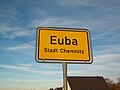 Euba, Ortseingangstafel.jpg 4,000 × 3,000; 3.5 MB
-
 Frankenberger Straße 136.jpg 3,257 × 2,443; 2.02 MB
-
 Grundschule Euba.jpg 4,000 × 3,000; 3.61 MB
-
 Hilbersdorf, Frankenberger Straße 154 und 156.jpg 3,639 × 2,729; 2.78 MB
-
 Hilbersdorf, Hohlweg 1.jpg 3,173 × 2,380; 1.94 MB
-
 Kiosk bei ehemaliger Straßenbahnendstelle in Chemnitz-Ebersdorf.jpg 3,716 × 2,787; 1.86 MB
-
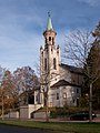
 Kirche Euba (2).jpg 4,000 × 3,000; 3.69 MB
-
 Kirche Euba (3).jpg 3,332 × 2,499; 1.21 MB
-
 Kirche Euba (5).jpg 4,000 × 3,000; 2.89 MB
-
 Kirche Euba (6).jpg 3,554 × 2,665; 1.57 MB
-
 Kirche Euba, Stempelstelle Sächsischer Jakobsweg.jpg 3,000 × 4,000; 3.61 MB
-
 Kirche Euba, Wegsweiser Sächsischer Jakobsweg.jpg 2,388 × 1,791; 579 KB
-
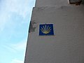 Pfarrhaus Euba, Symbol Sächsischer Jakobsweg.jpg 4,000 × 3,000; 3.67 MB
-
 Pfarrhaus Euba.jpg 4,000 × 3,000; 4.06 MB
-
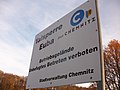 Talsperre Euba, Infotafel.jpg 4,000 × 3,000; 3.49 MB
-
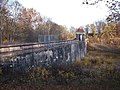
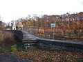 Talsperre Euba, Staumauer (1).jpg 4,000 × 3,000; 2.43 MB
-
 Talsperre Euba, Staumauer (2).jpg 2,464 × 1,848; 1.43 MB
-
 Talsperre Euba, Staumauer (3).jpg 4,000 × 3,000; 2.99 MB
-
 Talsperre Euba, Staumauer (4).jpg 4,000 × 3,000; 3.83 MB
-
 Talsperre Euba, Staumauer (5).jpg 4,000 × 3,000; 3.07 MB
-
 Teich in Euba.jpg 4,000 × 3,000; 3.72 MB
-
 Trinitatiskirche Chemnitz-Hilbersdorf (2).jpg 2,979 × 2,234; 2.44 MB
-
 Trinitatiskirche Chemnitz-Hilbersdorf (4).jpg 3,000 × 4,000; 3.86 MB
-
 Trinitatiskirche Chemnitz-Hilbersdorf (5).jpg 2,467 × 3,289; 2.47 MB
-
 Trinitatiskirche Chemnitz-Hilbersdorf (6).jpg 3,000 × 4,000; 3.15 MB
-
 Zeisigwald, Gedenktafel ehemaliger Standort Beutenbergturm (1).jpg 4,000 × 3,000; 3.65 MB
-
 Zeisigwald, Infotafel Beutenbergturm (1).jpg 4,000 × 3,000; 3.78 MB
-
 Zeisigwald, Infotafel Beutenbergturm (10).jpg 4,000 × 3,000; 3.47 MB
-
 Zeisigwald, Infotafel Beutenbergturm (11).jpg 4,000 × 3,000; 3.91 MB
-
 Zeisigwald, Infotafel Beutenbergturm (12).jpg 3,000 × 4,000; 3.88 MB
-
 Zeisigwald, Infotafel Beutenbergturm (2).jpg 3,000 × 4,000; 3.78 MB
-
 Zeisigwald, Infotafel Beutenbergturm (6).jpg 4,000 × 3,000; 3.98 MB
-
 Zeisigwald, Infotafel Beutenbergturm (7).jpg 3,000 × 4,000; 3.4 MB
-
 Zeisigwald, Infotafel Beutenbergturm (8).jpg 4,000 × 3,000; 3.45 MB
-
 Zeisigwald, Infotafel Beutenbergturm (9).jpg 4,000 × 3,000; 4.21 MB
-
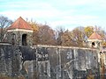
 Zeisigwald, Standort ehemaliger Beutenbergturm (2).jpg 4,000 × 3,000; 3.83 MB
-
 Zeisigwald, Wegweiser Beutenbergweg und Anton-Günther-Stein.jpg 4,000 × 3,000; 3.26 MB
-
 Zeisigwald, Wegweiser ehem. Beutenbergturm.jpg 2,958 × 2,219; 1.85 MB

.jpg)
.jpg)

.jpg)
.jpg)
.jpg)
.jpg)
.jpg)
.jpg)
.jpg)


.jpg)
.jpg)
.jpg)
.jpg)


.jpg)
.jpg)
.jpg)
.jpg)
.jpg)

.jpg)
.jpg)
.jpg)
.jpg)
.jpg)
.jpg)
.jpg)
.jpg)
.jpg)
.jpg)
.jpg)
.jpg)
.jpg)
.jpg)
.jpg)

