Category:Chelford
Jump to navigation
Jump to search
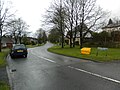
English: Chelford is a village and civil parish in the unitary authority of Cheshire East and the ceremonial county of Cheshire, England. It is situated close to the junction of the A537 and A535 roads, approximately six miles (10 km) west of Macclesfield, and six miles south-east of Knutsford. It is also served by a small railway station situated on the line between Crewe and Manchester. According to the 2001 census, Chelford had a total population of 1,254
village and civil parish in Cheshire, UK  | |||||
| Upload media | |||||
| Instance of | |||||
|---|---|---|---|---|---|
| Location | Cheshire East, Cheshire, North West England, England | ||||
 | |||||
Subcategories
This category has the following 4 subcategories, out of 4 total.
C
- Chelford railway station (4 F)
- Chelford Steam Rally (149 F)
- Chelford War Memorial (1 F)
Media in category "Chelford"
The following 74 files are in this category, out of 74 total.
-
 "The Mosses" Birch Wood - geograph.org.uk - 35820.jpg 640 × 480; 172 KB
-
 A535 at Chelford village boundary - geograph.org.uk - 3417421.jpg 640 × 481; 107 KB
-
 A535 Roadside Court, Chelford - geograph.org.uk - 3054066.jpg 3,456 × 2,304; 3.8 MB
-
 A537 approaching Chelford roundabout - geograph.org.uk - 2771491.jpg 640 × 480; 79 KB
-
 A537 Chelford Road junction Dixon Drive-Pepper Street - geograph.org.uk - 3055430.jpg 3,456 × 2,304; 3.51 MB
-
 A537 east of the Chelford roundabout - geograph.org.uk - 2771492.jpg 640 × 480; 63 KB
-
 A537 in Chelford - geograph.org.uk - 2771489.jpg 640 × 480; 59 KB
-
 A537 near Willow Gaff - geograph.org.uk - 2771494.jpg 640 × 480; 78 KB
-
 Alderley Road - geograph.org.uk - 4565868.jpg 5,104 × 3,183; 1.79 MB
-
 Alderley Road - geograph.org.uk - 4565869.jpg 5,184 × 2,787; 1.77 MB
-
 Alderley Road looking north - geograph.org.uk - 3417431.jpg 640 × 480; 66 KB
-
 Astle Farm East - geograph.org.uk - 3054040.jpg 3,456 × 2,304; 3.93 MB
-
 Astle Park - geograph.org.uk - 4565871.jpg 5,184 × 2,930; 1.71 MB
-
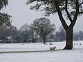 Astle Park in winter - geograph.org.uk - 86482.jpg 640 × 480; 96 KB
-
 B5539 - geograph.org.uk - 4565102.jpg 4,744 × 2,672; 1.69 MB
-
 Blooming potato field - geograph.org.uk - 3056499.jpg 3,456 × 2,304; 3.34 MB
-
 Brick Hills - geograph.org.uk - 5341599.jpg 640 × 426; 48 KB
-
 Bridlepath off Peover Lane - geograph.org.uk - 3056461.jpg 3,456 × 2,304; 5.65 MB
-
 Callwood's Moss - geograph.org.uk - 5341609.jpg 640 × 426; 38 KB
-
 Carter Lane junction Peck Mill Farm drive - geograph.org.uk - 3055421.jpg 3,456 × 2,304; 3.97 MB
-
 Cattle grazing near Chelford - geograph.org.uk - 3697989.jpg 640 × 324; 28 KB
-
 Chapel Wood - geograph.org.uk - 4565107.jpg 5,184 × 3,313; 1.93 MB
-
 Chelford Cricket Field - geograph.org.uk - 423197.jpg 640 × 480; 75 KB
-
 Chelford MMB 01 Crewe to Manchester Line 175007.jpg 4,209 × 2,769; 3.47 MB
-
 Chelford Post Office at 5.20am - geograph.org.uk - 2149412.jpg 1,024 × 768; 229 KB
-
 Chelford.jpg 2,592 × 1,944; 958 KB
-
 Corbishley Bridge over Alderley Road - geograph.org.uk - 3417434.jpg 640 × 480; 77 KB
-
 Corbishley Railway Bridge - geograph.org.uk - 1478383.jpg 640 × 480; 98 KB
-
 Cornfield from rear of Roadside Court - geograph.org.uk - 3054071.jpg 3,456 × 2,304; 3.6 MB
-
 Dixon Drive, Chelford - geograph.org.uk - 3055435.jpg 3,456 × 2,304; 5.62 MB
-
 Dixon Drive, Chelford - geograph.org.uk - 3278622.jpg 4,320 × 3,240; 3.12 MB
-
 Farmland and woodland, Brick Hills - geograph.org.uk - 3345840.jpg 800 × 543; 58 KB
-
 Farmland and woodland, Chelford Heath - geograph.org.uk - 3345844.jpg 1,024 × 601; 187 KB
-
 Farmland east of the railway, near Chelford - geograph.org.uk - 5015689.jpg 1,352 × 878; 154 KB
-
 Farmland near Chelford - geograph.org.uk - 3345841.jpg 640 × 480; 33 KB
-
 Farmland near Chelford - geograph.org.uk - 3697984.jpg 640 × 430; 43 KB
-
 Field near Chelford station - geograph.org.uk - 4925541.jpg 1,024 × 768; 122 KB
-
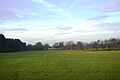
 Fields north-east of Chelford - geograph.org.uk - 4925560.jpg 1,024 × 768; 124 KB
-
 Four Oaks Nursery - geograph.org.uk - 423224.jpg 640 × 480; 100 KB
-
 Frosty lane on the southern edge of Chelford Heath - geograph.org.uk - 5279089.jpg 5,184 × 2,920; 5.76 MB
-
 Golden Bike - geograph.org.uk - 5095159.jpg 1,000 × 750; 170 KB
-
 Golden Bike - geograph.org.uk - 5095160.jpg 1,000 × 750; 153 KB
-
 Knowsley Farm - geograph.org.uk - 2771496.jpg 640 × 480; 50 KB
-
 Knutsford Road - geograph.org.uk - 2569388.jpg 640 × 480; 91 KB
-
-
 Pepper Street, Snelson - geograph.org.uk - 3055451.jpg 3,456 × 2,304; 4 MB
-
 Public Footpath to Astle Farm - geograph.org.uk - 2450957.jpg 640 × 480; 109 KB
-
 Roadside Farm - geograph.org.uk - 3826935.jpg 640 × 335; 34 KB
-
 Roadside Farm, Chelford - geograph.org.uk - 4925552.jpg 1,024 × 768; 108 KB
-
 Sand extraction at SJ8274 - geograph.org.uk - 2450974.jpg 640 × 480; 106 KB
-
-

-
 Single tree in a field, Chelford - geograph.org.uk - 2810916.jpg 640 × 430; 46 KB
-

-
 The A537 at Chelford - geograph.org.uk - 1908798.jpg 640 × 480; 100 KB
-
 The Corner Shoppe - geograph.org.uk - 1538896.jpg 640 × 428; 91 KB
-
 The corner Shoppe - geograph.org.uk - 1538898.jpg 640 × 428; 103 KB
-
 The footpath west from Astle Farms - geograph.org.uk - 3054049.jpg 3,456 × 2,304; 4.74 MB
-
 Two trees in a field - geograph.org.uk - 3829758.jpg 640 × 379; 40 KB
-
-
 A535 looking north - geograph.org.uk - 1190537.jpg 640 × 480; 227 KB
-
 Alderley Road - geograph.org.uk - 423193.jpg 640 × 491; 74 KB
-
 Astle, near Chelford - geograph.org.uk - 151143.jpg 640 × 480; 172 KB
-
 Barn at Knowsley Farm, Chelford - geograph.org.uk - 151150.jpg 640 × 377; 105 KB
-
 Carter Lane, Chelford - geograph.org.uk - 177650.jpg 640 × 480; 93 KB
-
 Congleton Lane, Chapel Wood - geograph.org.uk - 151148.jpg 640 × 480; 105 KB
-
 Fallows Hall, Monks Heath - geograph.org.uk - 151139.jpg 640 × 480; 104 KB
-

-
 Lakes at Dingle Bank Quarry - geograph.org.uk - 35818.jpg 640 × 480; 63 KB
-
 Lane near Jones's Wood Withington - geograph.org.uk - 440493.jpg 640 × 428; 187 KB
-
 Pepper Street, Chelford - geograph.org.uk - 177660.jpg 640 × 480; 135 KB
-
 Railway crossing the A535 - geograph.org.uk - 177583.jpg 640 × 462; 140 KB
-
 Red Lion Brook - geograph.org.uk - 498651.jpg 480 × 640; 156 KB
-


_-_geograph.org.uk_-_2451004.jpg)


