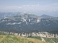
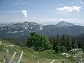
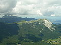
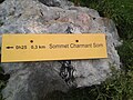
Category:Charmant Som
Jump to navigation
Jump to search
mountain in France   | |||||
| Upload media | |||||
| Instance of | |||||
|---|---|---|---|---|---|
| Made from material | |||||
| Location | Isère, Auvergne-Rhône-Alpes, Metropolitan France, France | ||||
| Mountain range | |||||
| Elevation above sea level |
| ||||
 | |||||
Subcategories
This category has the following 4 subcategories, out of 4 total.
C
- Chalets de Charmant Som (8 F)
O
- Oratoire d'Orgeval (4 F)
R
- Route du Charmant Som (15 F)
V
- Views from Charmant Som (28 F)
Media in category "Charmant Som"
The following 56 files are in this category, out of 56 total.
-
 Alpages au Charmant Som en Chartreuse.JPG 2,712 × 1,563; 1.15 MB
-
 Alpages Charmant Som.jpg 2,560 × 1,440; 982 KB
-
 Alpages- Charmant Som 38.JPG 2,592 × 1,944; 2.22 MB
-
 Calcaire Charmant Som.jpg 2,560 × 1,440; 1,010 KB
-
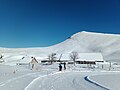 Chalets de Charmant Som 01.jpg 4,608 × 3,456; 4.02 MB
-
 Charmant Som - face Ouest.JPG 4,320 × 3,240; 2.69 MB
-
 Charmant Som @ Oratoire d'Orgeval 01.jpg 4,608 × 3,456; 3.69 MB
-
 Charmant Som @ Oratoire d'Orgeval 02.jpg 4,608 × 3,456; 3.54 MB
-
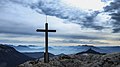
 Charmant Som croix.jpg 4,608 × 3,456; 2.19 MB
-
 Charmant Som depuis l'antécime sud.JPG 4,320 × 3,240; 2.68 MB
-
 Charmant Som sommet.jpg 4,608 × 3,456; 3.97 MB
-
 Charmant Som, seen from Saint-Hugues-de-Chartreuse-7449.jpg 5,184 × 3,456; 11.84 MB
-
 Charmant Som, summit.jpg 2,560 × 1,920; 1.18 MB
-
 Cret Hurtières Grenoble.jpg 14,039 × 5,000; 21.04 MB
-
 Croix du Charmant Som.jpg 5,058 × 2,845; 5 MB
-
 Croix-sommet-charmant-som1.jpg 5,184 × 3,888; 4.83 MB
-
 Croix-sommet-charmant-som2.jpg 5,184 × 3,888; 3.6 MB
-
 Escalade Chamant Som.jpg 305 × 288; 69 KB
-
 Forêt enneigée @ Route du Charmant Som 01.jpg 4,608 × 3,456; 3.37 MB
-
 Forêt enneigée @ Route du Charmant Som 02.jpg 4,608 × 3,456; 3.07 MB
-
 Forêt enneigée @ Route du Charmant Som 03.jpg 4,608 × 3,456; 6.58 MB
-
 Forêt enneigée @ Route du Charmant Som 04.jpg 4,608 × 3,456; 5.95 MB
-
 Forêt enneigée @ Route du Charmant Som 05.jpg 4,608 × 3,456; 7.46 MB
-
 Forêt enneigée @ Route du Charmant Som 06.jpg 4,608 × 3,456; 7.49 MB
-
 Le Charmant Som 2.JPG 1,600 × 1,200; 1.01 MB
-
 Le Charmant Som depuis face sud.JPG 1,600 × 1,200; 417 KB
-
 Le Charmant Som et Chamechaude depuis le Col de la Grande Vache.JPG 1,600 × 1,200; 1.03 MB
-
 Le Charmant Som.JPG 1,600 × 1,200; 353 KB
-
 Le gouffre François Thierry.jpg 3,456 × 4,608; 3.14 MB
-
 Le gouffre Kriska.jpg 3,456 × 4,608; 2.69 MB
-
 Le-charmant-som.jpg 5,184 × 3,888; 4.09 MB
-
 Les Égaux - Saint-Hugues-de-Chartreuse - Grand Som - Charmant Som-7431-34.jpg 13,895 × 2,714; 24.52 MB
-
 Light and snow.jpg 4,641 × 3,093; 2.59 MB
-
 Mer de nuages Grenoble @ Charmant Som 01.jpg 4,608 × 3,456; 3.93 MB
-
 Mer de nuages Grenoble @ Charmant Som 02.jpg 4,608 × 3,456; 3.41 MB
-
 Painting on a rock showing path to Charmant Som.jpg 2,560 × 1,920; 3.83 MB
-
 Panneau ascension Charmant Som.jpg 2,560 × 1,920; 3.1 MB
-
 Panneau zone restauration pelouse - parc naturel régional de Chartreuse.jpg 2,560 × 1,920; 2.9 MB
-
 Panorama depuis Chamechaude.JPG 1,795 × 816; 299 KB
-
 Pinéa @ Charmant Som 01.jpg 4,608 × 3,456; 3.52 MB
-
 Pinéa @ Charmant Som 02.jpg 4,608 × 3,456; 2.11 MB
-
 Piste du Charmant Som.jpg 4,608 × 3,456; 5.72 MB
-
 Rocher de Lorzier @ Charmant Som 01.jpg 4,608 × 3,456; 4.21 MB
-
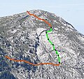
 Route Charmant Som 1.jpg 2,560 × 1,440; 1.02 MB
-
 Route Charmant Som 2.jpg 2,560 × 1,440; 971 KB
-
 Sentier d'accès à l'antécime sud du Charmant Som.JPG 4,320 × 3,240; 2.73 MB
-
 Som et lumiere.png 5,194 × 3,457; 14.84 MB
-
 Télésiège du Charmant Som 01.jpg 4,608 × 3,456; 6.78 MB
-
 Télésiège du Charmant Som 02.jpg 4,608 × 3,456; 7.21 MB
-
 Télésiège du Charmant Som 03.jpg 4,608 × 3,456; 7.05 MB
-
 VcCharmantSom2.jpg 3,280 × 2,170; 2.43 MB
-
 VcCharmantSom3.jpg 3,277 × 2,141; 2.66 MB
-
 VcCharmantSom4.jpg 3,280 × 2,170; 2.99 MB
-
 VcCharmantSom5.jpg 2,174 × 1,445; 1.28 MB
-
 Vue sur le secteur où se situe le réseau Ded.jpg 3,456 × 4,608; 6.5 MB
-
 Vératre blanc en Chartreuse.JPG 3,240 × 4,320; 2.66 MB


