Category:Charlton Horethorne
Jump to navigation
Jump to search
English: Charlton Horethorne is a village and civil parish in Somerset, England, situated five miles north-east of Sherborne and five miles south-west of Wincanton in the South Somerset district. The village has a population of 605.
village and civil parish in Somerset, United Kingdom  | |||||
| Upload media | |||||
| Instance of | |||||
|---|---|---|---|---|---|
| Location | South Somerset, Somerset, South West England, England | ||||
 | |||||
Subcategories
This category has the following 2 subcategories, out of 2 total.
S
Media in category "Charlton Horethorne"
The following 68 files are in this category, out of 68 total.
-
 B3145 entering Charlton Horethorne, Somerset.jpg 5,152 × 3,864; 4.41 MB
-
 B3145 near Wormhill Lane - geograph.org.uk - 4045268.jpg 640 × 441; 69 KB
-
 Barns on Maperton Road, Charlton Horethorne - geograph.org.uk - 5095850.jpg 1,600 × 1,043; 556 KB
-
 Beech Farm - geograph.org.uk - 4454688.jpg 800 × 533; 209 KB
-
 Byway near Clare Cottages - geograph.org.uk - 2551865.jpg 640 × 480; 107 KB
-
 Cattle on Corton Hill - geograph.org.uk - 4454682.jpg 800 × 533; 166 KB
-
 Charlton Gorse, Charlton Horethorne - geograph.org.uk - 637081.jpg 640 × 319; 204 KB
-
 Charlton Horethorne 01.jpg 5,152 × 3,864; 8.09 MB
-
 Charlton Horethorne 02.jpg 5,152 × 3,864; 4.32 MB
-
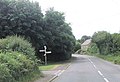
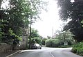
 Charlton Horethorne village centre - geograph.org.uk - 4045270.jpg 640 × 409; 56 KB
-

-
 Charlton Horethorne, Lane from Sigwells - geograph.org.uk - 1816527.jpg 799 × 684; 479 KB
-
 Charlton Horethorne, Service Station - geograph.org.uk - 1816536.jpg 736 × 800; 124 KB
-

-
 Charlton Horethorne, Village Green - geograph.org.uk - 1816545.jpg 800 × 535; 490 KB
-

-
 Church and farm buildings at Stowell - geograph.org.uk - 1899742.jpg 640 × 480; 169 KB
-
 Crossroads at Water Lane - geograph.org.uk - 4045269.jpg 640 × 435; 64 KB
-
 Derelict building, Sigwells, Somerset.jpg 5,152 × 3,864; 11.85 MB
-
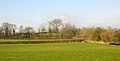 Farmland near Stowell - geograph.org.uk - 4348736.jpg 1,920 × 976; 332 KB
-
 Field at Stowell - geograph.org.uk - 3474050.jpg 640 × 293; 40 KB
-
 Field near Stowell - geograph.org.uk - 4755704.jpg 2,617 × 1,148; 530 KB
-
 Fields north of Sigwells - geograph.org.uk - 3366345.jpg 2,592 × 1,944; 1.56 MB
-
-
 Junction for Milborne Port - geograph.org.uk - 4045272.jpg 640 × 440; 82 KB
-
 Kings Arms, Charlton Horethorne - geograph.org.uk - 5095826.jpg 1,600 × 1,065; 466 KB
-
 Lane from Stowell to Templecoombe - geograph.org.uk - 1899757.jpg 640 × 480; 184 KB
-
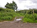
 Lane junction on the cycle byway - geograph.org.uk - 1899703.jpg 640 × 480; 203 KB
-
 Lane north from Stowell church and farm - geograph.org.uk - 5421026.jpg 640 × 480; 128 KB
-
 Manor Farm House - Charlton Horethorne - geograph.org.uk - 890904.jpg 640 × 384; 348 KB
-
 Milborne Port, Junction to Stowell - geograph.org.uk - 1816556.jpg 800 × 484; 457 KB
-
 Milk churn stand, Sigwells - geograph.org.uk - 2276490.jpg 640 × 482; 84 KB
-
 North Road Cottage, Charton Horethorne - geograph.org.uk - 5095843.jpg 1,600 × 1,065; 551 KB
-

-

-
 Postbox, Sigwells - geograph.org.uk - 2276472.jpg 480 × 640; 117 KB
-
 Quarrey House Charlton Horethorne - geograph.org.uk - 557413.jpg 640 × 525; 137 KB
-
 Railway bridge over Shoredown Lane - geograph.org.uk - 5417392.jpg 640 × 480; 190 KB
-

-
 Road past Stowell church and farm - geograph.org.uk - 5421019.jpg 640 × 480; 122 KB
-
 Scarp, Whitcombe - geograph.org.uk - 4454670.jpg 800 × 533; 163 KB
-
 Silage bales, Stowell Farm - geograph.org.uk - 5421150.jpg 640 × 428; 102 KB
-
 Stowell church - geograph.org.uk - 5417410.jpg 640 × 428; 132 KB
-
 The Cleeve, Charlton Horethorne 01.jpg 5,152 × 3,864; 4.33 MB
-
 The Cleeve, Charlton Horethorne 02.jpg 5,152 × 3,864; 4.34 MB
-
 The Cleeve, Charlton Horethorne 03.jpg 5,152 × 3,864; 4.35 MB
-
 The Cleeve, Charlton Horethorne 04.jpg 5,152 × 3,864; 4.41 MB
-
 The Cleeve, Charlton Horethorne 05.jpg 5,152 × 3,864; 4.36 MB
-
 The Cleeve, Charlton Horethorne 06.jpg 5,152 × 3,864; 4.48 MB
-
 The lane to Sherborne - geograph.org.uk - 3366357.jpg 2,592 × 1,944; 1.54 MB
-
 Two horses in a field - geograph.org.uk - 5421196.jpg 640 × 480; 152 KB
-
 Waterloo Crescent Charlton Horethorne - geograph.org.uk - 557397.jpg 640 × 480; 141 KB
-
 Whitcombe - geograph.org.uk - 4454657.jpg 800 × 533; 131 KB
-
-

-
-

-

-

-

-
 Charlton Gorse, Charlton Horethorne - geograph.org.uk - 637169.jpg 640 × 427; 366 KB
-
 Charlton Horethorne Stores - geograph.org.uk - 288286.jpg 640 × 480; 91 KB
-
 Down Farm from the end of Cowpath Lane - geograph.org.uk - 557375.jpg 601 × 442; 152 KB
-
 Gunville Farm entrance - geograph.org.uk - 557319.jpg 640 × 480; 169 KB
-
 Hanglands Lane bridleway - geograph.org.uk - 561624.jpg 640 × 425; 128 KB
-
 Near Charlton Horethorne - geograph.org.uk - 306399.jpg 640 × 480; 142 KB
-
 Penhill farm - geograph.org.uk - 560883.jpg 640 × 425; 80 KB
-
 Road approaching Five Acres - geograph.org.uk - 560873.jpg 640 × 425; 96 KB


_-_geograph.org.uk_-_5128593.jpg)
_-_geograph.org.uk_-_5128596.jpg)
_-_geograph.org.uk_-_5128608.jpg)
_-_geograph.org.uk_-_5128614.jpg)
_-_geograph.org.uk_-_5128616.jpg)
_-_geograph.org.uk_-_5128619.jpg)
_-_geograph.org.uk_-_5128622.jpg)


