Category:Charlevoix-Est Regional County Municipality
Jump to navigation
Jump to search
regional county municipality in Quebec, Canada | |||||
| Upload media | |||||
| Instance of | |||||
|---|---|---|---|---|---|
| Location | Capitale-Nationale, Quebec, Canada | ||||
| Capital | |||||
| Population |
| ||||
| Area |
| ||||
| official website | |||||
 | |||||
Subcategories
This category has the following 11 subcategories, out of 11 total.
Media in category "Charlevoix-Est Regional County Municipality"
The following 15 files are in this category, out of 15 total.
-
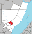
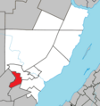
Baie-Sainte-Catherine Quebec location diagram.png 630 × 672; 118 KB
-
Cap-à-l'Aigle (La Malbaie, QC)-Vue sur le fleuve, de la rue Principale-2014-07-21(B).jpg 2,239 × 1,073; 671 KB
-
Charlevoix cote 2.jpg 3,843 × 2,499; 5.62 MB
-
Charlevoix cote.jpg 3,822 × 2,346; 5.03 MB
-
Clermont (Capitale-Nationale) Quebec location diagram.png 630 × 672; 118 KB
-
Domaine Forget (Saint-Irenée-Charlevoix)-Entrée principale-2014-07-21.jpg 2,715 × 1,896; 1.61 MB
-
La Malbaie Quebec location diagram.png 630 × 672; 118 KB
-
Mont-Élie Quebec location diagram.png 630 × 672; 118 KB
-
Notre-Dame-des-Monts Quebec location diagram.png 630 × 672; 118 KB
-
Port-au-persil - panoramio.jpg 5,252 × 1,451; 1.48 MB
-
Saint-Aimé-des-Lacs Quebec location diagram.png 630 × 672; 118 KB
-
Saint-Irenée (Charlevoix) - Chemin de fer.jpg 1,944 × 2,592; 2.55 MB
-
Saint-Irénée Quebec location diagram.png 630 × 672; 118 KB
-
Saint-Siméon (Capitale-Nationale) Quebec location diagram.png 630 × 672; 118 KB
-
Vue du sommet.jpg 3,264 × 2,448; 2.78 MB


