Category:Charlestown, Fife
Jump to navigation
Jump to search
English: Charlestown, Fife (also known as Charlestown-on-Forth) is a town in Scotland on the north shore of the Firth of Forth, adjoining Limekilns and Rosyth. Like Rosyth, Charlestown was home to a sizable shipbreaking industry in the mid twentieth century
village in Fife, Scotland, UK  | |||||
| Upload media | |||||
| Instance of | |||||
|---|---|---|---|---|---|
| Location |
| ||||
 | |||||
Subcategories
This category has the following 6 subcategories, out of 6 total.
C
- Charlestown harbour, Fife (21 F)
- Charlestown Quarry (3 F)
- Craigs Plantation, Fife (2 F)
L
- Charlestown lime kilns (18 F)
S
W
- Waulkmill Farm (2 F)
Media in category "Charlestown, Fife"
The following 71 files are in this category, out of 71 total.
-
 'Largo Law' at Charlestown - geograph.org.uk - 3329391.jpg 2,448 × 3,264; 3.79 MB
-
 'Largo Law' in Charlestown Harbour - geograph.org.uk - 3329392.jpg 3,264 × 2,448; 3.67 MB
-

-
 A Charlestown scene - geograph.org.uk - 1184479.jpg 640 × 480; 79 KB
-
 Across the Firth towards Limekilns from Blackness Castle - geograph.org.uk - 5216820.jpg 3,678 × 2,456; 3.8 MB
-
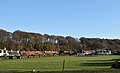
 Almost harvest time - geograph.org.uk - 1419689.jpg 640 × 480; 84 KB
-
 Approaching Limekilns from the West - geograph.org.uk - 3442169.jpg 800 × 600; 134 KB
-
 Blacksmith's Cottage - geograph.org.uk - 756136.jpg 640 × 427; 258 KB
-
 Bowling Green, Charlestown - geograph.org.uk - 1354392.jpg 640 × 360; 73 KB
-

-
 Charlestown from Rocks Plantation - geograph.org.uk - 1354388.jpg 360 × 640; 129 KB
-
 Charlestown harbour - geograph.org.uk - 2500959.jpg 2,560 × 1,920; 1.19 MB
-
 Charlestown Harbour - geograph.org.uk - 3329394.jpg 3,264 × 2,448; 3.32 MB
-
 Charlestown Harbour - geograph.org.uk - 3329397.jpg 3,264 × 2,448; 3.28 MB
-
 Charlestown Harbour - geograph.org.uk - 3441730.jpg 800 × 600; 159 KB
-
 Charlestown Harbour - geograph.org.uk - 3442130.jpg 800 × 600; 115 KB
-
 Charlestown Harbour - geograph.org.uk - 3442144.jpg 800 × 600; 112 KB
-
 Charlestown harbour - geograph.org.uk - 4259664.jpg 1,667 × 2,500; 2.93 MB
-
 Charlestown Harbour entrance - geograph.org.uk - 5501774.jpg 3,264 × 2,448; 3.92 MB
-
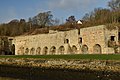 Charlestown Limekilns 1 to 11.jpg 3,000 × 2,000; 2.1 MB
-
 Charlestown Planned Village.jpg 3,000 × 1,825; 1.51 MB
-
 Charlestown Railway Station.jpg 776 × 467; 50 KB
-
 Charlestown village OS street names.jpg 955 × 614; 227 KB
-
 Classic cars, Charlestown - geograph.org.uk - 1516161.jpg 640 × 480; 92 KB
-
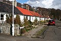
 Cottages - geograph.org.uk - 475606.jpg 640 × 424; 67 KB
-
 Cottages at Charlestown - geograph.org.uk - 1515946.jpg 640 × 480; 88 KB
-
 Disused Quarry - geograph.org.uk - 101742.jpg 640 × 480; 127 KB
-
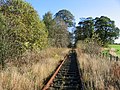
 Disused railway line - geograph.org.uk - 759356.jpg 640 × 426; 95 KB
-
 Disused railway, Sillieton - geograph.org.uk - 75966.jpg 640 × 480; 144 KB
-
 Double Row - geograph.org.uk - 1354346.jpg 640 × 475; 99 KB
-
 Double Row - geograph.org.uk - 756144.jpg 640 × 427; 272 KB
-
 Footbridge - geograph.org.uk - 101452.jpg 640 × 480; 172 KB
-
 Foreshore at Limekilns - geograph.org.uk - 5501867.jpg 2,736 × 2,052; 1.96 MB
-
 Idyllic cottage and garden, Charlestown - geograph.org.uk - 1516150.jpg 640 × 480; 138 KB
-
 In the Cutting - geograph.org.uk - 755649.jpg 473 × 640; 330 KB
-
 Ironmill Bay - geograph.org.uk - 101443.jpg 640 × 480; 111 KB
-
 Ivy-covered Trees - geograph.org.uk - 755970.jpg 427 × 640; 318 KB
-
 Limekilns - geograph.org.uk - 3351976.jpg 4,320 × 3,240; 3.39 MB
-
 Limekilns at Charlestown - geograph.org.uk - 3441745.jpg 800 × 600; 113 KB
-
 Limekilns Harbour - geograph.org.uk - 2811541.jpg 4,320 × 3,240; 2.34 MB
-
 Limekilns Harbour - geograph.org.uk - 4766388.jpg 640 × 425; 100 KB
-
 Limekilns pier - geograph.org.uk - 4333932.jpg 640 × 427; 263 KB
-
 Moored dinghy, Limekilns Harbour - geograph.org.uk - 5592718.jpg 3,264 × 2,448; 2.89 MB
-
 North Row Charlestown - geograph.org.uk - 1419676.jpg 640 × 480; 96 KB
-
 Post Office, Charlestown - geograph.org.uk - 1515935.jpg 640 × 480; 89 KB
-
 Queen's Hall - geograph.org.uk - 756154.jpg 640 × 427; 255 KB
-
 Railway bridge - geograph.org.uk - 476292.jpg 640 × 424; 60 KB
-
 Railway bridge near Limekilns - geograph.org.uk - 759368.jpg 640 × 402; 70 KB
-
 RFA Fort Rosalie at DM Crombie - geograph.org.uk - 5501725.jpg 3,264 × 2,448; 2.22 MB
-
 Rock Cutting - geograph.org.uk - 755895.jpg 640 × 427; 286 KB
-
 Rocks Plantation - geograph.org.uk - 1354377.jpg 640 × 444; 141 KB
-
 Rocks Plantation - geograph.org.uk - 1543359.jpg 480 × 640; 151 KB
-
 Sandstone Cliff - geograph.org.uk - 756092.jpg 640 × 367; 212 KB
-
 Shell Road - geograph.org.uk - 755945.jpg 640 × 427; 336 KB
-

-

-

-

-
 The Forth Bridges from Limekilns Promenade - geograph.org.uk - 5501886.jpg 2,945 × 2,206; 1.79 MB
-
 The Green - geograph.org.uk - 756104.jpg 640 × 268; 163 KB
-
 The Green - geograph.org.uk - 756119.jpg 640 × 320; 179 KB
-
 The Old School - geograph.org.uk - 755912.jpg 640 × 387; 273 KB
-
 The Promenade at Limekilns - geograph.org.uk - 5334496.jpg 3,264 × 2,448; 2.62 MB
-

-
 The road to Aberlyn - geograph.org.uk - 1184490.jpg 640 × 480; 111 KB
-
 The Sentinel - geograph.org.uk - 1354361.jpg 480 × 640; 159 KB
-
 The Ship Inn - geograph.org.uk - 5334487.jpg 3,264 × 2,448; 2.19 MB
-
 View from Charlestown Harbour - geograph.org.uk - 5501769.jpg 3,264 × 2,448; 3.39 MB
-
 View from Limekilns - geograph.org.uk - 4333939.jpg 640 × 373; 169 KB
-
 View from The Binns - geograph.org.uk - 700186.jpg 440 × 640; 68 KB
-
 Water's edge - geograph.org.uk - 2830685.jpg 1,536 × 2,048; 785 KB


.jpg)
.jpg)
.jpg)
.jpg)


