Category:Charity shoals
Jump to navigation
Jump to search
Media in category "Charity shoals"
The following 4 files are in this category, out of 4 total.
-
-
 NOAA bathymetric map of the West and East Kingston Basins.jpg 3,012 × 2,032; 3.78 MB
-
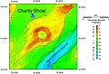 NOAA map of Charity Shoal in Lake Ontario.jpg 2,340 × 1,596; 1.51 MB
-
 NOAA map of Duck Galloo Ridge.jpg 2,736 × 2,228; 3.47 MB


