Category:Chapels in Kent
Jump to navigation
Jump to search
Ceremonial counties of England: Bedfordshire · Berkshire · Buckinghamshire · Cambridgeshire · Cheshire · Cornwall · Cumbria · Derbyshire · Devon · Dorset · Durham · East Riding of Yorkshire · East Sussex · Essex · Gloucestershire · Greater London · Greater Manchester · Hampshire · Herefordshire · Hertfordshire · Kent · Lancashire · Leicestershire · Lincolnshire · Merseyside · Norfolk · North Yorkshire · Northamptonshire · Northumberland · Nottinghamshire · Oxfordshire · Rutland · Shropshire · Somerset · South Yorkshire · Staffordshire · Suffolk · Surrey · Tyne and Wear · Warwickshire · West Midlands · West Sussex · West Yorkshire · Wiltshire · Worcestershire
City-counties: Bristol · City of London
Former historic counties:
Other former counties:
City-counties: Bristol · City of London
Former historic counties:
Other former counties:
Subcategories
This category has the following 17 subcategories, out of 17 total.
- Chapel organs in Kent (2 F)
B
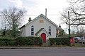
- Birchington Methodist Church (2 F)
C
- Greyfriars Chapel, Canterbury (11 F)
D
- Saint Edmund's Chapel, Dover (10 F)
K
M
P
- Poundsbridge Chapel (6 F)
T
- Tonbridge School Chapel (3 F)
Media in category "Chapels in Kent"
The following 49 files are in this category, out of 49 total.
-
 Ash Chapel - geograph.org.uk - 1178609.jpg 640 × 481; 73 KB
-
 Aylesford Friary.jpg 800 × 530; 622 KB
-
 Burrswood church interior - geograph.org.uk - 807603.jpg 640 × 480; 114 KB
-
 Chapel - geograph.org.uk - 244581.jpg 640 × 480; 75 KB
-

-
 Chapel on Forge Hill, Bethersden - geograph.org.uk - 788578.jpg 640 × 480; 182 KB
-
 Chapel Place on the High Street - geograph.org.uk - 1638465.jpg 480 × 640; 107 KB
-

-
 Congrecational Chapel, Higham - geograph.org.uk - 1399400.jpg 640 × 480; 81 KB
-
 Congregational Chapel, Higham, Kent - geograph.org.uk - 356331.jpg 640 × 480; 81 KB
-
 Disused Catholic Chapel, Grain - geograph.org.uk - 1107822.jpg 640 × 481; 86 KB
-
 Derelict church, Eastwell, near Ashford, Kent, England UK.jpg 3,648 × 2,736; 4.37 MB
-
 St Mary's Church Eastwell - geograph.org.uk - 941782.jpg 640 × 480; 96 KB
-
 St Mary's Church, Eastwell, Kent - geograph.org.uk - 809082.jpg 471 × 640; 110 KB
-
 St Mary, Eastwell, Kent - geograph.org.uk - 809069.jpg 640 × 471; 100 KB
-
 St. Mary's Church (ruins), Eastwell Park 02.JPG 2,816 × 2,112; 1.48 MB
-
 St. Mary's Church, Eastwell Park - geograph.org.uk - 1409525.jpg 480 × 640; 216 KB
-
 The church of St. Mary, Eastwell - geograph.org.uk - 1198814.jpg 480 × 640; 89 KB
-
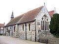
 St Mary, High Halden, Kent - geograph.org.uk - 324082.jpg 640 × 452; 119 KB
-
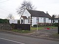
 Manston Methodist chapel - geograph.org.uk - 382738.jpg 640 × 480; 46 KB
-
 Methodist Chapel at East Peckham - geograph.org.uk - 89422.jpg 640 × 480; 73 KB
-
 Minster Bethel Congregational Church - geograph.org.uk - 1138312.jpg 640 × 481; 43 KB
-
 Old chapel, Finglesham - geograph.org.uk - 5807583.jpg 1,024 × 681; 170 KB
-
 Old Wesleyan Chapel - geograph.org.uk - 385965.jpg 640 × 480; 230 KB
-
 Pedlinge-church.JPG 2,592 × 1,944; 1.51 MB
-
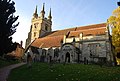
 St John the Baptist, Penshurst.jpg 1,600 × 1,200; 473 KB
-
 St. John the Baptist Church - geograph.org.uk - 1028633.jpg 640 × 430; 76 KB
-
 St.John the Baptist's church - geograph.org.uk - 842519.jpg 640 × 427; 65 KB
-
 Penshurst Church - geograph.org.uk - 1804919.jpg 640 × 480; 116 KB
-
 Providence Chapel 1866 - geograph.org.uk - 340286.jpg 640 × 428; 108 KB
-
 Rhodes Minnis Chapel - geograph.org.uk - 330374.jpg 480 × 640; 246 KB
-
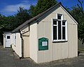
 Rhodes Minnis Chapel and village hall - geograph.org.uk - 330369.jpg 640 × 480; 177 KB
-
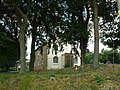
 The chapel of St. Bartholomew - geograph.org.uk - 219426.jpg 640 × 480; 104 KB
-
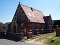
 Southdown Church - geograph.org.uk - 1222969.jpg 640 × 480; 90 KB
-
 St. Augustines Chapel, Chartham Downs - geograph.org.uk - 1806049.jpg 3,072 × 2,304; 1.77 MB
-
 Svs chapel.jpg 640 × 472; 49 KB
-
 The Chapel, Grain - geograph.org.uk - 1107812.jpg 640 × 481; 67 KB
-
 The Chapel, Grain - geograph.org.uk - 1354880.jpg 640 × 480; 74 KB
-
 The old chapel at Blean - geograph.org.uk - 88691.jpg 480 × 640; 142 KB
-
 The Old Wesleyan Chapel - geograph.org.uk - 2046253.jpg 3,072 × 2,304; 969 KB
-
 Tin Chapel, Sole Street, Kent.jpg 3,168 × 2,538; 1.98 MB
-
 Wesleyan Chapel, Ightham - geograph.org.uk - 331341.jpg 640 × 423; 124 KB
-
 Chantry Chapel, Three Kings Yard - geograph.org.uk - 750480.jpg 640 × 480; 106 KB
-
 Chapel on The Street, Finglesham - geograph.org.uk - 680211.jpg 640 × 480; 177 KB
-
 Concrete chapel, Dungeness, Kent - geograph.org.uk - 1416414.jpg 640 × 480; 55 KB
-
 Copse -, Chapel of St. Blaise - geograph.org.uk - 25354.jpg 640 × 480; 56 KB
-
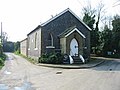
 Zion Chapel, Pembury Rd - geograph.org.uk - 1198723.jpg 640 × 430; 77 KB
-
 Zion Chapel, Pembury Rd, Tonbridge - geograph.org.uk - 1032460.jpg 640 × 430; 71 KB
-
 The Sanctuary, Dungeness - geograph.org.uk - 449509.jpg 640 × 479; 152 KB


,_Eastwell_Park_02.JPG)


