Category:Chapels at Flaybrick Memorial Gardens
Jump to navigation
Jump to search
| Object location | | View all coordinates using: OpenStreetMap |
|---|
grade II listed chapels in Birkenhead, Wirral, Merseyside, England, UK  | |||||
| Upload media | |||||
| Instance of | |||||
|---|---|---|---|---|---|
| Location | Flaybrick Memorial Gardens, Birkenhead, Wirral, Merseyside, North West England, England | ||||
| Heritage designation |
| ||||
 | |||||
Subcategories
This category has the following 3 subcategories, out of 3 total.
N
S
Media in category "Chapels at Flaybrick Memorial Gardens"
The following 9 files are in this category, out of 9 total.
-

-
-
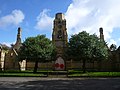
 Chapels at Flaybrick from the east.jpg 4,455 × 3,507; 8.42 MB
-
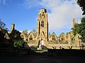
 Chapels at Flaybrick from the west 2.jpg 4,452 × 2,886; 6.63 MB
-
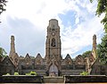
 Chapels at Flaybrick from the west.jpg 4,080 × 3,030; 8.07 MB
-
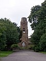 Flaybrick Chapel - geograph.org.uk - 1405238.jpg 480 × 640; 72 KB
-
 Flaybrick Memorial Gardens (11).JPG 4,320 × 3,240; 3.55 MB
-
 Flaybrick Memorial Gardens, Birkenhead (2).JPG 4,000 × 3,000; 2.96 MB
-
 Grotesque on west side of Flaybrick chapels.jpg 3,380 × 4,506; 12.16 MB


.JPG)
.JPG)
