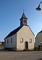
Category:Chapelle Sainte-Walburge (Lévelange)
Jump to navigation
Jump to search
| Object location | | View all coordinates using: OpenStreetMap |
|---|
 | |||||
| Upload media | |||||
| Instance of | |||||
|---|---|---|---|---|---|
| Location |
| ||||
 | |||||
Media in category "Chapelle Sainte-Walburge (Lévelange)"
The following 3 files are in this category, out of 3 total.
-
 Kapelle Lévelange 01.jpg 1,940 × 1,445; 1.67 MB
-
 Kapelle Lévelange 02.jpg 1,405 × 1,989; 1.51 MB
-
 Kapelle Lévelange 03.jpg 1,425 × 1,962; 1.39 MB

