Category:Chapelle Sainte-Catherine d'Hagenthal-le-Haut
Jump to navigation
Jump to search
| Object location | | View all coordinates using: OpenStreetMap |
|---|
|
This building is indexed in the base Mérimée, a database of architectural heritage maintained by the French Ministry of Culture, under the reference IA00024459
|
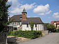
chapel located in Haut-Rhin, in France  | |||||
| Upload media | |||||
| Instance of | |||||
|---|---|---|---|---|---|
| Location | Hagenthal-le-Haut, canton of Huningue | ||||
| Street address |
| ||||
| Heritage designation | |||||
 | |||||
Media in category "Chapelle Sainte-Catherine d'Hagenthal-le-Haut"
This category contains only the following file.
-
 Hagenthal-le-Haut, Chapelle Sainte-Catherine.jpg 3,264 × 2,448; 1.99 MB