Category:Chapelle Saint-Thomas (Merscheid)
Jump to navigation
Jump to search
| Object location | | View all coordinates using: OpenStreetMap |
|---|
| Upload media | |||||
| Instance of | |||||
|---|---|---|---|---|---|
| Location | Esch-sur-Sûre, Canton of Wiltz, Luxembourg | ||||
 | |||||
Media in category "Chapelle Saint-Thomas (Merscheid)"
The following 17 files are in this category, out of 17 total.
-
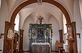 Altoer.jpg 2,048 × 1,327; 639 KB
-
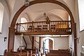 Ducksall.jpg 2,048 × 1,365; 712 KB
-
 Fënschter.jpg 1,022 × 2,048; 527 KB
-
 Kapelle Merscheid 01.jpg 2,600 × 1,810; 3.55 MB
-
 Kapelle Merscheid 02.jpg 1,790 × 2,640; 3.34 MB
-
 Kapelle Merscheid 03.jpg 1,780 × 2,651; 4.56 MB
-
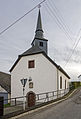
 Kierch vu Mëtscheed.jpg 1,685 × 1,302; 737 KB
-
 Medaillon.jpg 1,439 × 2,048; 906 KB
-
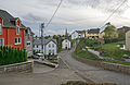 Merscheid 01.jpg 2,690 × 1,755; 3.62 MB
-
 Muttergottesstatu.jpg 1,030 × 2,048; 470 KB
-
 Muttergottesstatue.jpg 1,365 × 2,048; 733 KB
-
 Pieta am Altoer.jpg 1,294 × 2,048; 788 KB
-
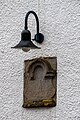 Portallampe.jpg 1,365 × 2,048; 1.19 MB
-
 Seitenfront.jpg 2,048 × 1,365; 812 KB
-
 Statue im Alter.jpg 1,121 × 2,048; 542 KB
-
 Statue im linken Teil des Altars.jpg 1,179 × 2,048; 744 KB
-
 Viischt Front vun der Kierch.jpg 1,344 × 2,048; 950 KB


