Category:Chapelle Saint-Pirmin (Kaundorf)
Jump to navigation
Jump to search
| Object location | | View all coordinates using: OpenStreetMap |
|---|
 | |||||
| Upload media | |||||
| Instance of | |||||
|---|---|---|---|---|---|
| Named after | |||||
| Location | Lac de la Haute-Sûre, Canton of Wiltz, Luxembourg | ||||
 | |||||
Media in category "Chapelle Saint-Pirmin (Kaundorf)"
The following 18 files are in this category, out of 18 total.
-
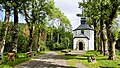
 Kaundorf, chapelle Saint-Pirmin (100).jpg 3,285 × 1,848; 1.93 MB
-
 Kaundorf, chapelle Saint-Pirmin (101).jpg 3,087 × 1,737; 2.28 MB
-
 Kaundorf, chapelle Saint-Pirmin (102).jpg 3,060 × 1,721; 1.65 MB
-
 Kaundorf, chapelle Saint-Pirmin (103).jpg 3,186 × 1,792; 2.3 MB
-
 Kaundorf, chapelle Saint-Pirmin (104).jpg 3,265 × 1,837; 1.79 MB
-
 Kaundorf, chapelle Saint-Pirmin (105).jpg 3,141 × 1,767; 1.6 MB
-
 Kaundorf, chapelle Saint-Pirmin (106).jpg 1,848 × 4,000; 1.81 MB
-
 Kaundorf, chapelle Saint-Pirmin (107).jpg 4,000 × 1,848; 1.38 MB
-
 Kaundorf, chapelle Saint-Pirmin (108).jpg 1,848 × 3,285; 1.64 MB
-
 Kaundorf, chapelle Saint-Pirmin (109).jpg 3,180 × 1,789; 1.05 MB
-
 Kaundorf, chapelle Saint-Pirmin (110).jpg 1,848 × 2,464; 708 KB
-
 Kaundorf, chapelle Saint-Pirmin (111).jpg 2,084 × 1,563; 542 KB
-
 Kaundorf, chapelle Saint-Pirmin (112).jpg 1,754 × 1,754; 903 KB
-
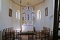
 Pirminuskapelle Kaundorf 01.jpg 2,763 × 1,710; 5.94 MB
-
 Pirminuskapelle Kaundorf 02.jpg 2,624 × 1,810; 5.9 MB
-
 Pirminuskapelle Kaundorf 03.jpg 2,641 × 1,790; 3.13 MB
-
 Pirminuskapelle Kaundorf 04.jpg 1,850 × 2,554; 3.5 MB
-
 PirmKapKau.JPG 2,036 × 2,188; 486 KB
.jpg)
.jpg)
.jpg)
.jpg)
.jpg)
.jpg)
.jpg)
.jpg)
.jpg)
.jpg)
.jpg)
.jpg)
.jpg)


