Category:Chapelle Notre-Dame des Douleurs (Scheidel)
Jump to navigation
Jump to search
| Object location | | View all coordinates using: OpenStreetMap |
|---|
 | |||||
| Upload media | |||||
| Instance of | |||||
|---|---|---|---|---|---|
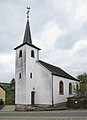
| Location | Scheidel, Bourscheid, Canton of Diekirch, Luxembourg | ||||
 | |||||
Media in category "Chapelle Notre-Dame des Douleurs (Scheidel)"
The following 3 files are in this category, out of 3 total.
-
 Kapelle Scheidel 01.jpg 1,924 × 1,454; 1.42 MB
-
 Kapelle Scheidel 02.jpg 1,387 × 2,017; 1.44 MB
-
 Kapelle Scheidel 03.jpg 1,425 × 1,962; 1.36 MB

