Category:Chapelle Mont Sainte-Marie (Ansembourg)
Jump to navigation
Jump to search
| Object location | | View all coordinates using: OpenStreetMap |
|---|
 | |||||
| Upload media | |||||
| Instance of | |||||
|---|---|---|---|---|---|
| Location | Ansembourg, Helperknapp, Canton of Mersch, Luxembourg | ||||
 | |||||
Media in category "Chapelle Mont Sainte-Marie (Ansembourg)"
The following 17 files are in this category, out of 17 total.
-
 AnsebuergMontMarie.jpg 960 × 1,318; 1.08 MB
-
 Fënster Privatkapell Aansebuerg.jpg 2,425 × 3,652; 6.47 MB
-
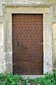
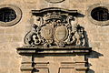 Portal Privatkapell Aansebuerg-001.jpg 3,614 × 2,400; 6.53 MB
-
 Portal Privatkapell Aansebuerg-002.jpg 4,288 × 2,848; 8.6 MB
-
 Portal Privatkapell Aansebuerg.jpg 2,769 × 4,169; 8.47 MB
-
 Privat Privatkapell Aansebuerg.jpg 2,815 × 2,426; 4.59 MB
-
 Privatkapell Aansebuerg-001.jpg 4,180 × 2,776; 7.6 MB
-
 Privatkapell Aansebuerg-002.jpg 4,116 × 2,734; 8.35 MB
-
 Privatkapell Aansebuerg-003.jpg 3,992 × 2,814; 7.69 MB
-
 Privatkapell Aansebuerg-004.jpg 3,830 × 2,544; 7.6 MB
-
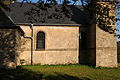
 Privatkapell Aansebuerg.jpg 3,102 × 2,060; 5.56 MB
-
 Säitendier Privatkapell Aansebuerg-001.jpg 2,585 × 3,892; 6.77 MB
-
 Säitendier Privatkapell Aansebuerg.jpg 2,651 × 3,991; 7.04 MB
-
 Tiermchen bei der Privatkapell Aansebuerg.jpg 3,583 × 2,380; 7.75 MB
-
 Trap Privatkapell Aansebuerg.jpg 2,583 × 3,888; 7.19 MB
-
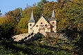
 Vue Park Schlass Aansebuerg-001.jpg 4,076 × 2,707; 10.69 MB
-
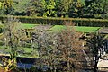
 Vue Park Schlass Aansebuerg.jpg 3,963 × 2,632; 9.13 MB


