Category:Chapel at cemetery Ruhland
Jump to navigation
Jump to search
| Object location | | View all coordinates using: OpenStreetMap |
|---|
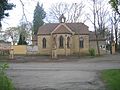
Friedhofskapelle in Ruhland
[edit]Deutsch: Diese Kategorie erfasst die Friedhofskapelle in Ruhland.
English: This category contains the chapel at cemetery Ruhland.
 | |||||
| Upload media | |||||
| Instance of | |||||
|---|---|---|---|---|---|
| Location | Cemetery Ruhland, Ruhland, Oberspreewald-Lausitz District, Brandenburg, Germany | ||||
| Located on street |
| ||||
 | |||||
Media in category "Chapel at cemetery Ruhland"
The following 21 files are in this category, out of 21 total.
-
 Friedhof Ruhland, Steinsäule am Hauptweg vor der Kapelle, 02.jpg 2,736 × 3,648; 5.66 MB
-
 Friedhofskapelle in Ruhland, Südansicht, segnender Engel über dem Eingang, 01.jpg 2,112 × 2,816; 1.61 MB
-
 Friedhofskapelle in Ruhland, Südansicht, segnender Engel über Eingang.jpg 2,112 × 2,816; 2.68 MB
-
 Ruhland Friedhof lub 2024-04-27 img01 Friedhofskapelle.jpg 4,032 × 3,024; 4.36 MB
-
 Ruhland Friedhofskapelle.jpg 3,264 × 2,448; 1.96 MB
-
 Ruhland, Friedhof, Eingang und Friedhofskapelle von Norden, Winter 01.jpg 2,272 × 1,704; 824 KB
-
 Ruhland, Friedhof, Eingang und Friedhofskapelle von Norden, Winter 02.jpg 2,272 × 1,704; 804 KB
-
 Ruhland, Friedhof, Eingang und Friedhofskapelle von Norden, Winter 03.jpg 2,272 × 1,704; 790 KB
-
 Ruhland, Friedhof, Eingang und Friedhofskapelle von Norden.jpg 2,272 × 1,704; 648 KB
-

-

-
 Ruhland, Friedhof, Eingangsbereich und Friedhofskapelle von Westen, Winter 01.jpg 2,272 × 1,704; 695 KB
-
 Ruhland, Friedhof, Eingangsbereich und Friedhofskapelle von Westen, Winter 02.jpg 2,272 × 1,704; 704 KB
-
 Ruhland, Friedhof, Eingangstür und Friedhofskapelle von Westen, Winter.jpg 1,704 × 2,272; 642 KB
-
 Ruhland, Friedhof, Friedhofskapelle und Tor Nordansicht 01.jpg 2,272 × 1,704; 650 KB
-
 Ruhland, Friedhof, Friedhofskapelle und Tor Nordansicht 02.jpg 2,272 × 1,704; 684 KB
-
 Ruhland, Friedhof, Friedhofskapelle Westansicht 02.jpg 2,272 × 1,704; 733 KB
-
 Ruhland, Friedhof, Friedhofskapelle Westansicht.jpg 1,704 × 2,272; 748 KB
-
 Ruhland, Friedhof, Friedhofskapelle, Nordansicht, Winter.jpg 2,272 × 1,704; 791 KB
-
 Ruhland, Friedhof, Friedhofskapelle, Südansicht, Winter.jpg 2,272 × 1,704; 605 KB
-
 Ruhland, Friedhofskapelle, Westnordwestansicht, Winter.jpg 2,272 × 1,704; 760 KB


