Category:Chalton, Bedfordshire
Jump to navigation
Jump to search
village and civil parish in Bedfordshire, UK  | |||||
| Upload media | |||||
| Instance of | |||||
|---|---|---|---|---|---|
| Location | Central Bedfordshire, Bedfordshire, East of England, England | ||||
| Population |
| ||||
 | |||||
English: Chalton is a village and civil parish in the Central Bedfordshire district of Bedfordshire, England, immediately north of the Luton/Dunstable conurbation and bounded to the east by the M1 motorway.
Media in category "Chalton, Bedfordshire"
The following 72 files are in this category, out of 72 total.
-
 Approach road, Sundon cement plant - geograph.org.uk - 3583066.jpg 1,600 × 995; 1.34 MB
-
 B579 Bridge, M1 - geograph.org.uk - 4730126.jpg 640 × 322; 35 KB
-
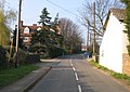 Blunham Road, Chalton, Beds - geograph.org.uk - 386794.jpg 640 × 451; 315 KB
-
 Central Bedfordshire , M1 Motorway - geograph.org.uk - 5979152.jpg 6,000 × 4,000; 7.14 MB
-
 Central Bedfordshire , M1 Motorway - geograph.org.uk - 5979153.jpg 6,000 × 4,000; 6.89 MB
-
 Central Bedfordshire , M1 Motorway - geograph.org.uk - 5979154.jpg 6,000 × 4,000; 6.86 MB
-
 Central Bedfordshire , M1 Motorway - geograph.org.uk - 5979155.jpg 6,000 × 4,000; 6.39 MB
-
 Central Bedfordshire , M1 Motorway - geograph.org.uk - 5979159.jpg 6,000 × 4,000; 6.35 MB
-
 Central Bedfordshire , M1 Motorway - geograph.org.uk - 5979863.jpg 6,000 × 4,000; 6.07 MB
-
 Central Bedfordshire , M1 Motorway - geograph.org.uk - 5979864.jpg 6,000 × 4,000; 5.84 MB
-
 Central Bedfordshire , M1 Motorway - geograph.org.uk - 5979865.jpg 6,000 × 4,000; 7.02 MB
-
 Chalton Cross Farm seen from M1 - geograph.org.uk - 2439079.jpg 640 × 480; 46 KB
-
 Chalton village hall - geograph.org.uk - 4862025.jpg 640 × 480; 137 KB
-
 Chalton Village Shop - geograph.org.uk - 395774.jpg 480 × 640; 59 KB
-
 Chiltern Way - geograph.org.uk - 2153955.jpg 640 × 480; 95 KB
-
 Chiltern Way - geograph.org.uk - 2153995.jpg 640 × 480; 116 KB
-
 Electrical pylon - geograph.org.uk - 4737538.jpg 640 × 297; 33 KB
-
 Factory part demolished - geograph.org.uk - 3320820.jpg 640 × 480; 78 KB
-
 Farmland between M1 and railway - geograph.org.uk - 4737535.jpg 640 × 327; 50 KB
-
 Field near Chalton - geograph.org.uk - 2705699.jpg 1,728 × 1,100; 739 KB
-
 Fields near Chalton - geograph.org.uk - 2705735.jpg 1,679 × 1,100; 563 KB
-
 Footbridge over the M1 - geograph.org.uk - 4699306.jpg 640 × 377; 45 KB
-
 Footbridge over the M1 - geograph.org.uk - 4730122.jpg 640 × 387; 48 KB
-
 Footpath to Sundon Road - geograph.org.uk - 2153985.jpg 640 × 480; 71 KB
-
 Grass field and footpath at Sundon - geograph.org.uk - 2468503.jpg 2,592 × 1,944; 2.54 MB
-
 Houses by the M1 - geograph.org.uk - 4517445.jpg 1,613 × 853; 796 KB
-
 Looking SE to Chalton - geograph.org.uk - 395785.jpg 480 × 640; 47 KB
-
 Looking SE to Chalton from Fancott - geograph.org.uk - 395848.jpg 640 × 439; 46 KB
-

-
 M1 motorway - Icknield Way bridge - geograph.org.uk - 2896389.jpg 640 × 480; 64 KB
-

-

-
 M1 motorway - Sundon Road bridge - geograph.org.uk - 2896375.jpg 640 × 480; 68 KB
-

-
 M1 motorway curving near Chalton - geograph.org.uk - 2896381.jpg 640 × 480; 65 KB
-
 M1 near Chalton Cross - geograph.org.uk - 4327120.jpg 640 × 409; 50 KB
-
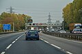
 M1 near Luton - geograph.org.uk - 3190762.jpg 640 × 480; 60 KB
-
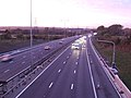
 M1 north of Luton - geograph.org.uk - 6261836.jpg 800 × 600; 600 KB
-
 M1 northbound - geograph.org.uk - 3766411.jpg 640 × 480; 51 KB
-
 M1 northbound - geograph.org.uk - 4431164.jpg 640 × 447; 38 KB
-
 M1 northbound - geograph.org.uk - 4431169.jpg 640 × 496; 53 KB
-
 M1 northbound - geograph.org.uk - 4431172.jpg 640 × 423; 52 KB
-
 M1 northbound - geograph.org.uk - 4431186.jpg 640 × 480; 59 KB
-
 M1 northbound - geograph.org.uk - 4431188.jpg 640 × 519; 55 KB
-
 M1 northbound - geograph.org.uk - 5622172.jpg 640 × 428; 80 KB
-
 M1 northbound - geograph.org.uk - 5622177.jpg 640 × 428; 71 KB
-
 M1 northbound - geograph.org.uk - 5622185.jpg 640 × 428; 76 KB
-
 M1 northbound - geograph.org.uk - 5622190.jpg 640 × 428; 83 KB
-
 M1 northbound - geograph.org.uk - 5622209.jpg 640 × 428; 94 KB
-
 M1 past north Luton - geograph.org.uk - 2496835.jpg 640 × 480; 48 KB
-
 M1, southbound - geograph.org.uk - 4699284.jpg 640 × 343; 35 KB
-
 M1, southbound - geograph.org.uk - 4730118.jpg 640 × 385; 44 KB
-
 M1, southbound - geograph.org.uk - 4730124.jpg 640 × 328; 33 KB
-
 M1, southbound - geograph.org.uk - 4730131.jpg 640 × 309; 33 KB
-
 M1, southbound - geograph.org.uk - 4730132.jpg 640 × 364; 33 KB
-
 M1, southbound - geograph.org.uk - 4730133.jpg 640 × 338; 36 KB
-
 M1, southbound - geograph.org.uk - 4730169.jpg 640 × 373; 41 KB
-
 Misty morning on B579 - geograph.org.uk - 4862007.jpg 640 × 480; 94 KB
-
 North Luton from the air - geograph.org.uk - 4547194.jpg 3,264 × 2,448; 4.01 MB
-

-

-

-
 Roadworks for a link to the M1 from the west - geograph.org.uk - 4547167.jpg 3,264 × 2,448; 3.82 MB
-
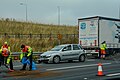
 Roadworks on the M1 near Luton - geograph.org.uk - 4326053.jpg 640 × 466; 52 KB
-
 Roundabout on Woodside Link, Dunstable - geograph.org.uk - 6614925.jpg 1,876 × 1,212; 1.02 MB
-
 Speed cameras on the M1 near Luton - geograph.org.uk - 4326050.jpg 640 × 400; 52 KB
-
 Sundon Road - geograph.org.uk - 2468485.jpg 2,592 × 1,944; 2.14 MB
-
 Sundon Road - geograph.org.uk - 4862073.jpg 640 × 480; 160 KB
-
 Sundon Road Bridge, M1 - geograph.org.uk - 4730128.jpg 640 × 349; 34 KB
-
 The BedPan line near Chalton - geograph.org.uk - 2468475.jpg 2,592 × 1,944; 2.13 MB
-
 The M1 and the BedPan line - geograph.org.uk - 2714262.jpg 3,264 × 2,448; 2.85 MB
-
 The Star at Chalton - geograph.org.uk - 395818.jpg 640 × 417; 51 KB


_-_geograph.org.uk_-_2896379.jpg)


