Category:Chalfont St Peter
Jump to navigation
Jump to search
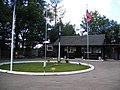
English: Chalfont St Peter is a village and civil parish within Chiltern district in south-east Buckinghamshire, England. It is situated in a small group of villages called The Chalfonts (locals have been known to call it St Peter) which also consists of Chalfont St Giles and Little Chalfont. The villages are located between High Wycombe and Rickmansworth. Chalfont St Peter is one of the largest villages in the UK with nearly 13,000 residents. The urban population for Chalfont St Peter and Gerrards Cross is 19,622 [1], the two villages being considered a single area by the Office for National Statistics.
village in Buckinghamshire, England, United Kingdom  | |||||
| Upload media | |||||
| Instance of | |||||
|---|---|---|---|---|---|
| Location | Buckinghamshire, South East England, England | ||||
| official website | |||||
 | |||||
Subcategories
This category has the following 7 subcategories, out of 7 total.
Media in category "Chalfont St Peter"
The following 200 files are in this category, out of 323 total.
(previous page) (next page)-
 A lone oak - geograph.org.uk - 4175858.jpg 640 × 480; 82 KB
-
 A road corner on the county boundary - geograph.org.uk - 3560204.jpg 640 × 480; 86 KB
-
 A40 at Birchland Wood - geograph.org.uk - 2831412.jpg 640 × 480; 99 KB
-
 A40 Chalfont St Peter - geograph.org.uk - 2299627.jpg 1,600 × 1,200; 593 KB
-
 A40 Chalfont St Peter - geograph.org.uk - 2299646.jpg 1,600 × 1,200; 599 KB
-
 A40 near Siblets wood - geograph.org.uk - 2831414.jpg 640 × 481; 88 KB
-

-

-
 All Saints, Oval Way, north door - geograph.org.uk - 5074835.jpg 480 × 640; 56 KB
-
 All Saints, Oval Way, noticeboard - geograph.org.uk - 5074830.jpg 640 × 480; 102 KB
-
 All Saints, Oval Way, parsonage - geograph.org.uk - 5074834.jpg 640 × 480; 59 KB
-

-

-

-

-

-
 Animal residence in Philipshill Wood, Chorleywood - geograph.org.uk - 5726495.jpg 2,048 × 1,536; 1.52 MB
-
 Anticlockwise on the M25 - geograph.org.uk - 4440713.jpg 640 × 426; 65 KB
-
 Approach to Chalfont St. Peter cemetery - geograph.org.uk - 4175865.jpg 640 × 480; 148 KB
-
 Austenwood Lane - geograph.org.uk - 6130814.jpg 800 × 600; 180 KB
-
 Austenwood Lane, Chalfont St Peter - geograph.org.uk - 3351339.jpg 2,048 × 1,536; 1.52 MB
-
 Austenwood Lane, Chalfont St Peter - geograph.org.uk - 6122572.jpg 4,288 × 3,182; 3.42 MB
-
-
 Banners on Market Place for the celebration of St Peter - geograph.org.uk - 3007697.jpg 2,560 × 1,920; 1.12 MB
-
 Beacon on Gold Hill Common - geograph.org.uk - 3007705.jpg 2,560 × 1,920; 1.13 MB
-
 Bloom Wood - geograph.org.uk - 3852923.jpg 768 × 1,024; 333 KB
-
 Blossom in the hedgerows, near Layter's Green - geograph.org.uk - 3925732.jpg 4,320 × 3,240; 5.27 MB
-

-

-
 Car park in Newland Park, Chorleywood - geograph.org.uk - 5726610.jpg 2,048 × 1,536; 1.52 MB
-
 Ccc-large.jpg 600 × 387; 34 KB
-

-
 Chalfont Common - Houses on Chesham lane - geograph-4175894.jpg 640 × 428; 80 KB
-
 Chalfont Common.jpg 3,264 × 2,448; 2.5 MB
-
 Chalfont Heights Scout Camp - geograph.org.uk - 229899.jpg 640 × 480; 111 KB
-
 Chalfont Lane Crosses the M25 - geograph.org.uk - 4517518.jpg 3,251 × 1,766; 2.67 MB
-
 Chalfont Lodge nursing home - geograph.org.uk - 106252.jpg 640 × 480; 191 KB
-
 Chalfont Park golf course - geograph.org.uk - 106305.jpg 640 × 480; 270 KB
-

-
 Chalfont St Peter (5612851305).jpg 1,600 × 1,200; 644 KB
-
 Chalfont St Peter (5613431064).jpg 1,600 × 1,200; 759 KB
-

-

-

-
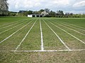 Chalfont St Peter, Athletics track - geograph.org.uk - 1840251.jpg 640 × 480; 95 KB
-
 Chalfont St Peter, Bridge House - geograph.org.uk - 1858123.jpg 640 × 480; 68 KB
-

-
-

-
 Chalfont St Peter, Chiltern Railway line - geograph.org.uk - 1840599.jpg 640 × 480; 121 KB
-
 Chalfont St Peter, Equine criminals - geograph.org.uk - 1836275.jpg 640 × 480; 107 KB
-

-

-

-

-
 Chalfont St Peter, Market Place - geograph.org.uk - 1835694.jpg 640 × 480; 72 KB
-

-

-
 Chalfont St Peter, Mystery road sign - geograph.org.uk - 4564125.jpg 640 × 480; 74 KB
-
 Chalfont St Peter, Old Shire Lane - geograph.org.uk - 2425339.jpg 640 × 480; 113 KB
-
 Chalfont St Peter, Old Shire Lane - geograph.org.uk - 2431993.jpg 640 × 480; 123 KB
-
 Chalfont St Peter, Rydinghurst House - geograph.org.uk - 2315257.jpg 640 × 486; 101 KB
-
 Chalfont St Peter, St Peter's Garden - geograph.org.uk - 1835670.jpg 640 × 480; 102 KB
-

-
 Chalfont St Peter, The Greyhound Inn - geograph.org.uk - 1858142.jpg 640 × 519; 76 KB
-
 Chalfont St Peter, The White Hart - geograph.org.uk - 1840418.jpg 640 × 480; 73 KB
-
 Chalfont St Peter, Vic Wotton Bridge - geograph.org.uk - 1835769.jpg 640 × 480; 155 KB
-
 Chalfont St Peter- Chalfont Park House (geograph 4563417).jpg 640 × 480; 76 KB
-
 Chalfont St. Peter, Bloom Wood - geograph.org.uk - 98143.jpg 640 × 480; 188 KB
-
 Chalfont St. Peter, Middle Wood - geograph.org.uk - 98131.jpg 640 × 480; 151 KB
-
 Chalfont St. Peter, West Hyde Lane - geograph.org.uk - 98159.jpg 640 × 480; 141 KB
-
 Chalfont1.jpg 400 × 251; 20 KB
-
 Chesham Lane - geograph.org.uk - 1065354.jpg 640 × 480; 103 KB
-
 Chiltern , Countryside Scenery - geograph.org.uk - 5733202.jpg 6,000 × 4,000; 6.02 MB
-
 Chiltern , Countryside Scenery - geograph.org.uk - 6113675.jpg 6,000 × 4,000; 7.65 MB
-
 Chiltern , M25 Motorway - geograph.org.uk - 5733201.jpg 6,000 × 4,000; 6.03 MB
-
 Chiltern , M25 Motorway - geograph.org.uk - 5733203.jpg 6,000 × 4,000; 5.73 MB
-
-
 Chiltern Way bordering Shrubs Wood - geograph.org.uk - 3746138.jpg 2,048 × 1,536; 499 KB
-
 Chiltern Way, Chalfont Common - geograph.org.uk - 5728200.jpg 2,048 × 1,536; 2.43 MB
-
 Circus on Gold Hill Common - geograph.org.uk - 3695287.jpg 4,320 × 3,240; 2.85 MB
-
 Corner of Grove Lane - geograph.org.uk - 829954.jpg 640 × 480; 98 KB
-
 Corner of Roberts Lane, Chalfont St Peter - geograph.org.uk - 2676930.jpg 1,600 × 1,200; 559 KB
-
 Cottages on Shire Lane - geograph.org.uk - 3560005.jpg 640 × 480; 95 KB
-
 Cottages on Shire Lane - geograph.org.uk - 6434392.jpg 1,024 × 768; 366 KB
-
 Crossing of the Shire Lanes and Chalfont Road - geograph.org.uk - 6434363.jpg 1,024 × 768; 541 KB
-
 Crossroads on Rickmansworth Road, Horn Hill - geograph.org.uk - 4691851.jpg 2,048 × 1,536; 1.4 MB
-
 Crowne Plaza Hotel, Gerrards Cross - geograph.org.uk - 6121404.jpg 800 × 507; 140 KB
-
 Cutting through Siblets Wood - geograph.org.uk - 4534691.jpg 640 × 426; 90 KB
-
 Denham Lane - geograph.org.uk - 850344.jpg 640 × 480; 71 KB
-
 Denham Lane at the junction of Joiners Lane - geograph.org.uk - 3351482.jpg 2,048 × 1,536; 1.37 MB
-
 Denham Lane at the junction of The Warren - geograph.org.uk - 4139310.jpg 2,560 × 1,920; 2.01 MB
-
 Denham Lane towards Chalfont St Peter - geograph.org.uk - 6123879.jpg 800 × 600; 127 KB
-
 Denham Lane, Chalfont St Peter - geograph.org.uk - 6123883.jpg 800 × 600; 168 KB
-
 Denham Lane, Chalfont St Peter - geograph.org.uk - 6123900.jpg 640 × 480; 81 KB
-
 Detached House on Penshurst Close - geograph.org.uk - 5278632.jpg 4,608 × 3,456; 5.64 MB
-
 Disused Tunnel (6185638894).jpg 1,600 × 1,067; 289 KB
-

-

-
 Elizabeth II postbox, Gold Hill Baptist Church - geograph.org.uk - 6122568.jpg 2,156 × 4,168; 1.62 MB
-
 Elizabeth II postbox, Gold Hill Baptist Church - geograph.org.uk - 6122569.jpg 5,184 × 3,888; 4.95 MB
-

-
 Entering Hertfordshire on Chalfont Lane - geograph.org.uk - 2677299.jpg 1,600 × 1,200; 430 KB
-
 Entrance to Chiltern Woodland Burial Park - geograph.org.uk - 2299604.jpg 1,600 × 1,200; 601 KB
-
 Entrance to Chiltern Woodland Burial Park, Jordans - geograph.org.uk - 2299591.jpg 1,600 × 1,200; 649 KB
-
 Entrance to farmland by M25, Chalfont Lane - geograph.org.uk - 2677304.jpg 1,600 × 1,200; 432 KB
-
 Entrance to public footpath off Chalfont Road - geograph.org.uk - 2677311.jpg 1,600 × 1,200; 557 KB
-
 Farmland, Chalfont St Peter - geograph.org.uk - 5358234.jpg 640 × 480; 95 KB
-
 Field and woodland of the A40 - geograph.org.uk - 6130858.jpg 800 × 600; 98 KB
-
 Field edge footpath, Chalfont St. Peter - geograph.org.uk - 4175883.jpg 640 × 480; 134 KB
-
 Field entrance off Denham Lane - geograph.org.uk - 6123881.jpg 800 × 600; 224 KB
-
 Field entrance on Denham Lane - geograph.org.uk - 4139432.jpg 2,560 × 1,920; 1.98 MB
-
 Field of Warren Farm, Chalfont St Peter - geograph.org.uk - 106296.jpg 640 × 480; 211 KB
-

-
 Fields by the M25, West Hyde - geograph.org.uk - 2676872.jpg 1,600 × 1,200; 587 KB
-
 Five Plantation, Chalfont Common - geograph.org.uk - 6399581.jpg 1,920 × 1,280; 2.29 MB
-
 Five Plantation, Maple Cross - geograph.org.uk - 6399579.jpg 1,280 × 1,920; 2.48 MB
-
 Fly tipping on Shire Lane - geograph.org.uk - 6434369.jpg 1,024 × 768; 596 KB
-
 Footpath crossing near Layters Green - geograph.org.uk - 5207002.jpg 4,911 × 3,260; 3.64 MB
-
 Footpath heading to Bloom Wood - geograph.org.uk - 850327.jpg 640 × 480; 84 KB
-

-
 Footpath through crops, Horn Hill - geograph.org.uk - 124964.jpg 480 × 640; 262 KB
-
 Footpath up to Chalfont Lodge - geograph.org.uk - 848944.jpg 640 × 480; 111 KB
-
 Footpath, Gerrards Cross Golf Club - geograph.org.uk - 6123878.jpg 800 × 600; 179 KB
-
 Foxdell Way, Chalfont St Peter - geograph.org.uk - 124548.jpg 640 × 480; 198 KB
-
 Full speed ahead - geograph.org.uk - 1994729.jpg 640 × 427; 35 KB
-
 Gated drive off Denham Lane - geograph.org.uk - 6123884.jpg 640 × 480; 120 KB
-
 George V postbox on Austenwood Lane, Chalfont St Peter - geograph.org.uk - 6122571.jpg 2,996 × 5,159; 3.59 MB
-
 George VI postbox on Joiners Lane, Chalfont St Peter - geograph.org.uk - 6122586.jpg 2,964 × 5,127; 3.52 MB
-
 Gerrards Cross Golf Course - geograph.org.uk - 6121291.jpg 800 × 600; 98 KB
-
 Gold-hill.jpg 600 × 429; 23 KB
-
 Goldhill Common - geograph.org.uk - 43127.jpg 640 × 421; 16 KB
-
 Goldhill Common - geograph.org.uk - 850352.jpg 640 × 480; 65 KB
-
 Goldhill Common - geograph.org.uk - 87675.jpg 640 × 480; 115 KB
-
 Gorelands Lane - geograph.org.uk - 3341754.jpg 640 × 480; 191 KB
-
 Gorelands Lane, Horn Hill - geograph.org.uk - 4693232.jpg 2,394 × 1,674; 1.54 MB
-
 Graffiti on railway bridge on Mumford Lane - geograph.org.uk - 3007709.jpg 2,560 × 1,920; 1.11 MB
-
 Gravel Hill at the junction of Copthall Lane - geograph.org.uk - 3351551.jpg 2,048 × 1,536; 1.38 MB
-
 Gravel Hill Junction - geograph.org.uk - 87769.jpg 640 × 480; 91 KB
-
 Grazing off Mumfords Lane - geograph.org.uk - 6121398.jpg 800 × 600; 118 KB
-
 Grove Lane at Orchard Grove - geograph.org.uk - 4862267.jpg 640 × 480; 49 KB
-
 Grove Lane, Chalfont St Peter - geograph.org.uk - 3351651.jpg 2,048 × 1,536; 1.44 MB
-
 High Street Chalfont St Peter - geograph.org.uk - 829939.jpg 640 × 480; 88 KB
-
 High Street, Chalfont St Peter - geograph.org.uk - 6122579.jpg 4,814 × 3,398; 2.46 MB
-
 Horn Hill Village Hall and Institute - geograph.org.uk - 3341724.jpg 640 × 480; 172 KB
-

-
 Horn Hill, Brawlings Lane direction post - geograph.org.uk - 2315395.jpg 640 × 480; 126 KB
-
 House in the woods - geograph.org.uk - 5395568.jpg 640 × 426; 72 KB
-

-
 House on Potkiln Lane - geograph.org.uk - 6130878.jpg 800 × 600; 120 KB
-
 House on Roberts Lane, Chalfont St Peter - geograph.org.uk - 2676912.jpg 1,600 × 1,200; 435 KB
-
 House on Shire Lane - geograph.org.uk - 6434465.jpg 1,024 × 768; 414 KB
-
 House on the corner of The Drive, Chalfont St Peter - geograph.org.uk - 3351469.jpg 2,048 × 1,536; 1.4 MB
-
 House reflected in Layters Gren Pond - geograph.org.uk - 4420194.jpg 4,268 × 3,170; 7.17 MB
-

-

-
 Inside All Saints, Oval Way (1) - geograph.org.uk - 5074836.jpg 640 × 480; 68 KB
-
 Inside All Saints, Oval Way (2) - geograph.org.uk - 5074838.jpg 480 × 640; 63 KB
-
 Inside All Saints, Oval Way (3) - geograph.org.uk - 5074841.jpg 640 × 480; 54 KB
-
 Inside All Saints, Oval Way (4) - geograph.org.uk - 5074842.jpg 640 × 480; 66 KB
-
 Inside All Saints, Oval Way (5) - geograph.org.uk - 5074843.jpg 640 × 480; 56 KB
-
 Inside All Saints, Oval Way (6) - geograph.org.uk - 5074844.jpg 480 × 640; 55 KB
-
 Joiners Lane, Chalfont St Peter - geograph.org.uk - 3351466.jpg 2,048 × 1,536; 1.37 MB
-
 Joiners Lane, Chalfont St Peter - geograph.org.uk - 6122587.jpg 5,184 × 3,888; 5.6 MB
-
 Joiners Lane, Chalfont St Peter - geograph.org.uk - 6123903.jpg 800 × 600; 120 KB
-
 Joiners Lane, Chalfont St Peter - geograph.org.uk - 6123909.jpg 640 × 480; 81 KB
-
 Jordans, Birchland Wood - geograph.org.uk - 1838298.jpg 640 × 480; 142 KB
-

-

-
 Jordans, Potkiln Lane railway bridge - geograph.org.uk - 1837885.jpg 640 × 480; 121 KB
-

-
 Junction of Rickmansworth Lane and Brawlings Lane - geograph.org.uk - 2676948.jpg 1,600 × 1,200; 536 KB
-
 Kerr Grave in Chalfont St Peter.jpg 3,264 × 1,460; 4 MB
-
 Layter's Green Lane - geograph.org.uk - 3695296.jpg 4,320 × 3,240; 2.93 MB
-
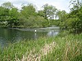
 Layter's Green pond - geograph.org.uk - 3695290.jpg 4,320 × 3,240; 2.9 MB
-

-
 Lodge to Newland Park - geograph.org.uk - 4367297.jpg 4,028 × 2,902; 5.36 MB
-

-

-

-
 M25 enters Buckinghamshire - geograph.org.uk - 2444859.jpg 640 × 436; 28 KB
-

-
 M25 Motorway looking north - geograph.org.uk - 2314856.jpg 640 × 480; 74 KB
-

-
 M25 Motorway, Mopes Farm Subway (1) - geograph.org.uk - 4506090.jpg 640 × 480; 109 KB
-
 M25 Motorway, Mopes Farm Subway (2) - geograph.org.uk - 4506112.jpg 480 × 640; 77 KB
-
 M25 Motorway, Mopes Farm Subway (3) - geograph.org.uk - 4506126.jpg 640 × 480; 94 KB
-
 M25 Motorway, Mopes Farm Subway (4) - geograph.org.uk - 4506135.jpg 480 × 640; 88 KB
-
 M25 northbound - geograph.org.uk - 4428415.jpg 640 × 448; 51 KB
-
 M25 south of junction 17 - geograph.org.uk - 3562530.jpg 640 × 428; 87 KB
-
 M25 southbound - geograph.org.uk - 5062072.jpg 640 × 480; 50 KB
-
 M25 viewed from Shire Lane - geograph.org.uk - 6434478.jpg 1,024 × 768; 277 KB
-
 M25, clockwise - geograph.org.uk - 3445410.jpg 640 × 416; 34 KB
-
 Market Place from Gold Hill North - geograph.org.uk - 2862707.jpg 640 × 480; 84 KB
-
 Market Place, Chalfont St Peter - geograph.org.uk - 3351379.jpg 2,048 × 1,536; 1.48 MB
-
 Moonlight (5838848967).jpg 1,600 × 1,067; 633 KB
-
 Mumfords Lane - geograph.org.uk - 6121401.jpg 800 × 600; 159 KB
-
 Mumfords Lane - geograph.org.uk - 910064.jpg 640 × 519; 295 KB
-
 Narcot Lane approaching the College - geograph.org.uk - 2862700.jpg 640 × 474; 107 KB
-
 New concrete road at Shire Lane crossing - geograph.org.uk - 6434830.jpg 1,024 × 768; 496 KB


_-_geograph.org.uk_-_5074845.jpg)
_-_geograph.org.uk_-_5074846.jpg)
_-_geograph.org.uk_-_5074847.jpg)
_-_geograph.org.uk_-_5074848.jpg)
_-_geograph.org.uk_-_5074850.jpg)


.jpg)
.jpg)


_-_geograph.org.uk_-_4563457.jpg)
_-_geograph.org.uk_-_4563468.jpg)


.jpg)


.jpg)


_-_geograph.org.uk_-_5074836.jpg)
_-_geograph.org.uk_-_5074838.jpg)
_-_geograph.org.uk_-_5074841.jpg)
_-_geograph.org.uk_-_5074842.jpg)
_-_geograph.org.uk_-_5074843.jpg)
_-_geograph.org.uk_-_5074844.jpg)


_-_geograph.org.uk_-_1837833.jpg)
_-_geograph.org.uk_-_1837860.jpg)


_-_geograph.org.uk_-_4506090.jpg)
_-_geograph.org.uk_-_4506112.jpg)
_-_geograph.org.uk_-_4506126.jpg)
_-_geograph.org.uk_-_4506135.jpg)


.jpg)


