Category:Chailey
Jump to navigation
Jump to search
village and civil parish in East Sussex, UK  | |||||
| Upload media | |||||
| Instance of | |||||
|---|---|---|---|---|---|
| Location | Lewes, East Sussex, South East England, England | ||||
| Population |
| ||||
| Area |
| ||||
| official website | |||||
 | |||||
Subcategories
This category has the following 14 subcategories, out of 14 total.
1
- 1 Coppard's Bridge (2 F)
B
- Bosun, Chailey (1 F)
C
- Chailey Brickworks (10 F)
- Chailey Free Church (1 F)
- Chailey War Memorial (6 F)
F
- Five Bells pub, Chailey (6 F)
H
N
O
- Oasts in Chailey (2 F)
R
S
- South Chailey (45 F)
W
- Wapsbourne Manor (4 F)
Media in category "Chailey"
The following 200 files are in this category, out of 1,184 total.
(previous page) (next page)-
 "Tudor" garage on Markstakes Lane - geograph.org.uk - 311544.jpg 429 × 640; 126 KB
-

-
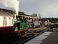
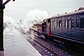
 78019 ready to depart from Sheffield Park, 2010 - geograph.org.uk - 6471126.jpg 1,024 × 685; 274 KB
-
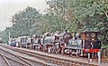
 80151 runs round at Sheffield Park, 2009 - geograph.org.uk - 6748363.jpg 1,024 × 685; 367 KB
-

-
 A Bad Spot on Cockfield Lane - geograph.org.uk - 311686.jpg 429 × 640; 116 KB
-
 A dry and barren Pound Common - geograph.org.uk - 2771005.jpg 4,000 × 3,000; 3.71 MB
-

-
 A peep at Holford Manor - geograph.org.uk - 1754727.jpg 640 × 428; 159 KB
-
 A small barn, Wapsbourne Manor - geograph.org.uk - 1957784.jpg 640 × 430; 144 KB
-

-
 A welcome from East Sussex on the A272 - geograph.org.uk - 5304709.jpg 800 × 600; 188 KB
-
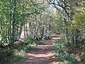
 A-maizeing path to Cottage Wood - geograph.org.uk - 1390179.jpg 640 × 480; 86 KB
-
 A272 - geograph.org.uk - 5226397.jpg 640 × 426; 79 KB
-
 A272 road - geograph.org.uk - 33042.jpg 640 × 480; 117 KB
-
 A275 at Bevern Bridge - geograph.org.uk - 2217935.jpg 640 × 480; 139 KB
-
 A275 through Sheffield Park - geograph.org.uk - 1982088.jpg 1,024 × 768; 170 KB
-
 A275, north - geograph.org.uk - 1951541.jpg 640 × 430; 173 KB
-
 A275, south - geograph.org.uk - 1951542.jpg 640 × 430; 152 KB
-
 A275, South Street - geograph.org.uk - 2235220.jpg 640 × 480; 71 KB
-
 Acre Plat - geograph.org.uk - 4593813.jpg 640 × 480; 85 KB
-
 Albino squirrel on Markskates Lane - geograph.org.uk - 2293768.jpg 4,000 × 3,000; 3.24 MB
-
 Alpacas in field - geograph.org.uk - 5743345.jpg 1,024 × 580; 126 KB
-
 An entrance to the dairy by the A275 - geograph.org.uk - 1957765.jpg 640 × 430; 143 KB
-
 Ancient tree by Wapsbourne Farmhouse - geograph.org.uk - 2781123.jpg 4,000 × 3,000; 3.61 MB
-
 Animal watering trough, Warr's Farm - geograph.org.uk - 1951365.jpg 640 × 430; 181 KB
-
 Apple Tree Cottage and Bush Cottage - geograph.org.uk - 2207179.jpg 640 × 480; 89 KB
-
 Apple Tree Field - geograph.org.uk - 2212413.jpg 640 × 480; 119 KB
-
 Approaching Chailey - geograph.org.uk - 5743157.jpg 1,024 × 582; 143 KB
-
 Approaching Cockfield Bridge - geograph.org.uk - 5571413.jpg 1,024 × 659; 312 KB
-
 Approaching Wilding Wood - geograph.org.uk - 5743350.jpg 1,024 × 646; 242 KB
-
 Arrival at Sheffield Park, 2009 - geograph.org.uk - 6482447.jpg 1,024 × 685; 306 KB
-
 Arriving at Sheffield Park - geograph.org.uk - 3960022.jpg 4,000 × 2,666; 7.92 MB
-
 At Sheffield Park - geograph.org.uk - 5648069.jpg 3,566 × 2,377; 7.59 MB
-
 At Sheffield Park - geograph.org.uk - 5648079.jpg 3,748 × 2,811; 7.61 MB
-
 Avenue of Trees - geograph.org.uk - 5742926.jpg 1,024 × 627; 277 KB
-
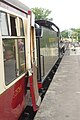 Awaiting departure from Sheffield Park - geograph.org.uk - 5815591.jpg 851 × 1,280; 304 KB
-
 B473 at Sheffield Park - geograph.org.uk - 3385741.jpg 6,000 × 4,000; 7.47 MB
-
 Balls Field - geograph.org.uk - 2213202.jpg 640 × 480; 76 KB
-
 Balneath Barn Farm - geograph.org.uk - 2219911.jpg 640 × 480; 81 KB
-
 Balneath House - geograph.org.uk - 2219893.jpg 480 × 640; 85 KB
-
 Balneath Lane (track) - geograph.org.uk - 2289951.jpg 4,000 × 3,000; 3.48 MB
-
 Balneath Lane - geograph.org.uk - 1542547.jpg 640 × 480; 153 KB
-
 Balneath Lane - geograph.org.uk - 2239231.jpg 640 × 480; 189 KB
-
 Balneath Lane - geograph.org.uk - 2239268.jpg 640 × 480; 196 KB
-
 Balneath Lane - geograph.org.uk - 2239305.jpg 640 × 480; 196 KB
-
 Balneath Lane - geograph.org.uk - 3051343.jpg 640 × 480; 122 KB
-
 Balneath Lane - geograph.org.uk - 3570131.jpg 640 × 480; 183 KB
-
 Balneath Manor - geograph.org.uk - 1542522.jpg 640 × 480; 120 KB
-
 Balneath Manor - geograph.org.uk - 5572010.jpg 1,024 × 610; 205 KB
-
 Balneath Manor Lane - geograph.org.uk - 2220606.jpg 480 × 640; 139 KB
-
 Balneath Mead - geograph.org.uk - 2219865.jpg 640 × 480; 87 KB
-
 Banks Road - geograph.org.uk - 2253797.jpg 640 × 480; 150 KB
-
 Banks Road junction with Warr's Hill Lane - geograph.org.uk - 2772127.jpg 4,000 × 3,000; 3.53 MB
-
 Barn at Teagues Farmhouse - geograph.org.uk - 3004512.jpg 640 × 480; 112 KB
-
 Barn at Teagues Farmhouse - geograph.org.uk - 3004516.jpg 640 × 480; 104 KB
-
 Barn converted into social area at the Wowo Centre - geograph.org.uk - 2781119.jpg 4,000 × 3,000; 3.3 MB
-
 Barn Field - geograph.org.uk - 2207657.jpg 640 × 480; 91 KB
-
 Barn Field - geograph.org.uk - 2210936.jpg 640 × 480; 54 KB
-
 Barn Field - geograph.org.uk - 2217893.jpg 640 × 480; 80 KB
-
 Barn Field - geograph.org.uk - 2226757.jpg 640 × 480; 109 KB
-
 Barn Field - geograph.org.uk - 2238987.jpg 640 × 480; 82 KB
-
 Barn Field - geograph.org.uk - 2378117.jpg 640 × 480; 79 KB
-
 Barn Lag - geograph.org.uk - 2254893.jpg 640 × 480; 83 KB
-
 Barn Mead - geograph.org.uk - 2226464.jpg 640 × 480; 91 KB
-
 Barn, Church Farm - geograph.org.uk - 2208169.jpg 640 × 480; 99 KB
-
 Barns and buildings, Warr's Farm - geograph.org.uk - 1951355.jpg 640 × 430; 126 KB
-
 Barns, Broomfield Farm - geograph.org.uk - 2238999.jpg 640 × 480; 75 KB
-
 Barns, Waspbourne Manor Farm - geograph.org.uk - 1957772.jpg 640 × 377; 83 KB
-
 Beards, Chailey Green - geograph.org.uk - 2212485.jpg 480 × 640; 97 KB
-
 Bee keeper at work by Red Gill Lane - geograph.org.uk - 2607089.jpg 4,000 × 3,000; 3.23 MB
-
 Beech Mead - geograph.org.uk - 2376298.jpg 640 × 480; 64 KB
-
 Beggar's Wood - geograph.org.uk - 2376426.jpg 640 × 480; 171 KB
-
 Beggar's Wood Pond - geograph.org.uk - 2376421.jpg 480 × 640; 162 KB
-
 Beggar's Wood Road - geograph.org.uk - 2121210.jpg 640 × 480; 65 KB
-
 Beggar's Wood Road - geograph.org.uk - 2376430.jpg 640 × 480; 109 KB
-
 Beggar's Wood Road - geograph.org.uk - 2540544.jpg 640 × 480; 158 KB
-
 Beggar's Wood Road, East Sussex - geograph.org.uk - 4174278.jpg 4,896 × 3,672; 5.84 MB
-
 Beggars Wood Pond - geograph.org.uk - 2206944.jpg 480 × 640; 153 KB
-
 Beggars Wood Road - geograph.org.uk - 2206936.jpg 640 × 480; 146 KB
-
 Better Keep Clear Then - geograph.org.uk - 2240446.jpg 480 × 640; 144 KB
-
 Bevern Bridge - geograph.org.uk - 2217946.jpg 480 × 640; 125 KB
-
 Bine Mead - geograph.org.uk - 2208197.jpg 640 × 480; 152 KB
-
 Bineham Lodge - geograph.org.uk - 2209326.jpg 640 × 442; 63 KB
-
 Bineham Wood - geograph.org.uk - 2206961.jpg 640 × 480; 138 KB
-
 Bineham Wood near Chailey Common - geograph.org.uk - 1391015.jpg 640 × 480; 73 KB
-
 Birch Grove at Sheffield Park - geograph.org.uk - 4531493.jpg 2,399 × 1,599; 501 KB
-
 Birch tree thinning on Pound Common - geograph.org.uk - 2783469.jpg 4,000 × 3,000; 3.48 MB
-
 Birch Woodland, Pound Common - geograph.org.uk - 2207224.jpg 640 × 480; 175 KB
-
 Birches on Red House Common - geograph.org.uk - 2771059.jpg 4,000 × 3,000; 3.44 MB
-
 Birchetts Mead - geograph.org.uk - 2207262.jpg 640 × 480; 65 KB
-
 Black 5 at Sheffield Park - geograph.org.uk - 3764188.jpg 640 × 425; 158 KB
-
 Blackbrook Bridge - geograph.org.uk - 4628625.jpg 640 × 468; 113 KB
-
 Blackbrook Bridge - geograph.org.uk - 5319920.jpg 800 × 600; 162 KB
-
 Blackmoor Vale at the Bluebell Railway - geograph.org.uk - 4804513.jpg 4,000 × 3,000; 3.27 MB
-
 Bluebell at Sheffield Park - geograph.org.uk - 3764174.jpg 640 × 425; 145 KB
-
 Bluebell Business Estate - geograph.org.uk - 1957780.jpg 640 × 430; 147 KB
-

-
 Bluebell Railway - geograph.org.uk - 3936909.jpg 4,000 × 2,666; 7 MB
-
 Bluebell Railway - geograph.org.uk - 3936912.jpg 4,000 × 2,666; 6.04 MB
-
 Bluebell Railway - geograph.org.uk - 3936916.jpg 4,000 × 2,250; 7.45 MB
-
 Bluebell Railway - geograph.org.uk - 3936920.jpg 4,000 × 2,666; 6.08 MB
-
 Bluebell Railway - geograph.org.uk - 4244720.jpg 4,240 × 2,832; 4.56 MB
-
 Bluebell Railway - geograph.org.uk - 4244725.jpg 3,540 × 2,832; 7.93 MB
-
 Bluebell Railway - geograph.org.uk - 5338930.jpg 3,994 × 2,662; 6.9 MB
-
 Bluebell Railway - geograph.org.uk - 5338976.jpg 3,985 × 2,656; 7.4 MB
-
 Bluebell Railway Locomotive Shed, Sheffield Park 1997 - geograph.org.uk - 5109230.jpg 2,373 × 1,531; 3.58 MB
-
-
 Bluebell Railway, Sheffield Park - geograph.org.uk - 5907777.jpg 1,024 × 768; 204 KB
-
 Bluebell Railway, Sheffield Park Railway Station - 2009 - geograph.org.uk - 3469375.jpg 2,272 × 1,704; 955 KB
-
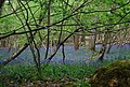
 Bluebells in Sawpit Wood - geograph.org.uk - 5742232.jpg 1,024 × 637; 320 KB
-
 Bluebells in Wapsbourne Wood - geograph.org.uk - 1959738.jpg 640 × 430; 197 KB
-
 Bluebells in Wapsbourne Wood - geograph.org.uk - 1959761.jpg 640 × 430; 207 KB
-
 Bluebells in Warr's Wood - geograph.org.uk - 1951378.jpg 640 × 430; 204 KB
-
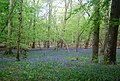 Bluebells, Wapsbourne Wood - geograph.org.uk - 1959739.jpg 640 × 430; 190 KB
-
 Bluebells, Warr's Wood - geograph.org.uk - 1951377.jpg 640 × 430; 197 KB
-
 Board Walk, Memorial Common - geograph.org.uk - 2209360.jpg 640 × 480; 149 KB
-
 Board Walk, Red House Common - geograph.org.uk - 2253782.jpg 480 × 640; 180 KB
-
 Boardwalk, Memorial Common - geograph.org.uk - 2376439.jpg 640 × 480; 118 KB
-
 Boggy area near Chart's Wood - geograph.org.uk - 2289929.jpg 4,000 × 3,000; 3.6 MB
-
 Bookends on the Bluebell - geograph.org.uk - 4143443.jpg 4,240 × 2,832; 4.37 MB
-
 Boundary Ditch, Red House Common - geograph.org.uk - 2253788.jpg 480 × 640; 194 KB
-
 Bower Farm - geograph.org.uk - 2238690.jpg 640 × 480; 83 KB
-
 Bower Farm - geograph.org.uk - 5516433.jpg 800 × 477; 87 KB
-
 Bower Farm near Popjoy Wood - geograph.org.uk - 1390135.jpg 640 × 480; 109 KB
-
 Bracken on Red House Common - geograph.org.uk - 2771054.jpg 4,000 × 3,000; 3.68 MB
-
 Brake Field - geograph.org.uk - 2209290.jpg 640 × 480; 107 KB
-
 Brick barn, Warr's Farm - geograph.org.uk - 1951359.jpg 640 × 430; 129 KB
-
 Brickyard Lane, South Chailey - geograph.org.uk - 2210259.jpg 480 × 640; 112 KB
-
 Bridge abutment, Sheffield Park - geograph.org.uk - 3399458.jpg 1,024 × 768; 201 KB
-
 Bridge Field - geograph.org.uk - 2210932.jpg 640 × 480; 90 KB
-
 Bridge over the former Lewes to East Grinstead line - geograph.org.uk - 2615842.jpg 4,000 × 3,000; 3.32 MB
-
 Bridge, Lumberpit Lane - geograph.org.uk - 2238732.jpg 480 × 640; 173 KB
-
 Bridleway and footpath crossing near Yokehurst - geograph.org.uk - 2594927.jpg 4,000 × 3,000; 3.45 MB
-
 Bridleway bridge on Redgill Lane - geograph.org.uk - 2607701.jpg 4,000 × 3,000; 3.76 MB
-
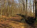
 Bridleway in Starvecrow Wood - geograph.org.uk - 2289939.jpg 4,000 × 3,000; 3.32 MB
-
 Bridleway south to Hurst Barns - geograph.org.uk - 2596172.jpg 4,000 × 3,000; 3.13 MB
-
 Bridleway south to The Warren - geograph.org.uk - 1952971.jpg 640 × 430; 197 KB
-
 Bridleway to Yokehurst - geograph.org.uk - 5742253.jpg 1,024 × 604; 270 KB
-
 Bridleway, Markstakes Common - geograph.org.uk - 2235296.jpg 480 × 640; 142 KB
-
 Broomday Field - geograph.org.uk - 2220700.jpg 640 × 480; 73 KB
-
 Broomfield Farm - geograph.org.uk - 2226424.jpg 640 × 480; 60 KB
-
 Broomfield Farm off Mill Lane - geograph.org.uk - 2594764.jpg 4,000 × 3,000; 3.12 MB
-
 Broomies - geograph.org.uk - 2229955.jpg 480 × 640; 103 KB
-
 Broomy Wood - geograph.org.uk - 2207637.jpg 640 × 480; 127 KB
-

-
 Bush Farm - geograph.org.uk - 2232139.jpg 640 × 480; 102 KB
-
 Bushy Field - geograph.org.uk - 2239121.jpg 640 × 480; 78 KB
-
 Business units at Wivelsden Farm - geograph.org.uk - 2783443.jpg 4,000 × 3,000; 3.49 MB
-
 Busy day at Sheffield Park station - geograph.org.uk - 4206281.jpg 640 × 428; 134 KB
-
 Buttons Mead-Harris Mead - geograph.org.uk - 2209357.jpg 640 × 480; 54 KB
-
 Car park on Lane End Common - geograph.org.uk - 2606987.jpg 4,000 × 3,000; 3.36 MB
-
 Car Park, Chailey Sports Ground - geograph.org.uk - 2258291.jpg 640 × 480; 93 KB
-
 Car Park, Romany Ridge Common - geograph.org.uk - 2376400.jpg 640 × 480; 113 KB
-
 Carriot Field-Cricket Field - geograph.org.uk - 2226504.jpg 640 × 480; 107 KB
-
 Cart House Field - geograph.org.uk - 2220590.jpg 640 × 480; 57 KB
-
 Cattle grazing east of Warr's Wood - geograph.org.uk - 1951523.jpg 640 × 430; 141 KB
-
 Cattle on footpath to Bower Farm - geograph.org.uk - 2591962.jpg 4,000 × 3,000; 3.83 MB
-
 Caveridge Farm - geograph.org.uk - 2210434.jpg 640 × 480; 103 KB
-
 Caveridge Farm - geograph.org.uk - 5571954.jpg 1,024 × 530; 106 KB
-
 Caveridge Lane - geograph.org.uk - 2235303.jpg 640 × 480; 142 KB
-
 Century Cottage, Lewes Road - geograph.org.uk - 4593808.jpg 640 × 480; 72 KB
-
 Chailey Common - geograph.org.uk - 1391050.jpg 640 × 480; 111 KB
-
 Chailey common nature reserve.jpg 640 × 480; 126 KB
-
 Chailey Garage - geograph.org.uk - 2376478.jpg 640 × 480; 83 KB
-
 Chailey Green - geograph.org.uk - 5743231.jpg 1,024 × 585; 145 KB
-
 Chailey Heritage - geograph.org.uk - 1106560.jpg 600 × 376; 58 KB
-
 Chailey Heritage church - geograph.org.uk - 20263.jpg 531 × 370; 39 KB
-
 Chailey Heritage School - geograph.org.uk - 2376566.jpg 640 × 492; 79 KB
-
 Chailey Moat - geograph.org.uk - 2207649.jpg 640 × 480; 77 KB
-
 Chailey Moat - geograph.org.uk - 5743075.jpg 1,024 × 660; 202 KB
-
 Chailey Parish Hall - geograph.org.uk - 2213184.jpg 640 × 480; 70 KB
-
 Chailey Parish Hall by the A275 - geograph.org.uk - 2593660.jpg 4,000 × 3,000; 3.68 MB
-
 Chailey Place, Chailey - geograph.org.uk - 4682860.jpg 640 × 517; 88 KB
-
 Chailey Reading Room - geograph.org.uk - 2121214.jpg 640 × 480; 67 KB
-
 Chailey Secondary School - geograph.org.uk - 1562067.jpg 640 × 480; 47 KB
-
 Chailey Secondary School - geograph.org.uk - 2594903.jpg 4,000 × 3,000; 3.46 MB
-
 Chailey Sports Ground - geograph.org.uk - 2206903.jpg 640 × 480; 50 KB
-
 Chailey Sports Ground - geograph.org.uk - 2209431.jpg 640 × 480; 34 KB
-
 Chailey Sports Pavilion - geograph.org.uk - 2258270.jpg 640 × 480; 86 KB
-
 Chailey village green - geograph.org.uk - 2593474.jpg 4,000 × 3,000; 3.17 MB
-
 Chailey village sign - geograph.org.uk - 2593571.jpg 4,000 × 3,000; 3.59 MB
-
 Chailey, East Sussex.JPG 3,262 × 2,446; 1.44 MB
-
 Chailey, St Peter - geograph.org.uk - 6368739.jpg 4,000 × 3,000; 4.84 MB
-
 Chameleon appearance of tree growth by Holford Manor - geograph.org.uk - 2782224.jpg 4,000 × 3,000; 4.21 MB
-
 Chapel Field - geograph.org.uk - 2257925.jpg 640 × 480; 75 KB
-
 Chapmans Meadow - geograph.org.uk - 2213208.jpg 640 × 480; 58 KB
-
 Chatfield - geograph.org.uk - 2238968.jpg 640 × 480; 86 KB
-
 Chatfield Field (1) - geograph.org.uk - 2238972.jpg 640 × 480; 67 KB
-
 Chatfield Field (2) - geograph.org.uk - 2238979.jpg 640 × 480; 72 KB
-
 Cherry Ground - geograph.org.uk - 2210964.jpg 640 × 480; 106 KB
-
 Chicken coop, Towning's Farm, North Chailey - geograph.org.uk - 3562062.jpg 1,600 × 1,201; 344 KB
-
 Church Farm Cottage - geograph.org.uk - 2208170.jpg 640 × 480; 132 KB
-
 Church Field - geograph.org.uk - 2208187.jpg 640 × 480; 93 KB
-
 Church House, Chailey - geograph.org.uk - 1493407.jpg 640 × 480; 44 KB
-
 Cinder Hill - geograph.org.uk - 2235183.jpg 640 × 480; 94 KB
-
 Cinder Hill - geograph.org.uk - 3001257.jpg 640 × 480; 147 KB
-
 Clappers Piece (1) - geograph.org.uk - 2226482.jpg 640 × 480; 74 KB
-
 Clappers Piece (2) - geograph.org.uk - 2226540.jpg 640 × 480; 105 KB
-
 Clappers Piece (3) - geograph.org.uk - 2238283.jpg 640 × 480; 90 KB


_-_geograph.org.uk_-_2289951.jpg)


_-_geograph.org.uk_-_2238972.jpg)
_-_geograph.org.uk_-_2238979.jpg)


_-_geograph.org.uk_-_2226482.jpg)
_-_geograph.org.uk_-_2226540.jpg)
_-_geograph.org.uk_-_2238283.jpg)