Category:Cerrigydrudion
Jump to navigation
Jump to search
village and community in Conwy County Borough, Wales, UK  Canol pentref Cerrigydrudion  | |||||
| Upload media | |||||
| Instance of | |||||
|---|---|---|---|---|---|
| Location |
| ||||
| Population |
| ||||
| Area |
| ||||
 | |||||
Cymraeg: Pentref bychan yn ne-ddwyrain sir Conwy (Sir Ddinbych gynt) yw Cerrigydrudion (neu Cerrig-y-drudion). Saif yn y bryniau ar lôn yr A5 8 milltir i'r gogledd-orllewin o Gorwen. Yn ogystal â'r A5, mae lôn yn cysylltu'r pentref â Rhuthun i'r gogledd-ddwyrain a Dinbych i'r gogledd. Cerrigydrudion yw'r pentref mwyaf yn ardal Uwchaled, sydd yn cynnwys yn ogystal Llangwm, Pentrefoelas, Pentre-llyn-cymer, Dinmael, Glasfryn, Cefn-brith, Llanfihangel Glyn Myfyr a Cwmpenanner. Yn ôl cyfrifiad 2001 mae 75% o'r boblogaeth o 692 o bobl yn siarad y Gymraeg fel iaith bob dydd.
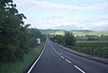
English: Cerrigydrudion (or Cerrig-y-drudion) is a village and its surrounding parish in Conwy county borough, north Wales. Previously it was part of the historic county of Denbighshire (pre 1974) and then Clwyd. The village formerly lay on the A5, but a short by-pass now takes the road along the south-western edge of the village.
Subcategories
This category has the following 5 subcategories, out of 5 total.
C
- Caer Caradog (3 F)
- Capel Moreia, Cerrigydrudion (2 F)
G
- Glasfryn (23 F)
M
W
- Waun Garnedd-y-filiast (3 F)
Media in category "Cerrigydrudion"
The following 200 files are in this category, out of 423 total.
(previous page) (next page)-
 A crossing of roads above Tai-ucha'n-cwm - geograph.org.uk - 5984618.jpg 4,000 × 3,000; 3.11 MB
-

-
 A section of the B4501 road near Pont yr Aber - geograph.org.uk - 5984118.jpg 4,000 × 3,000; 3 MB
-

-
 A small stream beside the Alwen Trail - geograph.org.uk - 3103364.jpg 480 × 640; 142 KB
-
 A5 - geograph.org.uk - 3170741.jpg 640 × 430; 49 KB
-
 A5 approaching Cerrigydrudion - geograph.org.uk - 3170745.jpg 640 × 356; 40 KB
-
 A5 eastbound - geograph.org.uk - 4464101.jpg 640 × 481; 33 KB
-

-
 A5 heads east out of Glasfryn - geograph.org.uk - 4464099.jpg 640 × 481; 41 KB
-
 A5 south of Cerrigydrudion - geograph.org.uk - 3170765.jpg 640 × 392; 43 KB
-
 A5 south of Cerrigydrudion - geograph.org.uk - 3170771.jpg 640 × 380; 38 KB
-
 A5, a long straight - geograph.org.uk - 3170732.jpg 640 × 384; 38 KB
-
 A5, a long straight - geograph.org.uk - 3170742.jpg 640 × 430; 51 KB
-
 A5, approaching the B4501 turning - geograph.org.uk - 3170750.jpg 640 × 430; 48 KB
-
 A5, east of Glasfryn - geograph.org.uk - 3167343.jpg 640 × 428; 38 KB
-
 A5, Glan-y-gors - geograph.org.uk - 3170739.jpg 640 × 430; 58 KB
-

-
 Afon Alwen - geograph.org.uk - 1807711.jpg 480 × 640; 127 KB
-
 Afon Alwen - geograph.org.uk - 1807835.jpg 480 × 640; 117 KB
-
 Afon Alwen at Pentre-Llyn-Cymmer - geograph.org.uk - 5715690.jpg 640 × 480; 101 KB
-
 Afon Ceirw - geograph.org.uk - 1233200.jpg 640 × 480; 84 KB
-
 Afon Ceirw - geograph.org.uk - 157716.jpg 640 × 480; 84 KB
-
 Afon Ceirw - geograph.org.uk - 5389492.jpg 640 × 480; 76 KB
-
 Almshouses, Cerrigydrudion - geograph.org.uk - 612268.jpg 640 × 431; 71 KB
-
 Alwen Dam - geograph.org.uk - 1244118.jpg 640 × 426; 42 KB
-
 Alwen dam - geograph.org.uk - 2860478.jpg 3,296 × 2,472; 2.03 MB
-
 Alwen Plantation - geograph.org.uk - 3103348.jpg 480 × 640; 133 KB
-
 Alwen Reservoir - geograph.org.uk - 2282558.jpg 1,024 × 768; 148 KB
-
 Alwen reservoir - geograph.org.uk - 4955152.jpg 3,264 × 2,448; 3.59 MB
-
 Alwen Reservoir dam - geograph.org.uk - 6194446.jpg 5,184 × 3,888; 5.25 MB
-
 Alwen Reservoir dam - geograph.org.uk - 962047.jpg 640 × 480; 71 KB
-
 Alwen reservoir dam overflowing - geograph.org.uk - 4952190.jpg 3,264 × 2,448; 3.68 MB
-
 Alwen trail beside reservoir - geograph.org.uk - 4952228.jpg 3,264 × 2,448; 3.71 MB
-
 Alwen trail crosses an old boundary - geograph.org.uk - 4952328.jpg 3,264 × 2,448; 3.7 MB
-
 Alwen Trail footpath - geograph.org.uk - 4987688.jpg 4,608 × 3,456; 5.95 MB
-
 Alwen Trail in between the trees - geograph.org.uk - 4955179.jpg 3,264 × 2,448; 3.7 MB
-
 Alwen Trail Information Board - geograph.org.uk - 5725537.jpg 640 × 480; 94 KB
-
 Alwen Trail through the trees - geograph.org.uk - 4952320.jpg 3,264 × 2,448; 3.7 MB
-
 Approaching Pentre-Llyn-Cymmer - geograph.org.uk - 1807850.jpg 640 × 480; 78 KB
-
 Approaching Pentre-Llyn-Cymmer - geograph.org.uk - 5715692.jpg 640 × 434; 75 KB
-
 Araf, A5 - geograph.org.uk - 3170733.jpg 640 × 378; 36 KB
-
 Ascending the hillside - geograph.org.uk - 4354529.jpg 640 × 360; 50 KB
-
 At Bwlch Blaen-y-cwm - geograph.org.uk - 4354477.jpg 640 × 360; 74 KB
-
 B5105 leaving Cerrigydrudion - geograph.org.uk - 4464110.jpg 640 × 480; 54 KB
-
 Barley field - geograph.org.uk - 962314.jpg 640 × 480; 90 KB
-
 Barn at Rhos Gwern-nannau - geograph.org.uk - 157720.jpg 640 × 480; 70 KB
-
 Barn, Bryn-saint - geograph.org.uk - 3170749.jpg 640 × 430; 45 KB
-
 Beef cattle - geograph.org.uk - 243746.jpg 640 × 481; 69 KB
-
 Below the Alwen dam - geograph.org.uk - 4762424.jpg 640 × 480; 74 KB
-

-
 Big Brother is watching^ - geograph.org.uk - 6403131.jpg 3,886 × 2,770; 1.85 MB
-
 Boats on Llyn Brenig - geograph.org.uk - 2304603.jpg 1,280 × 856; 178 KB
-
 Boats on the Brenig - geograph.org.uk - 2657738.jpg 1,920 × 2,560; 1.73 MB
-

-
 Bridge over the river Alwen - geograph.org.uk - 5715682.jpg 640 × 480; 110 KB
-
 Bron Afallen near Cerrigydrudion - geograph.org.uk - 3743212.jpg 1,600 × 1,179; 228 KB
-
 Bryn Ffynnon - geograph.org.uk - 6403095.jpg 4,000 × 3,000; 2.6 MB
-
 Bryn Tirion - geograph.org.uk - 6402942.jpg 4,000 × 3,000; 2.2 MB
-
 Bryn-du - geograph.org.uk - 3261065.jpg 800 × 450; 67 KB
-
 Capel Hermon - geograph.org.uk - 4077048.jpg 4,608 × 3,456; 3.45 MB
-
 Capel Hermon, Pentre-Llyn-Cymmer - geograph.org.uk - 1807866.jpg 640 × 480; 89 KB
-
 Capel Hermon, Pentre-Llyn-Cymmer - geograph.org.uk - 5715688.jpg 640 × 480; 74 KB
-
 Capel Jerusalem - geograph.org.uk - 3170753.jpg 640 × 430; 44 KB
-
 Capel Jerusalem, Cerrigydrudion - geograph.org.uk - 1235498.jpg 640 × 480; 51 KB
-
 Capel Ty Mawr - geograph.org.uk - 964826.jpg 640 × 480; 95 KB
-
 Capel Ty Mawr, Cwmpenanner - geograph.org.uk - 133197.jpg 640 × 480; 87 KB
-
 Caravan in Field near Pant Dedwdd - geograph.org.uk - 6042173.jpg 800 × 600; 590 KB
-
 Cattle sheds at Fron Heulog - geograph.org.uk - 6402946.jpg 4,000 × 3,000; 2.91 MB
-
 Cerrigwhitelion.jpg 400 × 300; 41 KB
-
 Cerrigydrudion - geograph.org.uk - 4530495.jpg 800 × 531; 103 KB
-
 Cerrigydrudion - geograph.org.uk - 52323.jpg 640 × 432; 126 KB
-
 Cerrigydrudion TV transmitter - geograph.org.uk - 4678671.jpg 5,312 × 2,988; 3.96 MB
-
 Cerrigydrudion Village Centre - geograph.org.uk - 61282.jpg 640 × 480; 85 KB
-
 Cerrigydrudion.jpg 400 × 300; 30 KB
-
 Chicken shed by the A5 - geograph.org.uk - 3173918.jpg 640 × 430; 52 KB
-
 Church of St Mary - geograph.org.uk - 3170761.jpg 640 × 391; 44 KB
-
-
 Clear felled forest beside the reservoir - geograph.org.uk - 4952345.jpg 3,264 × 2,448; 3.37 MB
-
 Clearing in Clocaenog Forest - geograph.org.uk - 5715694.jpg 640 × 480; 88 KB
-
 Clearing, Hafod Lom Woods - geograph.org.uk - 962322.jpg 640 × 480; 109 KB
-
 Commemorative plaque, Llyn Brenig - geograph.org.uk - 962038.jpg 640 × 480; 127 KB
-
 Commemorative stone pillar at Alwen Reservoir - geograph.org.uk - 2860624.jpg 3,296 × 2,472; 1.91 MB
-
 Conservation enclosure - geograph.org.uk - 970173.jpg 640 × 480; 80 KB
-
 Country road approaching Cerrigydrudion - geograph.org.uk - 3117143.jpg 1,024 × 680; 210 KB
-
 Country road near Isgear Wen - geograph.org.uk - 3635128.jpg 1,024 × 680; 190 KB
-
 Country road through forestry - geograph.org.uk - 3636778.jpg 680 × 1,024; 210 KB
-
 Cronfa Alwen Reservoir - geograph.org.uk - 3003212.jpg 640 × 480; 63 KB
-
 Cronfa Alwen Reservoir - geograph.org.uk - 3008423.jpg 640 × 480; 60 KB
-
 Cronfa Alwen Reservoir - geograph.org.uk - 3008438.jpg 640 × 480; 31 KB
-
 Cross roads near to Tan-y-Bwlch - geograph.org.uk - 2810673.jpg 4,320 × 3,240; 3.1 MB
-
 Crossroads above Cwm Penanner - geograph.org.uk - 3118640.jpg 1,024 × 680; 148 KB
-
 Crossroads in the forest - geograph.org.uk - 3635125.jpg 1,024 × 680; 160 KB
-
 Cwm Penanner - geograph.org.uk - 3117166.jpg 1,024 × 680; 170 KB
-
 Dawn over the foggy valleys - geograph.org.uk - 2732635.jpg 2,304 × 1,704; 791 KB
-
 Dinmael chapel - geograph.org.uk - 243753.jpg 640 × 480; 104 KB
-
 Draw off Tower, Llyn Brenig - geograph.org.uk - 1447607.jpg 640 × 386; 59 KB
-
 Dried river bed - geograph.org.uk - 243731.jpg 640 × 480; 159 KB
-
 Eastern approach to the Alwen Dam - geograph.org.uk - 3008426.jpg 480 × 640; 50 KB
-
 Elorgarreg Uchaf, Isaf - geograph.org.uk - 2688648.jpg 2,722 × 1,815; 1.7 MB
-
 End of the forestry road - geograph.org.uk - 4955173.jpg 3,264 × 2,448; 3.79 MB
-
 End of the forestry track - geograph.org.uk - 4952313.jpg 1,600 × 1,200; 557 KB
-

-
 Erratic boulders - geograph.org.uk - 964839.jpg 640 × 480; 97 KB
-
 Farm land north of Cerrigydrudion - geograph.org.uk - 6403132.jpg 3,783 × 2,391; 1.68 MB
-

-
 Farmland and view towards Cefn Brith from Swch-y-Llan - geograph.org.uk - 4678690.jpg 5,312 × 2,988; 6.69 MB
-
 Farmland at Swch-y-Llan looking towards Moel y Gydros - geograph.org.uk - 4678719.jpg 5,312 × 2,988; 5.06 MB
-
 Farmland in Clocaenog Forest - geograph.org.uk - 5715709.jpg 640 × 480; 86 KB
-
 Farmland in the Merddwr valley - geograph.org.uk - 3749572.jpg 1,024 × 768; 114 KB
-
 Farmland near Cerrigydrudion - geograph.org.uk - 157699.jpg 640 × 480; 92 KB
-
 Farmland near Cerrigydrudion - geograph.org.uk - 181791.jpg 640 × 480; 82 KB
-

-
 Fence lined road to Tai-ucha'n-cwm - geograph.org.uk - 5984614.jpg 4,000 × 3,000; 3.2 MB
-
 Fenced minor road near Bwlch-y-mawn - geograph.org.uk - 5984607.jpg 4,000 × 3,000; 2.91 MB
-

-
 Field and valley view near Tal y Cefn Isaf - geograph.org.uk - 4054001.jpg 1,024 × 768; 177 KB
-
 Field at Tal y Cefn Isaf - geograph.org.uk - 3636851.jpg 1,024 × 680; 228 KB
-
 Field boundary and ruin - geograph.org.uk - 1235525.jpg 640 × 480; 118 KB
-
 Fields below Isgaer wen - geograph.org.uk - 836731.jpg 640 × 480; 132 KB
-
 Fields near to Glasfryn - geograph.org.uk - 6042012.jpg 800 × 533; 683 KB
-
 Fields near Tyn-y-rhos - geograph.org.uk - 964421.jpg 640 × 480; 95 KB
-
 Fields west of Cerrigydrudion - geograph.org.uk - 6042183.jpg 800 × 533; 657 KB
-
 First glimpse of the Alwen Reservoir - geograph.org.uk - 3006488.jpg 640 × 480; 79 KB
-
 Fisherman by the Alwen Reservoir - geograph.org.uk - 3008471.jpg 640 × 480; 95 KB
-
 Fishing at the Alwen Reservoir - geograph.org.uk - 4762425.jpg 640 × 480; 127 KB
-
 Fishing on Llyn Brenig - geograph.org.uk - 962019.jpg 640 × 480; 73 KB
-
 Fly Agaric, Hafod Lom woods - geograph.org.uk - 962327.jpg 640 × 480; 131 KB
-
 Following the fenceline - geograph.org.uk - 4354555.jpg 640 × 360; 49 KB
-
 Following the fenceline - geograph.org.uk - 4354560.jpg 640 × 360; 70 KB
-
 Footpath along the dam at Llyn Brenig - geograph.org.uk - 962026.jpg 480 × 640; 78 KB
-
 Footpath near Tai-ucha'n-cwm - geograph.org.uk - 3115444.jpg 1,024 × 680; 174 KB
-
 Footpath sign and stile - geograph.org.uk - 5715699.jpg 640 × 480; 96 KB
-
 Footpath to the Hiraethog hills - geograph.org.uk - 5715167.jpg 640 × 480; 82 KB
-
 Forest edge, Clocaenog Forest - geograph.org.uk - 5715706.jpg 640 × 480; 147 KB
-

-
 Forest Road, Llyn Alwen - geograph.org.uk - 3103322.jpg 640 × 480; 70 KB
-
 Forestry track on Alwen trail - geograph.org.uk - 4952276.jpg 3,264 × 2,448; 3.66 MB
-
 Forestry track passing through young Larch trees - geograph.org.uk - 4955160.jpg 3,264 × 2,448; 3.64 MB
-
 Forestry track through a clear fell - geograph.org.uk - 4955156.jpg 3,264 × 2,448; 3.78 MB
-
 Former chapel in Cerrigydrudion - geograph.org.uk - 6010448.jpg 2,592 × 1,944; 1.37 MB
-
 Fron Deg - geograph.org.uk - 5394830.jpg 640 × 480; 56 KB
-
 Fron Deg caravan park - geograph.org.uk - 5394836.jpg 640 × 480; 64 KB
-
 Frozen peat bog - geograph.org.uk - 4354544.jpg 640 × 360; 58 KB
-
 Gap in the woods - geograph.org.uk - 2454862.jpg 640 × 480; 135 KB
-
 Garden at Isgaer wen - geograph.org.uk - 836714.jpg 640 × 480; 148 KB
-
 Gardens at Isgaer wen - geograph.org.uk - 836722.jpg 640 × 480; 155 KB
-
 Gellioedd Congregation Chapel - geograph.org.uk - 1233208.jpg 640 × 480; 74 KB
-
 Glan-dwr - geograph.org.uk - 181909.jpg 640 × 480; 86 KB
-
 Glan-y-gors - geograph.org.uk - 3170740.jpg 640 × 430; 39 KB
-
 Glasfryn - geograph.org.uk - 3167336.jpg 640 × 430; 45 KB
-
 Grazing land above Glasfryn - geograph.org.uk - 3117159.jpg 1,024 × 680; 156 KB
-
 Growinau - geograph.org.uk - 3170728.jpg 640 × 430; 39 KB
-
 Gwaith Glan y Gors (Pentref Cerrig y Drudion).jpg 1,264 × 956; 204 KB
-
 Hafod Lom Woods - geograph.org.uk - 962317.jpg 640 × 480; 63 KB
-
 Hafod Lom woods - geograph.org.uk - 966205.jpg 480 × 640; 139 KB
-
 Hafod y Llan Isaf - geograph.org.uk - 3006486.jpg 640 × 480; 52 KB
-
 Harvest home - geograph.org.uk - 964845.jpg 640 × 480; 95 KB
-

-
 Heading towards Betws-y-coed on the A5 - geograph.org.uk - 1717248.jpg 640 × 480; 190 KB
-
 Hill pasture - geograph.org.uk - 970156.jpg 640 × 480; 82 KB
-
 Hillside view near Ysbyty Ifan - geograph.org.uk - 4354511.jpg 640 × 360; 53 KB
-
 Hiraethog Trail - geograph.org.uk - 5389009.jpg 640 × 480; 78 KB
-
 Hiraethog Trail nearing Afon Ceirw - geograph.org.uk - 5389487.jpg 640 × 480; 71 KB
-
 Holyhead 55 - geograph.org.uk - 5124721.jpg 1,024 × 768; 301 KB
-
 Holyhead 56 - geograph.org.uk - 4930366.jpg 1,024 × 683; 198 KB
-
 Holyhead 57 - geograph.org.uk - 4713584.jpg 1,024 × 683; 222 KB
-
 House near Nant y Felin - geograph.org.uk - 181862.jpg 640 × 480; 72 KB
-
 HSBC Bank, Cerrigydrudion - geograph.org.uk - 4530500.jpg 800 × 531; 111 KB
-

-
 In Clocaenog Forest - geograph.org.uk - 1807839.jpg 640 × 480; 104 KB
-
 Inlet on the eastern shore - geograph.org.uk - 2380346.jpg 637 × 469; 112 KB
-
 Inlet, Llyn Brenig - geograph.org.uk - 962310.jpg 480 × 640; 131 KB
-
 Isgaer wen house - geograph.org.uk - 836718.jpg 640 × 480; 135 KB
-
 Jerusalem CM Chapel, Cerrigydrudion - geograph.org.uk - 5388056.jpg 640 × 480; 78 KB
-
 King Street - geograph.org.uk - 4574900.jpg 640 × 480; 97 KB
-
 Lakeside at Llyn Brenig - geograph.org.uk - 2380294.jpg 639 × 475; 93 KB
-
 Landslide at Ty Nant - geograph.org.uk - 260889.jpg 640 × 480; 88 KB
-
 Lane junction in the Clocaenog Forest - geograph.org.uk - 4053984.jpg 720 × 1,024; 130 KB
-
 Lane leading to Isgaer wen - geograph.org.uk - 836707.jpg 640 × 480; 150 KB
-

-
 Lichen and ice - geograph.org.uk - 4955184.jpg 3,264 × 2,448; 3.55 MB
-

-
 Lichen encrusted Alder bush - geograph.org.uk - 4952217.jpg 4,608 × 3,456; 6.05 MB
-
 Llidiart-y-gwartheg - geograph.org.uk - 157705.jpg 640 × 480; 72 KB
-
 Llidiart-y-Gwartheg - geograph.org.uk - 5389011.jpg 640 × 480; 108 KB
-
 Llyn Alwen - geograph.org.uk - 4762426.jpg 640 × 480; 74 KB
-
 Llyn Brenig - geograph.org.uk - 2304626.jpg 1,280 × 856; 236 KB
-
 Llyn Brenig - geograph.org.uk - 2304899.jpg 1,280 × 856; 249 KB
-
 Llyn Brenig - geograph.org.uk - 4578925.jpg 4,608 × 3,456; 3.67 MB
-
 Llyn Brenig - geograph.org.uk - 5714397.jpg 640 × 480; 62 KB
-
 Llyn Brenig - geograph.org.uk - 5762891.jpg 1,080 × 810; 160 KB
-
 Llyn Brenig - geograph.org.uk - 842347.jpg 640 × 480; 97 KB
-
 Llyn Brenig - geograph.org.uk - 962030.jpg 640 × 480; 76 KB
-
 Llyn Brenig - geograph.org.uk - 962053.jpg 640 × 408; 55 KB
-
 Llyn Brenig - geograph.org.uk - 962062.jpg 640 × 480; 62 KB
-
 Llyn Brenig circuit - geograph.org.uk - 962305.jpg 480 × 640; 106 KB
-
 Llyn Brenig dam - geograph.org.uk - 5762884.jpg 1,080 × 810; 134 KB
-
 Llyn Brenig Dam - geograph.org.uk - 907031.jpg 7,888 × 5,259; 3.65 MB
-
 Llyn Brenig form the circuit road - geograph.org.uk - 2380341.jpg 640 × 480; 98 KB


.jpg)


