Category:Centre històric de Reus
Jump to navigation
Jump to search
| Object location | | View all coordinates using: OpenStreetMap |
|---|
 | |||||
| Upload media | |||||
| Instance of | |||||
|---|---|---|---|---|---|
| Location | Reus, Baix Camp, Camp de Tarragona, Tarragona Province, Catalonia | ||||
| Heritage designation |
| ||||
 | |||||
Català: Centre històric de Reus
This is a category about a building listed in the Catalan heritage register as Bé Cultural d'Interès Local (BCIL) under the reference IPA-9753. |
Subcategories
This category has the following 9 subcategories, out of 9 total.
Media in category "Centre històric de Reus"
The following 2 files are in this category, out of 2 total.
-
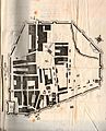
 Dibuix de les antigues muralles de Reus.JPG 986 × 653; 132 KB
-
 Reus. Segle XV.jpg 3,732 × 4,626; 2.56 MB
