Category:Census maps of DuPage County, Illinois
Jump to navigation
Jump to search
Media in category "Census maps of DuPage County, Illinois"
The following 13 files are in this category, out of 13 total.
-
 Bartlett IL 2009 reference map.png 575 × 425; 57 KB
-
 Bensenville IL 2009 reference map.png 575 × 425; 58 KB
-
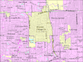
 Burr Ridge IL 2009 reference map.png 575 × 425; 69 KB
-
 Elk Grove Village IL 2009 reference map.png 575 × 425; 64 KB
-
 Elmhurst IL 2009 reference map.png 575 × 425; 58 KB
-
 Hanover Park IL 2009 reference map.gif 575 × 425; 73 KB
-
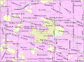
 Hinsdale IL 2009 reference map.gif 575 × 425; 67 KB
-
 Lemont IL 2009 reference map.gif 575 × 425; 70 KB
-
 Oak Brook IL 2009 reference map.gif 575 × 425; 67 KB
-
 Roselle IL 2009 reference map.gif 575 × 425; 68 KB
-
 Schaumburg IL 2009 reference map.gif 575 × 425; 74 KB
-
 Willow Springs IL 2009 reference map.gif 575 × 425; 68 KB
-
 Woodridge IL 2009 reference map.gif 575 × 425; 70 KB


