Category:Ceapabhal
Jump to navigation
Jump to search
Media in category "Ceapabhal"
The following 65 files are in this category, out of 65 total.
-

-
 Blick vom Sound of Harris zum Berg Chaipaval, Harris.jpg 5,027 × 3,222; 8.13 MB
-
 Blick von der Fähre zurück nach Harris auf den Berg Chaipaval.jpg 5,184 × 3,456; 5.02 MB
-
 Blick zum Berg Chaipaval, südliches Harris.jpg 5,184 × 3,456; 6.17 MB
-
 Cairn on NW top of Chaipaval - geograph.org.uk - 563087.jpg 640 × 480; 148 KB
-
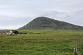
 Ceapabhal - geograph.org.uk - 311126.jpg 640 × 512; 86 KB
-
 Ceapabhal - Isle of Harris, Scotland, UK - May 22, 1989.jpg 3,200 × 2,201; 4.53 MB
-
 Ceapabhal cairn - geograph.org.uk - 837727.jpg 640 × 409; 63 KB
-
 Ceapabhal from Traigh Scarasta - geograph.org.uk - 152946.jpg 640 × 480; 40 KB
-
 Ceapabhal seen across Tràigh an Taoibh Thuath - geograph.org.uk - 4993563.jpg 2,689 × 2,015; 1.49 MB
-
 Ceapabhal Shoreline - geograph.org.uk - 25280.jpg 640 × 431; 54 KB
-
 Ceapabhal trig point - geograph.org.uk - 837827.jpg 640 × 480; 81 KB
-
 Ceapabhal's trig pillar - geograph.org.uk - 2297326.jpg 1,007 × 680; 119 KB
-
 Chaipaval (Ceapabhal) - geograph.org.uk - 3277144.jpg 1,600 × 1,200; 870 KB
-
 Chaipaval hillside - geograph.org.uk - 563094.jpg 640 × 480; 140 KB
-
 Chaipaval trig point S8988 - geograph.org.uk - 563102.jpg 640 × 480; 139 KB
-
 Chaipaval, South Harris - geograph.org.uk - 230443.jpg 640 × 427; 37 KB
-
 Climbing the southeast ridge of Ceapabhal - geograph.org.uk - 5294671.jpg 1,024 × 615; 154 KB
-
 Clouds, surf and sand - geograph.org.uk - 1524330.jpg 640 × 480; 34 KB
-
 East ridge of Ceapabhal - geograph.org.uk - 794272.jpg 640 × 427; 51 KB
-
 Eastern coastline of Ceapabhal - geograph.org.uk - 1468451.jpg 640 × 480; 67 KB
-
 Footprints in the sand - geograph.org.uk - 1515129.jpg 640 × 480; 47 KB
-
 Goat Skull - Ceapabhal, Isle of Harris, Scotland, UK - May 22, 1989.jpg 2,001 × 3,000; 2.38 MB
-

-
 Loch, South Harris - geograph.org.uk - 1576240.jpg 640 × 428; 73 KB
-
 Looking SE From Ceapabhal - geograph.org.uk - 3244216.jpg 4,608 × 3,072; 3.27 MB
-

-
 Machair flowers. - geograph.org.uk - 19115.jpg 640 × 394; 64 KB
-
 Machair, Taobh Tuath. - geograph.org.uk - 19116.jpg 640 × 366; 50 KB
-
 Markantes Felsenband an einem Berg im südlichen Harris.jpg 5,184 × 3,456; 6.85 MB
-
 Marshy ground - geograph.org.uk - 492092.jpg 640 × 470; 94 KB
-

-
 North east from Ceapabhal summit - geograph.org.uk - 2351676.jpg 1,200 × 584; 163 KB
-
 On the east ridge of Ceapabhal - geograph.org.uk - 2344365.jpg 1,200 × 808; 253 KB
-
 Pegmatite on Ceapabhal - geograph.org.uk - 5011398.jpg 3,264 × 2,448; 3.78 MB
-
 Rainbow on Ceapabhal - geograph.org.uk - 826399.jpg 640 × 426; 49 KB
-
 Rubh' an Teampaill Chapel - geograph.org.uk - 836542.jpg 640 × 421; 86 KB
-
 Scarista Beach - geograph.org.uk - 101936.jpg 640 × 480; 122 KB
-

-
 Schäre in Sound of Harris, gezoomt, im Hintergrund die Flanke des Ceapabhal.jpg 5,101 × 3,333; 9.52 MB
-
 Sgeir Chruaidh - geograph.org.uk - 1498859.jpg 640 × 480; 54 KB
-
 Sheep on the Beach - geograph.org.uk - 1361204.jpg 640 × 480; 48 KB
-
 Shoreline below Chaipaval - geograph.org.uk - 563065.jpg 640 × 480; 128 KB
-
 Shoreline below Chaipaval - geograph.org.uk - 563077.jpg 640 × 480; 157 KB
-
 Skerries in the Sound of Harris - geograph.org.uk - 1344270.jpg 640 × 391; 171 KB
-
 Skerries in the Sound of Harris - geograph.org.uk - 1498855.jpg 640 × 480; 55 KB
-
 Sound of Harris - geograph.org.uk - 1344134.jpg 640 × 337; 143 KB
-
 Summit of Beinn Shleibhe - geograph.org.uk - 643137.jpg 640 × 360; 39 KB
-
 Summit of Ceapabhal - geograph.org.uk - 19118.jpg 640 × 399; 48 KB
-
 Sunset from Tuath - geograph.org.uk - 834409.jpg 640 × 293; 13 KB
-
 Sunset over Traigh Losgaintir - geograph.org.uk - 853890.jpg 640 × 426; 47 KB
-
 Taransay - Buaileabhal from Ard Mhanais - geograph.org.uk - 467018.jpg 640 × 428; 169 KB
-
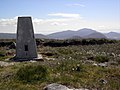
 The OS Trig station on Ceapabhal - geograph.org.uk - 2344518.jpg 1,200 × 589; 186 KB
-
 Towards Chaipaval - geograph.org.uk - 563115.jpg 640 × 480; 114 KB
-
 Traigh an Taoibh Thuath - geograph.org.uk - 205986.jpg 640 × 480; 104 KB
-
 Traigh an Taoibh Thuath, Harris - geograph.org.uk - 867498.jpg 640 × 464; 75 KB
-

-
 Tràigh na Cleabhaig - geograph.org.uk - 4485806.jpg 1,024 × 655; 142 KB
-
 Tràigh Scarasta - geograph.org.uk - 1514298.jpg 640 × 480; 63 KB
-
 Tràigh Scarasta - geograph.org.uk - 202734.jpg 640 × 215; 101 KB
-
 Tràigh Scarasta looking South West - geograph.org.uk - 1455452.jpg 640 × 237; 31 KB
-
 View Along the Flank of Ceapabhal Towards Rubha an Teampaill - geograph.org.uk - 2646332.jpg 4,000 × 3,000; 1.66 MB
-
 View over Geodha Martainn - geograph.org.uk - 1360205.jpg 640 × 480; 65 KB
-
 View to Ceapabhal from Taobh Tuath - geograph.org.uk - 2551559.jpg 800 × 533; 164 KB
-
 View Towards A Distant Ceapabhal - geograph.org.uk - 3685497.jpg 2,560 × 1,920; 2.84 MB


_-_geograph.org.uk_-_3277144.jpg)


