Category:Caynham
Jump to navigation
Jump to search

village and civil parish in Shropshire, United Kingdom  | |||||
| Upload media | |||||
| Instance of | |||||
|---|---|---|---|---|---|
| Location | Shropshire, West Midlands, England | ||||
 | |||||
Subcategories
This category has the following 6 subcategories, out of 6 total.
Media in category "Caynham"
The following 187 files are in this category, out of 187 total.
-
 5 Miles to Ludlow - geograph.org.uk - 1988817.jpg 4,000 × 3,000; 2.86 MB
-
 A back entrance to Clee Quarry - geograph.org.uk - 2253296.jpg 640 × 430; 94 KB
-
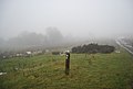
 A Foggy Teme Valley - geograph.org.uk - 2215303.jpg 3,991 × 2,862; 1.56 MB
-

-
 A4117 approaching B4214 junction - geograph.org.uk - 2860576.jpg 640 × 497; 62 KB
-
 A4117 approaching Cleehill - geograph.org.uk - 2571216.jpg 640 × 480; 79 KB
-
 A4117 at Cleehill post office - geograph.org.uk - 2571225.jpg 640 × 480; 69 KB
-
 A4117 below Cleehill - geograph.org.uk - 4938799.jpg 1,280 × 960; 379 KB
-

-

-
 A4117 entering Clee Hill from the west - geograph.org.uk - 3487296.jpg 1,024 × 615; 67 KB
-
 A4117 in Cleehill - geograph.org.uk - 2571219.jpg 640 × 480; 65 KB
-
 A4117 south of Dhustone - geograph.org.uk - 2571213.jpg 640 × 480; 71 KB
-
 Amperley Farm - geograph.org.uk - 4412150.jpg 800 × 530; 508 KB
-
 An Old Quarry Building - geograph.org.uk - 2386916.jpg 2,592 × 1,944; 1.91 MB
-
 Around The Houses - geograph.org.uk - 2386895.jpg 2,592 × 1,944; 2.06 MB
-
 B4214 approaching Cleehill - geograph.org.uk - 2867026.jpg 640 × 458; 69 KB
-
 B4214 Heading up Clee Hill - geograph.org.uk - 2398172.jpg 2,592 × 1,944; 2.03 MB
-
 B4214 in Cleehill - geograph.org.uk - 2867031.jpg 640 × 422; 54 KB
-
 Behind the Houses - geograph.org.uk - 2386902.jpg 960 × 720; 255 KB
-
 Below Caynham Hill - geograph.org.uk - 5250949.jpg 1,000 × 662; 665 KB
-
 Bridleway junction near Dhustone - geograph.org.uk - 2253215.jpg 640 × 430; 98 KB
-
 BT Exchange - geograph.org.uk - 1607479.jpg 640 × 480; 60 KB
-
 Cattle grid, Dhustone Lane - geograph.org.uk - 2253292.jpg 640 × 430; 96 KB
-
 Cattle Grid, Dhustone Lane - geograph.org.uk - 2255175.jpg 640 × 430; 22 KB
-
 Cattle, Caynham - geograph.org.uk - 5062317.jpg 1,024 × 683; 252 KB
-
 Cattle, Caynham - geograph.org.uk - 5062327.jpg 1,024 × 683; 279 KB
-
 Caynam Road - geograph.org.uk - 5952495.jpg 1,024 × 684; 386 KB
-
 Caynham - geograph.org.uk - 147391.jpg 640 × 480; 60 KB
-
 Caynham - geograph.org.uk - 4057025.jpg 640 × 480; 285 KB
-
 Caynham Camp - geograph.org.uk - 5250204.jpg 1,000 × 662; 514 KB
-
 Caynham Camp - geograph.org.uk - 5250942.jpg 1,000 × 662; 819 KB
-
 Caynham Camp - geograph.org.uk - 5250944.jpg 1,000 × 662; 788 KB
-
 Caynham House - geograph.org.uk - 5268403.jpg 1,000 × 662; 825 KB
-
 Caynham Pound - geograph.org.uk - 5268577.jpg 1,000 × 662; 890 KB
-
 Caynham Road, Knowbury - geograph.org.uk - 5642881.jpg 1,024 × 683; 370 KB
-
 Caynham to the Ashfords road - geograph.org.uk - 6219048.jpg 1,024 × 683; 283 KB
-
 Caynham Village Hall - geograph.org.uk - 5268581.jpg 1,000 × 662; 835 KB
-
 Church of St Paul, Knowbury - geograph.org.uk - 4476431.jpg 3,776 × 2,520; 3.94 MB
-
 Clee Hill - geograph.org.uk - 6141872.jpg 640 × 480; 56 KB
-
 Clee Hill 2G Phone Mast - geograph.org.uk - 2386936.jpg 2,592 × 1,944; 1.84 MB
-
 Clee Hill 2G Phone Mast - geograph.org.uk - 2386941.jpg 2,592 × 1,944; 2 MB
-

-
 Clee Hill quarries incline top - geograph.org.uk - 4937822.jpg 960 × 1,280; 409 KB
-
 Clee Hill Quarry - geograph.org.uk - 5814695.jpg 1,280 × 720; 621 KB
-
 Clee Hill Quarry Land - geograph.org.uk - 2386923.jpg 2,592 × 1,944; 2.15 MB
-
 Clee Hill Quarry Land - geograph.org.uk - 2386928.jpg 2,592 × 1,944; 2.29 MB
-
 Clee Hill Quarry Land - geograph.org.uk - 2386932.jpg 2,592 × 1,944; 2.12 MB
-
 Clee Hill Village - geograph.org.uk - 6518106.jpg 640 × 458; 53 KB
-
 Clee Hill village in the mist - geograph.org.uk - 2253186.jpg 640 × 430; 94 KB
-
 Clee Hill, primary school - geograph.org.uk - 2412803.jpg 1,024 × 768; 206 KB
-
 Cloudscape over Clee Hill - geograph.org.uk - 4927339.jpg 960 × 1,280; 181 KB
-
 Coldoak Cottages - geograph.org.uk - 4434116.jpg 640 × 480; 101 KB
-
 Construction, Knowbury - geograph.org.uk - 4324504.jpg 800 × 600; 444 KB
-
 Cottages at Dhustone Quarry, Clee Hill in 1969 - geograph.org.uk - 5737583.jpg 1,280 × 720; 665 KB
-
 Dhustone Hamlet on the summit road to Titterstone Clee Hill - geograph.org.uk - 3873118.jpg 4,128 × 2,322; 2.53 MB
-
 Dhustone Lane - geograph.org.uk - 2253290.jpg 640 × 430; 101 KB
-
 Dhustone Lane - geograph.org.uk - 2253301.jpg 640 × 430; 96 KB
-
 Dhustone Lane in the mist - geograph.org.uk - 2253299.jpg 640 × 430; 94 KB
-
 Dhustone, Rouse-Boughton Terrace - geograph.org.uk - 2951067.jpg 2,574 × 1,890; 1.91 MB
-

-

-
 Down A Quarry Track - geograph.org.uk - 2386909.jpg 2,592 × 1,944; 2.25 MB
-
 East from Caynham Camp - geograph.org.uk - 5250946.jpg 1,000 × 662; 532 KB
-
 East from Caynham Camp - geograph.org.uk - 5250948.jpg 1,000 × 662; 676 KB
-
 Eastern gate, Caynham Camp - geograph.org.uk - 5062334.jpg 1,024 × 683; 461 KB
-
 Elan Valley Aqueduct inspection chamber - geograph.org.uk - 5249230.jpg 1,000 × 662; 620 KB
-
 Elan Valley Aqueduct inspection chamber - geograph.org.uk - 5250194.jpg 1,000 × 662; 631 KB
-

-

-
 Farm building near Tree Pits Quarry - geograph.org.uk - 2253206.jpg 640 × 430; 114 KB
-
 Fence along Dhustone Lane - geograph.org.uk - 2384324.jpg 3,264 × 2,448; 3.56 MB
-
 Field edge - geograph.org.uk - 5250196.jpg 1,000 × 662; 756 KB
-
 Field edge - geograph.org.uk - 5255651.jpg 1,000 × 662; 666 KB
-
 Field edge - geograph.org.uk - 5256457.jpg 1,000 × 662; 783 KB
-
 Field edge - geograph.org.uk - 5256458.jpg 1,000 × 662; 714 KB
-
 Field near Knowbury - geograph.org.uk - 5249229.jpg 1,000 × 662; 578 KB
-
 Field off Caynham Road - geograph.org.uk - 5952486.jpg 1,024 × 684; 399 KB
-
 Field, Caynham Camp - geograph.org.uk - 5062326.jpg 1,024 × 683; 348 KB
-
 Flooded quarry pit on Titterstone Clee Hill - geograph.org.uk - 4026410.jpg 3,796 × 2,030; 3.19 MB
-

-
 Footpath off Dhustone Lane - geograph.org.uk - 2253289.jpg 640 × 430; 102 KB
-
 Footpath off Dhustone Lane - geograph.org.uk - 2253305.jpg 640 × 430; 112 KB
-
 Footpath south of Caynham - geograph.org.uk - 4412189.jpg 800 × 530; 566 KB
-
 Footpath to Heath Farm - geograph.org.uk - 4544361.jpg 640 × 478; 186 KB
-
-
 Glebe Court and The Coach House - geograph.org.uk - 5268450.jpg 1,000 × 662; 670 KB
-
 Harvested rape field, Caynham - geograph.org.uk - 5062311.jpg 1,024 × 683; 309 KB
-
 Hedgehog House at Dhustone - geograph.org.uk - 2214565.jpg 1,024 × 768; 212 KB
-
 Hedgehog House, Dhustone - geograph.org.uk - 2253221.jpg 640 × 430; 103 KB
-
 Hey 30 Ahead - geograph.org.uk - 891825.jpg 640 × 421; 78 KB
-
 High Street, Clee Hill - geograph.org.uk - 5642886.jpg 1,024 × 683; 306 KB
-
 Hillcrest - geograph.org.uk - 3625177.jpg 800 × 530; 402 KB
-
 Inside Caynham Camp - geograph.org.uk - 5062335.jpg 1,024 × 683; 313 KB
-
 Interpretation board at Caynham Camp - geograph.org.uk - 2433392.jpg 640 × 480; 105 KB
-
 Inversion mist and fog Teme Valley - geograph.org.uk - 2163624.jpg 2,016 × 1,512; 847 KB
-
 Knowbury - geograph.org.uk - 5642883.jpg 1,024 × 683; 344 KB
-
 Knowbury Memorial Hall - geograph.org.uk - 3625162.jpg 800 × 530; 442 KB
-
 Ledwyche Brook Crossing - geograph.org.uk - 5252758.jpg 1,000 × 662; 677 KB
-
 Ledwyche Brook Crossing - geograph.org.uk - 5252760.jpg 1,000 × 662; 876 KB
-
 Ledwyche Brook Crossing - geograph.org.uk - 5252762.jpg 662 × 1,000; 773 KB
-
 Ledwyche Brook Crossing - geograph.org.uk - 5252763.jpg 1,000 × 662; 810 KB
-
 Looking out to Worcestershire - geograph.org.uk - 2386949.jpg 2,592 × 1,944; 1.86 MB
-
 Looking West towards the Teme Valley - geograph.org.uk - 2215400.jpg 2,592 × 1,944; 1.74 MB
-
 Methodist Chapel, Caynham.jpg 800 × 530; 664 KB
-
 Milestone near Cleehill - geograph.org.uk - 4938802.jpg 960 × 1,280; 637 KB
-
 Mont de Seigneur - geograph.org.uk - 5268470.jpg 1,000 × 662; 763 KB
-
 Mont de Seigneur - geograph.org.uk - 5268474.jpg 1,000 × 662; 1.05 MB
-
 Muddy track by the Ledwyche Brook - geograph.org.uk - 3856394.jpg 640 × 480; 298 KB
-
 Newly mown field near Knowbury - geograph.org.uk - 4324501.jpg 800 × 600; 437 KB
-
 Northern side of Caynham Camp - geograph.org.uk - 5062338.jpg 1,024 × 683; 316 KB
-
 Old Fordson tractor near Caynham Camp - geograph.org.uk - 2433395.jpg 640 × 480; 108 KB
-
 Old House Farm - geograph.org.uk - 4412145.jpg 800 × 530; 538 KB
-
 Old House Farm - geograph.org.uk - 5250198.jpg 1,000 × 662; 683 KB
-
 Old House Farm - geograph.org.uk - 5250200.jpg 1,000 × 662; 822 KB
-
 Old Post Office - geograph.org.uk - 3625183.jpg 800 × 530; 426 KB
-
 Old Quarry Building - geograph.org.uk - 2386885.jpg 2,592 × 1,944; 2.07 MB
-
 Old Quarry Building - geograph.org.uk - 2386888.jpg 1,568 × 1,168; 806 KB
-
 Old quarry building, Clee Hill - geograph.org.uk - 2253212.jpg 640 × 430; 100 KB
-
 Old quarry buildings, Clee Hill Quarry - geograph.org.uk - 2253213.jpg 640 × 430; 100 KB
-
 Old quarrying at Caynham Camp - geograph.org.uk - 2434168.jpg 640 × 480; 149 KB
-
 Old Toll House, Cleehill - geograph.org.uk - 6114836.jpg 480 × 640; 45 KB
-
-
 Part of Clee Hill village in winter - geograph.org.uk - 3308715.jpg 640 × 480; 65 KB
-
 Part of the view from Clee Hill - geograph.org.uk - 3202351.jpg 640 × 480; 64 KB
-
 Path near Knowbury - geograph.org.uk - 5249226.jpg 1,000 × 662; 626 KB
-
 Pedestrian crossing and shops in Cleehill - geograph.org.uk - 3487681.jpg 1,024 × 767; 93 KB
-
 Pervin Farm - geograph.org.uk - 5255650.jpg 1,000 × 662; 777 KB
-
 Pervin Farm - geograph.org.uk - 5256459.jpg 1,000 × 662; 1,000 KB
-
 Ploughed field - geograph.org.uk - 5268393.jpg 1,000 × 662; 676 KB
-
 Poughnhill Farm - geograph.org.uk - 4565265.jpg 2,592 × 1,936; 1.95 MB
-
 Primrose Bank - geograph.org.uk - 5250201.jpg 1,000 × 662; 656 KB
-
 Primrosehill - geograph.org.uk - 4412091.jpg 800 × 530; 562 KB
-
 Public convenience, High Street - geograph.org.uk - 1970476.jpg 800 × 537; 149 KB
-
 Railway Terrace, Dhustone - geograph.org.uk - 2253218.jpg 640 × 430; 90 KB
-
 Rear of New Buildings, Dhustone - geograph.org.uk - 2253219.jpg 640 × 430; 98 KB
-
 Redthorpe Villa - geograph.org.uk - 3625182.jpg 800 × 530; 411 KB
-
 Richard C Swift, Baker, 29 High Street - geograph.org.uk - 1970857.jpg 800 × 572; 120 KB
-
 Road junction - geograph.org.uk - 5268465.jpg 1,000 × 662; 735 KB
-
 Roadworks on A4117 at Clee Hill - geograph.org.uk - 2860583.jpg 640 × 496; 74 KB
-
 Round bales, Caynham Camp - geograph.org.uk - 5062336.jpg 1,024 × 683; 289 KB
-
 Rouse-Broughton Terrace, Dhustone - geograph.org.uk - 4938793.jpg 1,280 × 960; 329 KB
-
 Royal Oak - geograph.org.uk - 3475704.jpg 2,592 × 1,944; 1.18 MB
-
 Sewage works, Knowbury - geograph.org.uk - 1093557.jpg 480 × 640; 132 KB
-
 Sheet Road and the woodland beside the Ledwyche Brook - geograph.org.uk - 5167435.jpg 1,600 × 1,201; 819 KB
-
 Sheet Road near Caynham - geograph.org.uk - 6033344.jpg 574 × 640; 140 KB
-
 Shops, Clee Hill - geograph.org.uk - 2742883.jpg 640 × 480; 45 KB
-

-
 Snitton Lane - geograph.org.uk - 2218369.jpg 1,024 × 752; 326 KB
-
 Snow on Hoar Edge - geograph.org.uk - 4937857.jpg 1,280 × 960; 350 KB
-
 South of Caynham - geograph.org.uk - 5255643.jpg 1,000 × 662; 913 KB
-
 South of Caynham - geograph.org.uk - 5255644.jpg 1,000 × 662; 606 KB
-
 South of Caynham - geograph.org.uk - 5255645.jpg 1,000 × 662; 699 KB
-
 South of Caynham - geograph.org.uk - 5255647.jpg 1,000 × 662; 1,024 KB
-
 St Johns and Mont de Seigneur - geograph.org.uk - 5268480.jpg 1,000 × 662; 751 KB
-
 St Mary, Caynham - geograph.org.uk - 5062304.jpg 1,024 × 683; 339 KB
-
 St Mary, Caynham - geograph.org.uk - 5062306.jpg 683 × 1,024; 342 KB
-
 Standing cross, Caynham - geograph.org.uk - 5062309.jpg 683 × 1,024; 389 KB
-
 Stile near Caynham - geograph.org.uk - 5250203.jpg 1,000 × 662; 635 KB
-
 Sunken lane, Caynham - geograph.org.uk - 5062322.jpg 1,024 × 683; 457 KB
-
 Sunset from Titterstone Clee Hill - geograph.org.uk - 5246090.jpg 662 × 1,000; 245 KB
-
 Surveying point on the Elan Aqueduct - geograph.org.uk - 2398167.jpg 720 × 960; 308 KB
-
 Sycamore Grove - geograph.org.uk - 3624885.jpg 800 × 530; 405 KB
-
 Telephone Kiosk and Bus Stop, Clee Hill - geograph.org.uk - 2253184.jpg 640 × 430; 111 KB
-
 Temperature inversion below Clee Hill - geograph.org.uk - 2163615.jpg 2,016 × 1,512; 961 KB
-
 Tenbury Road Clee Hill 1937 - geograph.org.uk - 1988368.jpg 640 × 369; 65 KB
-
 Tenbury Road Clee Hill 2010 - geograph.org.uk - 1988363.jpg 4,000 × 3,000; 2.55 MB
-
 The approach to The Kremlin Inn - geograph.org.uk - 1970901.jpg 1,024 × 677; 190 KB
-
 The Common, Clee Hill - geograph.org.uk - 4325462.jpg 800 × 600; 476 KB
-
 The Crescent, Clee Hill - geograph.org.uk - 2253189.jpg 640 × 430; 117 KB
-
 The Crescent, Clee Hill - geograph.org.uk - 5642888.jpg 1,024 × 683; 327 KB
-
 The Glebe - geograph.org.uk - 5268444.jpg 1,000 × 662; 762 KB
-
 The Kremlin Inn - geograph.org.uk - 1970937.jpg 1,024 × 748; 247 KB
-
 The Old School - geograph.org.uk - 3624874.jpg 800 × 530; 465 KB
-
 The Royal Oak pub below Clee Hill - geograph.org.uk - 3202360.jpg 640 × 480; 54 KB
-
-
 Titterstone Clee quarrying - geograph.org.uk - 4026289.jpg 4,048 × 3,040; 5.71 MB
-
 Titterstone Clee quarrying and radar station - geograph.org.uk - 4026361.jpg 4,048 × 3,040; 4.55 MB
-
 Titterstone Clee quarrying plant - geograph.org.uk - 4026306.jpg 2,701 × 2,030; 2.32 MB
-
 Towards Caynham Hill - geograph.org.uk - 5252764.jpg 1,000 × 662; 584 KB
-
 Towards Primrosehill - geograph.org.uk - 4412162.jpg 800 × 530; 402 KB
-
 Tree Pits Quarry in the mist - geograph.org.uk - 2253208.jpg 640 × 447; 62 KB
-
 Up on the Hill of Clee - geograph.org.uk - 2386943.jpg 2,592 × 1,944; 1.82 MB
-
 Victoria Cottages - geograph.org.uk - 4544234.jpg 2,592 × 1,936; 1.58 MB
-
 View from the re-routed Shropshire Way - geograph.org.uk - 2434150.jpg 640 × 480; 109 KB
-
 Western gate, Caynham Camp - geograph.org.uk - 5062337.jpg 1,024 × 683; 433 KB
-
 Willow Cottage and Rose Cottage (geograph 5268488).jpg 1,000 × 662; 809 KB


.jpg)