Category:Cattle in Cheshire
Jump to navigation
Jump to search
Ceremonial counties of England: Bedfordshire · Berkshire · Buckinghamshire · Cambridgeshire · Cheshire · Cornwall · Cumbria · Derbyshire · Devon · Dorset · Durham · East Riding of Yorkshire · East Sussex · Essex · Gloucestershire · Greater London · Greater Manchester · Hampshire · Herefordshire · Hertfordshire · Isle of Wight · Kent · Lancashire · Leicestershire · Lincolnshire · Merseyside · Norfolk · North Yorkshire · Northamptonshire · Northumberland · Nottinghamshire · Oxfordshire · Rutland · Shropshire · Somerset · South Yorkshire · Staffordshire · Suffolk · Surrey · Tyne and Wear · Warwickshire · West Midlands · West Sussex · West Yorkshire · Wiltshire · Worcestershire
City-counties:
Former historic counties:
Other former counties:
City-counties:
Former historic counties:
Other former counties:
Media in category "Cattle in Cheshire"
The following 96 files are in this category, out of 96 total.
-
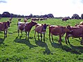
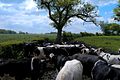
 A fine line of Longhorns. - geograph.org.uk - 2317411.jpg 1,704 × 2,272; 1.65 MB
-
-
 Bickerton Cow - geograph.org.uk - 380237.jpg 640 × 480; 151 KB
-
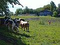
 Bickerton woods cows.jpg 1,200 × 800; 519 KB
-
 Bickley - Manor Farm.jpg 640 × 470; 131 KB
-
 Bridge Stile and Cows near Highfield Farm - geograph.org.uk - 412228.jpg 640 × 480; 196 KB
-
 Bridge Stile and Cows near Highfield Farm - geograph.org.uk - 412288.jpg 640 × 480; 275 KB
-
 Bull and Heifers in a Cheshire Field - geograph.org.uk - 412318.jpg 640 × 480; 211 KB
-
 Bullocks by railings - geograph.org.uk - 210333.jpg 640 × 501; 119 KB
-
 Cattle above Quarry Wood - geograph.org.uk - 846969.jpg 640 × 480; 311 KB
-
 Cattle at Cholmondeley - geograph.org.uk - 255870.jpg 640 × 480; 57 KB
-
 Cattle at Oak Farm - geograph.org.uk - 2812981.jpg 640 × 480; 471 KB
-

-
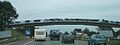 Cattle Crossing the M6 - geograph.org.uk - 65203 (cropped).jpg 640 × 240; 34 KB
-
 Cattle Crossing the M6 - geograph.org.uk - 65203.jpg 640 × 386; 45 KB
-
 Cattle feeding at Beech Tree Farm - geograph.org.uk - 1102341.jpg 640 × 480; 112 KB
-

-
 Cattle Grazing, near Audlem, Cheshire - geograph.org.uk - 578986.jpg 640 × 437; 135 KB
-
 Cattle near Cross Lanes Farm - geograph.org.uk - 815222.jpg 640 × 407; 126 KB
-
 Cattle near Highfield Lodge - geograph.org.uk - 407703.jpg 640 × 480; 209 KB
-
 Cattle, 109th Poynton Show - geograph.org.uk - 1466386.jpg 640 × 480; 101 KB
-
 Cattle, 109th Poynton Show - geograph.org.uk - 1466392.jpg 640 × 480; 108 KB
-
 Cattle, 109th Poynton Show - geograph.org.uk - 1466397.jpg 640 × 448; 118 KB
-
 Cattle, 109th Poynton Show - geograph.org.uk - 1466403.jpg 640 × 480; 149 KB
-
 Cheshire Cattle.JPG 1,600 × 1,200; 384 KB
-
 Cheshire Champion - geograph.org.uk - 4788219.jpg 4,103 × 2,916; 4.46 MB
-
 Cow and Weaver - geograph.org.uk - 1388188.jpg 640 × 480; 88 KB
-
 Cow Bickerton Aug 2007.jpg 1,200 × 754; 552 KB
-
 Cow on Pale Heights - geograph.org.uk - 1758619.jpg 3,072 × 2,304; 3.3 MB
-
 Cows and Oil - geograph.org.uk - 873976.jpg 640 × 479; 94 KB
-
 Cows at Little Heath - geograph.org.uk - 183762.jpg 640 × 480; 116 KB
-
 Cows Grazing - geograph.org.uk - 216020.jpg 640 × 480; 84 KB
-
 Cows grazing in birch woods at Bickerton - geograph.org.uk - 715766.jpg 640 × 427; 180 KB
-
 Cows in the Dane Valley - geograph.org.uk - 1567544.jpg 640 × 480; 108 KB
-
 Cows with calves in the Weaver Valley - geograph.org.uk - 62569.jpg 640 × 480; 104 KB
-
 Cowshed, Hoole Bank, Cheshire - geograph.org.uk - 655213.jpg 640 × 480; 118 KB
-
 Curious cattle at Stock-in-Hey Farm - geograph.org.uk - 2366114.jpg 3,638 × 2,670; 6.07 MB
-

-
 Deeside Cows - geograph.org.uk - 1077724.jpg 640 × 481; 110 KB
-
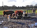
 Dumkins Farm taken Autumn 1975 - geograph.org.uk - 508945.jpg 640 × 512; 84 KB
-

-

-

-
 Heifers admire White Nancy Monument, Bollington - geograph.org.uk - 3291869.jpg 1,024 × 768; 103 KB
-
 Hockenhull Hatchery, Hockenhull - geograph.org.uk - 129282.jpg 640 × 484; 71 KB
-
 Houses on Bankhouse Lane - geograph.org.uk - 230390.jpg 640 × 480; 30 KB
-

-
 Inquisitive cows near Hollin Green - geograph.org.uk - 823017.jpg 640 × 427; 164 KB
-
 Inquisitive cows near Norbury Mere - geograph.org.uk - 190340.jpg 640 × 480; 128 KB
-

-
 Make My Day^ - geograph.org.uk - 1451549.jpg 640 × 480; 108 KB
-
 Milking time - geograph.org.uk - 1566267.jpg 640 × 480; 76 KB
-
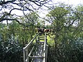
 Musket's Hole, Bickerton Hill - geograph.org.uk - 183741.jpg 640 × 511; 140 KB
-
 Nether Alderley church from the NNW - geograph.org.uk - 1563724.jpg 640 × 427; 49 KB
-
 Penned in - geograph.org.uk - 4869020.jpg 3,930 × 2,947; 2.67 MB
-
 Some Of My New Best Friends - geograph.org.uk - 1337662.jpg 640 × 480; 196 KB
-
 Spring Farm, Minshull Vernon - geograph.org.uk - 197123.jpg 576 × 384; 267 KB
-
 Spring farmland in evening light - geograph.org.uk - 1459916.jpg 640 × 480; 133 KB
-
 Stile and Cows near Highfield Farm - geograph.org.uk - 412265.jpg 640 × 480; 76 KB
-
 The indignity of it^ - geograph.org.uk - 2317380.jpg 2,272 × 1,704; 1.36 MB
-
 Thirsty Bull. Explored. - Flickr - Wildlife Terry.jpg 1,600 × 900; 884 KB
-

-
 Tree and cattle by the River Dee - geograph.org.uk - 1126918.jpg 640 × 480; 190 KB
-
 Valewood Farm residents' welcoming group - geograph.org.uk - 3305279.jpg 3,456 × 2,304; 4.68 MB
-
 Cattle grazing by Woodhey Chapel - geograph.org.uk - 214153.jpg 640 × 438; 112 KB
-
 Woodhey Chapel Faddiley.jpg 767 × 587; 167 KB
-

-
 Black and White Cattle - geograph.org.uk - 38606.jpg 640 × 480; 143 KB
-
 Bullocks by a small wood - geograph.org.uk - 218622.jpg 640 × 429; 140 KB
-
 Bullocks in woodland - geograph.org.uk - 386196.jpg 640 × 445; 166 KB
-
 Bullocks near Blackhurst Farm - geograph.org.uk - 218689.jpg 640 × 487; 123 KB
-
 Bulls at Dodcott Grange - geograph.org.uk - 218600.jpg 640 × 490; 146 KB
-
 Calves in field - geograph.org.uk - 473336.jpg 640 × 480; 101 KB
-
 Cattle and Farmland - geograph.org.uk - 334975.jpg 640 × 480; 244 KB
-

-
 Cattle in field - geograph.org.uk - 473237.jpg 640 × 480; 119 KB
-

-
 Cow by pond - geograph.org.uk - 430912.jpg 640 × 480; 95 KB
-
 Cow crossing - geograph.org.uk - 190612.jpg 640 × 509; 127 KB
-
 Cows and hay bales - geograph.org.uk - 183756.jpg 640 × 480; 121 KB
-
 Cows at Brookfields - geograph.org.uk - 35829.jpg 640 × 480; 94 KB
-
 Cows at Rope Farm, near Shavington - geograph.org.uk - 323178.jpg 640 × 525; 145 KB
-
 Cows grazing - geograph.org.uk - 493186.jpg 640 × 480; 167 KB
-
 Cows in a field - geograph.org.uk - 183715.jpg 640 × 480; 149 KB
-
 Cows near Beeston - geograph.org.uk - 381342.jpg 640 × 429; 116 KB
-
 Cows near River Weaver - geograph.org.uk - 438224.jpg 640 × 480; 90 KB
-
 Cows near Twemlow Green - geograph.org.uk - 493159.jpg 640 × 480; 98 KB
-
 Cows on the Longster Trail - geograph.org.uk - 224901.jpg 640 × 480; 99 KB
-
-
 Dairy herd beside Norton's Lane - geograph.org.uk - 422485.jpg 614 × 460; 277 KB
-
 Footpath through field of cows - geograph.org.uk - 430903.jpg 640 × 480; 74 KB
-
 Gorsecroft Farm, Audlem - geograph.org.uk - 189819.jpg 640 × 427; 82 KB
-
 Inquisitive bullocks, Green Farm - geograph.org.uk - 202149.jpg 640 × 488; 136 KB
-
 Inquisitive calves near Adamley Pool - geograph.org.uk - 186198.jpg 640 × 464; 94 KB
-
 Limosins - geograph.org.uk - 45576.jpg 640 × 480; 165 KB
-
 Maltkiln Farm, Hunsterson - geograph.org.uk - 174586.jpg 640 × 480; 99 KB


_-_geograph.org.uk_-_264133.jpg)


.jpg)