Category:Catthorpe
Jump to navigation
Jump to search
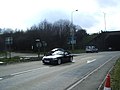
English: Catthorpe is a village and civil parish in the Harborough district of Leicestershire, England. It is close to the A5 road which forms the border with Warwickshire - the nearest town is Rugby, about four miles (6 km) south-west. The parish had a population of 179 according to the 2001 census. The parish church is St Thomas. The local pub is the Cherry Tree on Main Street.
village in the United Kingdom  | |||||
| Upload media | |||||
| Instance of | |||||
|---|---|---|---|---|---|
| Location | Harborough, Leicestershire, East Midlands, England | ||||
| Population |
| ||||
| Area |
| ||||
 | |||||
Subcategories
This category has the following 3 subcategories, out of 3 total.
L
- Lilbourne railway station (7 F)
T
- The Cherry Tree, Catthorpe (7 F)
- St Thomas church, Catthorpe (5 F)
Media in category "Catthorpe"
The following 106 files are in this category, out of 106 total.
-
 A14 East, Catthorpe - geograph.org.uk - 1756909.jpg 1,024 × 768; 115 KB
-
 A14 West near Catthorpe, south of Swinford - geograph.org.uk - 1756916.jpg 1,024 × 768; 116 KB
-
 Bridleway access, Catthorpe Interchange - geograph.org.uk - 1775254.jpg 1,024 × 768; 147 KB
-
 Bridleway alongside M6 - geograph.org.uk - 1758292.jpg 1,024 × 768; 182 KB
-
 Bridleway beside the M6 - geograph.org.uk - 3909247.jpg 640 × 480; 104 KB
-
 Bridleway nearing A5 Watling Street - geograph.org.uk - 1758322.jpg 768 × 1,024; 245 KB
-
 Bridleway to Swinford Corner - geograph.org.uk - 5718801.jpg 1,280 × 851; 451 KB
-
 Bridleway, A5 Watling Street - geograph.org.uk - 1758344.jpg 1,024 × 768; 211 KB
-
 Bridleway, M6 interchange, Catthorpe - geograph.org.uk - 1775270.jpg 1,024 × 768; 144 KB
-
 Catthorpe Farmland - geograph.org.uk - 3967694.jpg 1,024 × 768; 267 KB
-
 Catthorpe Interchange - geograph.org.uk - 1335433.jpg 640 × 425; 64 KB
-
 Catthorpe Interchange - geograph.org.uk - 1775217.jpg 1,024 × 768; 129 KB
-
 Catthorpe Manor - geograph.org.uk - 3865270.jpg 1,024 × 768; 170 KB
-
 Catthorpe Manor Clock Tower - geograph.org.uk - 3967681.jpg 1,024 × 768; 177 KB
-
 Catthorpe Manor clock tower - geograph.org.uk - 6574785.jpg 768 × 1,024; 179 KB
-
 Catthorpe Manor in south Leicestershire - geograph.org.uk - 4758894.jpg 800 × 538; 136 KB
-
 Catthorpe map old.jpg 1,280 × 720; 144 KB
-
 Catthorpe, Leicestershire - geograph.org.uk - 595198.jpg 640 × 490; 77 KB
-

-
 Catthorpe-M6 Motorway - geograph.org.uk - 4352753.jpg 1,600 × 975; 402 KB
-
 Catthorpe-River Avon - geograph.org.uk - 3967622.jpg 1,024 × 768; 353 KB
-
 Catthorpe-River Avon - geograph.org.uk - 3967647.jpg 1,024 × 768; 248 KB
-
 Catthorpe-Rugby Road - geograph.org.uk - 1601823.jpg 640 × 480; 65 KB
-
 Crop field near Catthorpe - geograph.org.uk - 3909244.jpg 640 × 480; 69 KB
-
 Cross fields Right of Way - geograph.org.uk - 1758057.jpg 768 × 1,024; 163 KB
-
 Crossing the River Avon, M1 - geograph.org.uk - 4689745.jpg 640 × 331; 37 KB
-
 Descending to Catthorpe - geograph.org.uk - 3577712.jpg 640 × 480; 64 KB
-
 Down to Catthorpe - geograph.org.uk - 1818426.jpg 640 × 480; 131 KB
-
 End Of The M6 - geograph.org.uk - 1223399.jpg 640 × 486; 48 KB
-
 End of the M6 at Catthorpe - geograph.org.uk - 4517319.jpg 3,873 × 2,070; 3.21 MB
-
 Entering Catthorpe - geograph.org.uk - 3909240.jpg 640 × 480; 57 KB
-
 Entering Leicestershire - geograph.org.uk - 2804346.jpg 800 × 600; 103 KB
-
 Farmland near the River Avon - geograph.org.uk - 3909233.jpg 640 × 480; 61 KB
-
 Footbridge across the River Avon - geograph.org.uk - 4758472.jpg 800 × 571; 215 KB
-
 Footpath near Catthorpe Manor - geograph.org.uk - 3909235.jpg 640 × 480; 141 KB
-
 Footpath to Catthorpe - geograph.org.uk - 3909234.jpg 480 × 640; 93 KB
-
 Gated bridleway near M6 motorway - geograph.org.uk - 1758249.jpg 1,024 × 768; 160 KB
-
 Gnarled tree - geograph.org.uk - 3865247.jpg 1,024 × 967; 399 KB
-
 Hillside view of Catthorpe - geograph.org.uk - 1758237.jpg 1,024 × 768; 124 KB
-
 Houses along Lilbourne Lane, Lilbourne - geograph.org.uk - 4758911.jpg 800 × 523; 120 KB
-
 Joining the M6 Motorway - geograph.org.uk - 594160.jpg 640 × 488; 140 KB
-
 Lake at Catthorpe Manor - geograph.org.uk - 5782497.jpg 1,600 × 1,067; 438 KB
-
 Lovepark Farm - geograph.org.uk - 3909237.jpg 640 × 480; 92 KB
-
 M1 - A14 interchange, Catthorpe - geograph.org.uk - 1775343.jpg 1,024 × 768; 112 KB
-
 M1 - A14 interchange, Catthorpe - geograph.org.uk - 1775362.jpg 768 × 1,024; 145 KB
-

-
 M1 southbound - geograph.org.uk - 3586468.jpg 640 × 480; 33 KB
-
 M6 - A14 interchange, Catthorpe - geograph.org.uk - 1775306.jpg 1,024 × 768; 107 KB
-
 M6 - A14 interchange, Catthorpe - geograph.org.uk - 1775334.jpg 1,024 × 768; 120 KB
-
 M6 bridge over Shawell Lane - geograph.org.uk - 3909248.jpg 640 × 480; 68 KB
-
 M6 motorway at Shawell Lane bridge - geograph.org.uk - 3574311.jpg 640 × 480; 51 KB
-
 M6 Motorway, Catthorpe Interchange - geograph.org.uk - 3680323.jpg 640 × 480; 272 KB
-
 M6 motorway, Shawell - geograph.org.uk - 1758211.jpg 1,024 × 768; 152 KB
-
 M6 motorway, Shawell Lane - geograph.org.uk - 1758138.jpg 1,024 × 768; 191 KB
-
 M6 Sliproad at Catthorpe Interchange - geograph.org.uk - 3680338.jpg 640 × 480; 317 KB
-
 M6 southbound from A14 turn off - geograph.org.uk - 2071281.jpg 640 × 498; 58 KB
-
 M6, Exit at the Catthorpe Interchange - geograph.org.uk - 3680333.jpg 640 × 480; 242 KB
-
 Main Street, Catthorpe - geograph.org.uk - 657331.jpg 640 × 428; 117 KB
-
 Misdirected footpath sign - geograph.org.uk - 1758116.jpg 1,024 × 768; 182 KB
-
 Motorway bridge supports - geograph.org.uk - 594159.jpg 498 × 640; 106 KB
-
 Motorway bridges - geograph.org.uk - 594154.jpg 640 × 452; 102 KB
-
 Newton-Watling Crescent - geograph.org.uk - 539656.jpg 640 × 480; 138 KB
-
 Pond and reflected trees - geograph.org.uk - 3865284.jpg 1,024 × 768; 239 KB
-
 Public footpath near Catthorpe Manor - geograph.org.uk - 4758877.jpg 800 × 613; 174 KB
-
 Right of Way, A5 - geograph.org.uk - 1597795.jpg 480 × 640; 227 KB
-
 River Avon and footpath to Catthorpe - geograph.org.uk - 1737659.jpg 1,024 × 768; 141 KB
-
 River Avon near Lilbourne - geograph.org.uk - 3909230.jpg 640 × 480; 76 KB
-
 Rugby Road, Catthorpe - geograph.org.uk - 1337084.jpg 640 × 466; 97 KB
-
 Shawell Lane towards Catthorpe - geograph.org.uk - 595200.jpg 640 × 464; 83 KB
-
 Shawell Road, Footpath - geograph.org.uk - 1775086.jpg 1,014 × 761; 134 KB
-
 Sheep and farmland south of Catthorpe - geograph.org.uk - 4758915.jpg 800 × 557; 131 KB
-
 Sheep and pasture near Catthorpe Manor - geograph.org.uk - 4758901.jpg 800 × 655; 167 KB
-

-
 Sliproad, M6 motorway, Catthorpe Interchange - geograph.org.uk - 1775242.jpg 1,024 × 768; 114 KB
-
 Sliproad, M6 motorway, Catthorpe Interchange - geograph.org.uk - 1775289.jpg 1,024 × 768; 182 KB
-
 Snowdrops - geograph.org.uk - 3865155.jpg 1,024 × 768; 349 KB
-
 Stile and footpath to Tomley Hall Farm - geograph.org.uk - 1775229.jpg 768 × 1,024; 175 KB
-
 Telephone Exchange, Catthorpe - geograph.org.uk - 3636139.jpg 3,072 × 2,304; 1.8 MB
-
 The M1 heading north - geograph.org.uk - 6301002.jpg 2,700 × 2,025; 327 KB
-
 The M6 at Catthorpe - geograph.org.uk - 1335450.jpg 640 × 425; 78 KB
-
 The M6 Motorway - geograph.org.uk - 594164.jpg 640 × 469; 101 KB
-
 Three counties in view - geograph.org.uk - 1219375.jpg 640 × 480; 206 KB
-
 Tomley Hall Farm from Shawell Lane - geograph.org.uk - 1758104.jpg 1,024 × 768; 131 KB
-
 Tomley Hall Farm, from bridleway - geograph.org.uk - 1775131.jpg 1,024 × 768; 163 KB
-
 Top of the hill, M6 motorway - geograph.org.uk - 1758221.jpg 1,024 × 768; 131 KB
-
 Towards Birmingham - geograph.org.uk - 3349782.jpg 640 × 508; 41 KB
-
 View north from the Dow Bridge - geograph.org.uk - 1219393.jpg 640 × 480; 202 KB
-
 View towards Tomley Hall Farm, Shawell Lane - geograph.org.uk - 1758095.jpg 1,024 × 768; 134 KB
-
 Approaching Catthorpe along Swinford Road - geograph.org.uk - 594166.jpg 640 × 440; 113 KB
-
 Catthorpe - geograph.org.uk - 60256.jpg 640 × 480; 115 KB
-
 Catthorpe Manor - geograph.org.uk - 666333.jpg 640 × 480; 107 KB
-
 Catthorpe Manor - geograph.org.uk - 666335.jpg 640 × 480; 99 KB
-
 Lane towards the A5 Watling Street - geograph.org.uk - 595202.jpg 640 × 432; 74 KB
-
 Leicestershire countryside near Catthorpe - geograph.org.uk - 594168.jpg 640 × 405; 106 KB
-
 Lilbourne Lane near Catthorpe - geograph.org.uk - 594177.jpg 640 × 438; 155 KB
-
 Lilbourne Lane towards Catthorpe - geograph.org.uk - 594175.jpg 640 × 506; 173 KB
-
 Lilbourne Station House - geograph.org.uk - 667133.jpg 640 × 480; 73 KB
-
 Masts - geograph.org.uk - 39045.jpg 480 × 640; 96 KB
-
 Masts anchor bases. - geograph.org.uk - 39047.jpg 640 × 480; 152 KB
-
 Newton - geograph.org.uk - 60260.jpg 640 × 480; 109 KB
-
 Newton-Clifton Lakes - geograph.org.uk - 539676.jpg 640 × 480; 111 KB
-
 Newton-Clifton Lakes - geograph.org.uk - 539680.jpg 640 × 480; 136 KB
-
 Public footpath along Swinford Road - geograph.org.uk - 595210.jpg 479 × 640; 107 KB
-
 Rugby - Hillmorton - geograph.org.uk - 63786.jpg 640 × 480; 98 KB
-
 Rural scene south of Catthorpe - geograph.org.uk - 594174.jpg 640 × 468; 109 KB
-
 Swinford Road in Catthorpe - geograph.org.uk - 594169.jpg 640 × 499; 134 KB


