Category:Catharinastraat 7, Goedereede
Jump to navigation
Jump to search
| Object location | | View all coordinates using: OpenStreetMap |
|---|
 | |||||
| Upload media | |||||
| Instance of |
| ||||
|---|---|---|---|---|---|
| Location | Goedereede, Goedereede | ||||
| Street address |
| ||||
| Located on street |
| ||||
| Heritage designation |
| ||||
 | |||||
|
This is a category about rijksmonument number 16145
|
| Address |
|
Media in category "Catharinastraat 7, Goedereede"
The following 9 files are in this category, out of 9 total.
-
 Exterieur ACHTERGEVELS - Goedereede - 20279958 - RCE.jpg 1,185 × 1,200; 290 KB
-
 Exterieur LINKER ZIJGEVEL, ACHTERGEVEL - Goedereede - 20279959 - RCE.jpg 1,192 × 1,200; 322 KB
-
 Exterieur OVERZICHT VOORGEVELS - Goedereede - 20279953 - RCE.jpg 1,190 × 1,200; 279 KB
-
 Exterieur OVERZICHT VOORGEVELS, ZIJGEVEL - Goedereede - 20279955 - RCE.jpg 1,188 × 1,200; 297 KB
-
 Exterieur VOORGEVEL, RECHTER ZIJGEVEL - Goedereede - 20279954 - RCE.jpg 1,188 × 1,200; 293 KB
-
 Exterieur VOORGEVELS - Goedereede - 20279956 - RCE.jpg 1,200 × 1,200; 231 KB
-
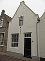 RM16145 Goedereede - Catharinastraat 7.jpg 1,944 × 2,592; 921 KB
-
 Voorgevels - Goedereede - 20079026 - RCE.jpg 1,200 × 807; 156 KB
-
 Voorgevels - Goedereede - 20079031 - RCE.jpg 811 × 1,200; 165 KB


