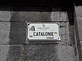
Category:Cataloniëstraat (Gent)
Jump to navigation
Jump to search
| Object location | | View all coordinates using: OpenStreetMap |
|---|
street in Ghent  | |||||
| Upload media | |||||
| Instance of | |||||
|---|---|---|---|---|---|
| Named after | |||||
| Location | Ghent, Arrondissement of Ghent, East Flanders, Flemish Region, Belgium | ||||
 | |||||
Subcategories
This category has the following 5 subcategories, out of 5 total.
C
- Cataloniëstraat 2, Gent (6 F)
- Cataloniëstraat 3, Gent (6 F)
- Cataloniëstraat 4, Gent (5 F)
G
- Gildenhuis der metselaars (Gent) (29 F)
N
Media in category "Cataloniëstraat (Gent)"
The following 24 files are in this category, out of 24 total.
-
 4315 DeLijn - Flickr - antoniovera1.jpg 3,648 × 2,736; 2.88 MB
-
 AG280T03.jpg 800 × 600; 115 KB
-
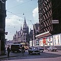
 Benelux´05 (2395562096).jpg 1,175 × 705; 687 KB
-
 Board Fast Jpg (158511017).jpeg 1,192 × 795; 214 KB
-
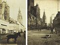 Cataloniestraat, Ghent, Belgium by Edmond Sacré.jpg 1,549 × 1,150; 589 KB
-
 Gent (48196706861).jpg 5,184 × 3,456; 9.15 MB
-
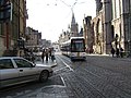
 Gent - 20220626 143903.jpg 4,128 × 3,096; 4.1 MB
-
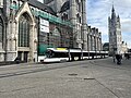
 Gent Cataloniestraat R01.jpg 3,824 × 2,549; 8.63 MB
-
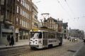
 Gent tram 1966.jpg 2,790 × 2,776; 540 KB
-
 Gent tram 2007.JPG 3,072 × 2,304; 1.52 MB
-
 Ghent 2024-02-25 11.jpg 4,032 × 3,024; 6.7 MB
-
 Ghent 2024-02-25 12.jpg 4,032 × 3,024; 6.69 MB
-
 Ghent 2024-02-25 13.jpg 4,032 × 3,024; 4.5 MB
-
 Ghent 2024-02-25 14.jpg 4,032 × 3,024; 4.06 MB
-
 Ghent 2024-02-25 16.jpg 4,032 × 3,024; 8.71 MB
-
 Ghent 2024-02-25 17.jpg 4,032 × 3,024; 5.34 MB
-
 Sint-Niklaaskerk, Gent.jpg 1,080 × 1,080; 408 KB
-
 TramGent2.JPG 1,189 × 794; 126 KB
-
 Tramway de Gand - Aménagement des voies sur Cataloniëstraat.jpg 2,560 × 1,920; 579 KB
-
 Trolley wacht1.JPG 2,288 × 1,712; 816 KB
-
 Trolley wacht2.JPG 2,288 × 1,712; 821 KB
-
 TrolleyGhent.jpg 1,193 × 798; 177 KB
-
 Вид на Белфорт - panoramio.jpg 3,072 × 2,304; 3.09 MB
-
 Страна велосипедов - panoramio.jpg 4,288 × 3,216; 4.19 MB


.jpg)
.jpeg)

.jpg)


