Category:Castlehill, Dumbarton
Jump to navigation
Jump to search

Subcategories
This category has the following 2 subcategories, out of 2 total.
B
- Bruce's Flagstaff (2 F)
K
- Knowetop Community Farm (8 F)
Media in category "Castlehill, Dumbarton"
The following 19 files are in this category, out of 19 total.
-
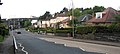 Cardross Road Dumbarton - geograph.org.uk - 431898.jpg 640 × 288; 54 KB
-
 Castlehill sculpture- "Making our Mark" (geograph 5656984).jpg 1,024 × 768; 209 KB
-
 Cats Castle - geograph.org.uk - 1057768.jpg 640 × 480; 66 KB
-
 Cleared site of the former OLSP (geograph 6087363).jpg 1,024 × 640; 174 KB
-
 Cleared site of the former OLSP (geograph 6087366).jpg 1,024 × 683; 150 KB
-
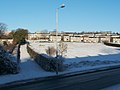
 Cumbrae Crescent South, Castlehill - geograph.org.uk - 2215032.jpg 1,024 × 512; 105 KB
-
 Demolition of the former OLSP (geograph 5944635).jpg 1,024 × 683; 167 KB
-
 Demolition of the former OLSP (geograph 5944638).jpg 1,600 × 960; 304 KB
-
 Demolition of the former OLSP (geograph 5972534).jpg 1,600 × 1,000; 293 KB
-
 Footpath to Ardoch - geograph.org.uk - 1054924.jpg 640 × 480; 116 KB
-
 Hawthorn Avenue - geograph.org.uk - 2213898.jpg 1,024 × 768; 185 KB
-
 Hawthornhill, Dumbarton - geograph.org.uk - 84919.jpg 640 × 479; 126 KB
-
 Our Lady and St Patrick's High School (geograph 5655503).jpg 2,400 × 1,371; 2.33 MB
-
 Our Lady and St Patrick's High School - geograph.org.uk - 3453497.jpg 4,608 × 3,456; 5.9 MB
-
 Our Lady and St Patricks High School - geograph.org.uk - 431894.jpg 640 × 480; 84 KB
-
 Path to Dalmoak - geograph.org.uk - 2213908.jpg 1,024 × 768; 158 KB
-
 Perrays Drive (geograph 3685426).jpg 640 × 480; 177 KB
-
 Play area at Hawthornhill (geograph 5658999).jpg 1,024 × 683; 159 KB
-
 St Michael's RC Church, Dumbarton (44).jpg 1,024 × 640; 133 KB

.jpg)


.jpg)
.jpg)
.jpg)


.jpg)


.jpg)
.jpg)
.jpg)
.jpg)
.jpg)