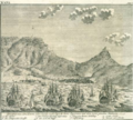
Category:Castle of Good Hope illustrations
Jump to navigation
Jump to search
Media in category "Castle of Good Hope illustrations"
The following 28 files are in this category, out of 28 total.
-
AMH-2473-NA Ground plan, in elevation, of the north side of the Fort of Good Hope.jpg 2,400 × 1,720; 641 KB
-
AMH-2477-NA Ground plan of the Fort of Good Hope.jpg 2,400 × 1,822; 629 KB
-
AMH-2478-NA Fort of Good Hope, waterfront perspective.jpg 2,400 × 1,774; 632 KB
-
AMH-2479-NA Blueprint for the fortification of the Fort of Good Hope.jpg 1,811 × 2,400; 668 KB
-
AMH-2480-NA Plan for the enlargement of the Fort of Good Hope.jpg 1,951 × 2,400; 467 KB
-
AMH-2485-NA Ground plan of the Fort the Good Hope.jpg 2,400 × 2,272; 854 KB
-
AMH-2534-NA Plan of the Fort of Good Hope.jpg 2,400 × 1,808; 668 KB
-
AMH-2535-NA Plan of the Fort of Good Hope.jpg 2,400 × 1,729; 627 KB
-
AMH-2541-NA Map and elevation of the Fort of Good Hope.jpg 2,400 × 1,864; 503 KB
-
AMH-2542-NA Ground plan and elevation of the Fort of Good Hope.jpg 2,400 × 1,850; 606 KB
-
AMH-2543-NA Map of the Fort of Good Hope.jpg 2,400 × 1,850; 659 KB
-
AMH-2545-NA Map of the Fort of Good Hope.jpg 2,400 × 1,769; 514 KB
-
AMH-2546-NA Elevation of the Fort of Good Hope.jpg 2,400 × 1,520; 472 KB
-
AMH-2548-NA Ground plan of the Fort of Good Hope.jpg 1,993 × 2,400; 729 KB
-
AMH-2549-NA Plan of the Fort of Good Hope with its gardens and houses.jpg 2,063 × 2,400; 750 KB
-
AMH-2550-NA Ground plan of the Fort of Good Hope with the start of a new pentagon.jpg 1,792 × 2,400; 598 KB
-
AMH-2654-NA Ground plan of the Fort of Good Hope.jpg 1,818 × 2,400; 571 KB
-
AMH-5332-NA Map of the Fort of Good Hope and surroundings.jpg 2,400 × 1,640; 823 KB
-
AMH-7113-KB View of Table Bay and the Fort of Good Hope.jpg 2,400 × 2,067; 1.54 MB
-
AMH-7961-KB Map of Cape Town and the fort De Goede Hoop (Good Hope).jpg 2,400 × 2,036; 1.09 MB
-
John Barrow00a.jpg 2,584 × 1,697; 1.1 MB
-
Kap der Guten Hoffnung.png 458 × 411; 292 KB
-
Kasteel de Goede Hoop circa 1680.jpg 2,029 × 1,266; 1.87 MB


