Category:Castle Bromwich
Jump to navigation
Jump to search
suburb situated within Solihull in the English county of the West Midlands  | |||||
| Upload media | |||||
| Instance of | |||||
|---|---|---|---|---|---|
| Location | Solihull, West Midlands, England | ||||
| Population |
| ||||
| Area |
| ||||
 | |||||
Subcategories
This category has the following 5 subcategories, out of 5 total.
Media in category "Castle Bromwich"
The following 85 files are in this category, out of 85 total.
-
 7.5.16 Castle Bromwich 40s Day 002 (26294040764).jpg 6,016 × 4,000; 9.41 MB
-
 A motorway sign gantry over the M6 - geograph.org.uk - 4511171.jpg 1,500 × 999; 146 KB
-
 A motorway speed gantry over the M6 - geograph.org.uk - 4511170.jpg 1,500 × 996; 138 KB
-
 A452 crossed by the B4118 - geograph.org.uk - 3336786.jpg 640 × 480; 47 KB
-

-

-
 B4118 bridges M6 North - geograph.org.uk - 2104693.jpg 640 × 384; 333 KB
-
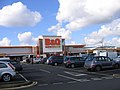 BandQ Warehouse "Spitfire Island" - geograph.org.uk - 1190673.jpg 640 × 480; 62 KB
-
 Birmingham aerial view II.jpg 1,167 × 738; 124 KB
-
 Castle Bromwich - view across city - geograph.org.uk - 2108743.jpg 1,460 × 1,095; 287 KB
-
 Castle Bromwich Aerial View.jpg 1,600 × 1,200; 678 KB
-
 Castle Bromwich Birmingham Chester Road 2.JPG 3,072 × 2,048; 2.02 MB
-
 Castle Bromwich Birmingham Chester Road.JPG 3,072 × 2,048; 2.17 MB
-
 Castle Bromwich Hall - geograph.org.uk - 4000134.jpg 1,142 × 857; 440 KB
-
 Castle Bromwich Hall and Church - geograph.org.uk - 2776015.jpg 3,648 × 2,736; 4.04 MB
-
 Castle Bromwich Infant and Nursery School - geograph.org.uk - 2810179.jpg 3,648 × 2,048; 2.5 MB
-
 Castle Bromwich Infant ^ Nursery School - geograph.org.uk - 4355983.jpg 1,142 × 857; 451 KB
-
 Castle Bromwich JEERA Birmingham Chester Road.JPG 1,600 × 1,200; 409 KB
-
 Castle Bromwich Junior School - geograph.org.uk - 4356198.jpg 1,142 × 857; 470 KB
-
 Castle Bromwich war memorial - geograph.org.uk - 148667.jpg 640 × 480; 110 KB
-
 CCTV appeal Criminal damage (40951851345).jpg 2,500 × 1,406; 644 KB
-

-
 Chester Road - geograph.org.uk - 3336793.jpg 640 × 480; 82 KB
-
 Chester Road - geograph.org.uk - 3336800.jpg 640 × 480; 81 KB
-

-
 Disused section of Birmingham Road - geograph.org.uk - 4000113.jpg 816 × 612; 327 KB
-
 Electrical sub-station on Lanchester Way - geograph.org.uk - 4831585.jpg 1,142 × 857; 304 KB
-
 Filling station on Chester Road - geograph.org.uk - 3336726.jpg 640 × 480; 75 KB
-
 Houses by Water Orton Road - geograph.org.uk - 4831588.jpg 1,142 × 857; 516 KB
-
 Houses on Lanchester Way - geograph.org.uk - 4830192.jpg 1,306 × 979; 452 KB
-
 Hurst Lane Clinic - geograph.org.uk - 2810186.jpg 3,648 × 2,048; 1.72 MB
-

-
 I Think I Parked Next to the Jaguar... (9629716096).jpg 4,160 × 2,657; 3.38 MB
-
 Junction 5 slip road joins the M6 - geograph.org.uk - 3125209.jpg 640 × 396; 56 KB
-

-
 Local Library - geograph.org.uk - 2810182.jpg 2,736 × 3,648; 2.5 MB
-
 M6 approaching J4a - geograph.org.uk - 3125215.jpg 640 × 430; 38 KB
-

-
 M6 at Junction 5 - geograph.org.uk - 3125208.jpg 640 × 316; 36 KB
-
 M6 between J5 and 4a - geograph.org.uk - 3125214.jpg 640 × 430; 58 KB
-

-
 M6 Junction 5 and the City - geograph.org.uk - 2108773.jpg 3,648 × 2,048; 1.82 MB
-
 M6 Junction 5 Sliproad Eastbound - geograph.org.uk - 4420905.jpg 640 × 462; 53 KB
-
 M6 Junction 5, Castle Bromwich - geograph.org.uk - 2108759.jpg 3,648 × 2,048; 2.06 MB
-
 M6 motorway - joining at junction 5 - geograph.org.uk - 2801842.jpg 640 × 480; 68 KB
-

-

-

-
 M6 Near Birmingham from the Air (geograph 4216853).jpg 2,784 × 1,568; 2.09 MB
-
 M6 near Junction 5 northbound - geograph.org.uk - 2842025.jpg 640 × 481; 37 KB
-
 M6 north from B4118 - geograph.org.uk - 2404807.jpg 3,648 × 2,736; 2.85 MB
-

-
 M6 northbound at Castle Bromwich - geograph.org.uk - 2842007.jpg 640 × 481; 47 KB
-
 M6 passes under the B4118 bridge - geograph.org.uk - 4688056.jpg 3,588 × 2,334; 1.75 MB
-
 M6 southbound - geograph.org.uk - 4831587.jpg 1,142 × 857; 325 KB
-
 Old Boundary Marker - geograph.org.uk - 3180539.jpg 1,024 × 768; 378 KB
-
 On the M6 - geograph.org.uk - 1887974.jpg 640 × 480; 59 KB
-

-

-

-

-
 OS benchmark - Shard End, 155 Chester Road - geograph.org.uk - 4359988.jpg 857 × 1,142; 512 KB
-
 OS benchmark - Shard End, 343 Chester Road - geograph.org.uk - 4359993.jpg 857 × 1,142; 517 KB
-
 Other famous homes of Great Britain and their stories (1902) (14760340696).jpg 1,752 × 2,736; 1.03 MB
-
 Park Hall Academy - geograph.org.uk - 2388278.jpg 3,648 × 2,048; 2.04 MB
-
 River Tame and M6 motorway (east) - geograph.org.uk - 1773069.jpg 922 × 692; 134 KB
-
 Road junction in Buckland End - geograph.org.uk - 4000106.jpg 1,142 × 857; 346 KB
-
 Small pond, Parkfield Drive - geograph.org.uk - 2388518.jpg 3,648 × 2,048; 2.35 MB
-
 Special-Occasions-Shop-Front1.jpg 1,000 × 622; 177 KB
-
 St Mary ^ St Margaret's church, Castle Bromwich - geograph.org.uk - 3212013.jpg 1,067 × 1,600; 458 KB
-
 St Mary ^ St Margaret's church, Castle Bromwich - geograph.org.uk - 4000198.jpg 1,142 × 857; 424 KB
-
 St. Clements Church - geograph.org.uk - 2810193.jpg 3,648 × 2,736; 3.6 MB
-
 Stable Block to Castle Bromwich Hall - geograph.org.uk - 4000162.jpg 1,142 × 857; 455 KB
-
 Street Atlas of Birmingham - 1939 - Sheet 09 - Castle Bromwich.jpg 1,000 × 774; 369 KB
-
 Sunset over City - geograph.org.uk - 2388510.jpg 3,648 × 2,736; 1.31 MB
-
 The B4118 crosses the M6 - geograph.org.uk - 3703300.jpg 3,642 × 2,480; 1.66 MB
-
 The M6 at Castle Bromwich - geograph.org.uk - 3703304.jpg 3,985 × 2,020; 1.61 MB
-
 The Skylark Pub (last orders) - geograph.org.uk - 1777394.jpg 1,024 × 768; 117 KB
-
 The Skylark pub - geograph.org.uk - 271562.jpg 640 × 480; 102 KB
-
 The Spitfire pub, Parkfield Drive - geograph.org.uk - 3336790.jpg 640 × 480; 57 KB
-

-
 Water Orton Road bridge - geograph.org.uk - 4831586.jpg 1,142 × 857; 360 KB
-
 Water Orton Road crosses the M6 - geograph.org.uk - 4511166.jpg 1,500 × 999; 129 KB
-
 Wild marshy Castle Bromwich - geograph.org.uk - 2775996.jpg 3,648 × 2,736; 4.04 MB
-
 Windward Way - geograph.org.uk - 2811378.jpg 3,648 × 2,048; 1.72 MB
.jpg)


.jpg)
_east_of_the_junction_with_Bradford_Road_-_geograph.org.uk_-_3336809.jpg)


.jpg)


.jpg)


_(14760340696).jpg)

_-_geograph.org.uk_-_1773069.jpg)


_-_geograph.org.uk_-_1777394.jpg)


