Category:Castell de Pontils
Jump to navigation
Jump to search
| Object location | | View all coordinates using: OpenStreetMap |
|---|
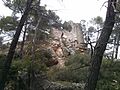
cultural property in Pontils, Spain  | |||||
| Upload media | |||||
| Instance of | |||||
|---|---|---|---|---|---|
| Location | Pontils, Conca de Barberà, Camp de Tarragona, Tarragona Province, Catalonia | ||||
| Street address |
| ||||
| Heritage designation | |||||
| Elevation above sea level |
| ||||
 | |||||
Català: Castell de Pontils
This is a category about a monument listed in the Catalan heritage register of Béns Culturals d'Interès Nacional and the Spanish heritage register of Bienes de Interés Cultural under the reference RI-51-0006723. |
Subcategories
This category has only the following subcategory.
Media in category "Castell de Pontils"
The following 3 files are in this category, out of 3 total.
-
 Castell de Pontils 20151018 2.jpg 3,264 × 2,448; 1.64 MB
-
 Castell de Pontils 20151018.jpg 3,264 × 2,448; 1.71 MB
-
 Sistema prelitoral central - 40.jpg 4,608 × 3,072; 6.73 MB

