Category:Cartington
Jump to navigation
Jump to search
village and former civil parish in Northumberland, United Kingdom  | |||||
| Upload media | |||||
| Instance of |
| ||||
|---|---|---|---|---|---|
| Location | Thropton, Northumberland, North East England, England | ||||
 | |||||
English: Category:Villages in Northumberland
Subcategories
This category has the following 3 subcategories, out of 3 total.
C
- Cartington Castle (5 F)
P
- The Priest and Clerk (2 F)
Media in category "Cartington"
The following 85 files are in this category, out of 85 total.
-
 'Posh' sign at Cartington - geograph.org.uk - 2371049.jpg 4,000 × 3,000; 4.8 MB
-
 A gate onto the Moor - geograph.org.uk - 1525992.jpg 640 × 480; 97 KB
-
 A Gate onto the moor - geograph.org.uk - 1610956.jpg 640 × 426; 78 KB
-
 Abandoned quarry - geograph.org.uk - 2678314.jpg 2,000 × 1,500; 508 KB
-
 Across the Moor - geograph.org.uk - 1610890.jpg 640 × 426; 46 KB
-
 Beeches near Cartington - geograph.org.uk - 2183395.jpg 640 × 374; 175 KB
-
 Blackburn Lake - geograph.org.uk - 920167.jpg 640 × 480; 133 KB
-
 Boo^ - geograph.org.uk - 1954242.jpg 480 × 640; 185 KB
-
 Boundary Stone - geograph.org.uk - 1610901.jpg 640 × 426; 93 KB
-
 Boundary Stone at Debdon - geograph.org.uk - 1610917.jpg 640 × 538; 126 KB
-

-
 Bridge on estate road - geograph.org.uk - 1891836.jpg 2,000 × 1,500; 1,016 KB
-
 Cairn and trig point (249m) - geograph.org.uk - 1151125.jpg 640 × 360; 81 KB
-
 Carriageway track at Addycombe - geograph.org.uk - 1151858.jpg 640 × 480; 123 KB
-
 Cartington Waterfall - geograph.org.uk - 3994619.jpg 2,160 × 2,160; 1.51 MB
-
 Cartington, UK - panoramio (1).jpg 4,176 × 2,784; 3.84 MB
-
 Cartington, UK - panoramio (2).jpg 4,176 × 2,784; 4.05 MB
-
 Cartington, UK - panoramio (3).jpg 4,176 × 2,784; 3.53 MB
-
 Cartington, UK - panoramio (4).jpg 4,176 × 2,784; 3.97 MB
-
 Cartington, UK - panoramio (5).jpg 4,176 × 2,784; 4.08 MB
-
 Cartington, UK - panoramio.jpg 4,176 × 2,784; 3.75 MB
-
 Chirnell's Moor - geograph.org.uk - 1151155.jpg 640 × 360; 90 KB
-
 Country road near Cartington (1) - geograph.org.uk - 2183435.jpg 640 × 436; 242 KB
-
 Cragend Quarry, now a picnic site - geograph.org.uk - 920160.jpg 640 × 480; 130 KB
-
 Cragend, Cartington - geograph.org.uk - 1905009.jpg 2,000 × 1,383; 616 KB
-
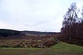
 Crags and moorland above Rothbury - geograph.org.uk - 1513453.jpg 640 × 427; 189 KB
-
 Cragside House - geograph.org.uk - 1881117.jpg 853 × 1,280; 416 KB
-
 Cragside House. - geograph.org.uk - 1954239.jpg 480 × 640; 161 KB
-
 Cragside, Rothbury, Northumberland - geograph.org.uk - 1942475.jpg 768 × 1,024; 253 KB
-
 Cragside, the south front - geograph.org.uk - 1892180.jpg 2,000 × 1,392; 725 KB
-
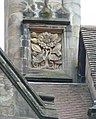 Date stone on Cragside - geograph.org.uk - 1892127.jpg 1,607 × 2,000; 617 KB
-
 Debden - geograph.org.uk - 1497926.jpg 369 × 640; 64 KB
-
 Debdon Forest - geograph.org.uk - 787234.jpg 640 × 480; 142 KB
-
 Debdon Pitt Cottage - geograph.org.uk - 1497918.jpg 640 × 340; 56 KB
-
 Debdon Plantation - geograph.org.uk - 1498414.jpg 640 × 312; 70 KB
-
-
 Disused dam, Cragside Estate - geograph.org.uk - 1905052.jpg 2,000 × 1,500; 1.15 MB
-
 Drained lake, Gragside - geograph.org.uk - 785431.jpg 480 × 640; 121 KB
-
 Fields near West Raw Farm - geograph.org.uk - 1427197.jpg 640 × 480; 73 KB
-
 Football Cairn east of Glitteringstone - geograph.org.uk - 1151144.jpg 640 × 480; 105 KB
-

-
 Forest track in Primrose Wood - geograph.org.uk - 1151385.jpg 640 × 480; 119 KB
-
 Gateway to the Labyrinth - geograph.org.uk - 1912436.jpg 2,435 × 1,692; 1.33 MB
-
 Grouse butt^ in Rothbury Forest - geograph.org.uk - 305567.jpg 640 × 480; 88 KB
-

-
 Home Farm, Cragside - geograph.org.uk - 1954234.jpg 640 × 480; 172 KB
-
 Inner courtyard, Cragside House - geograph.org.uk - 1954237.jpg 640 × 480; 158 KB
-
 Inside the Little House in the Labyrinth - geograph.org.uk - 1935084.jpg 2,592 × 1,944; 1.32 MB
-
 Inside The Thatched Boathouse - geograph.org.uk - 972153.jpg 426 × 640; 363 KB
-
 Little House in the Labyrinth - geograph.org.uk - 1935073.jpg 2,039 × 1,631; 1.01 MB
-
 Looking towards Simonside Hills - geograph.org.uk - 1464236.jpg 640 × 480; 92 KB
-
 Mind the toad^ - geograph.org.uk - 1912517.jpg 2,592 × 1,944; 1.26 MB
-
 Model 'A' Ford - geograph.org.uk - 1935212.jpg 1,944 × 2,592; 1.26 MB
-
 Moorland near Debdon - geograph.org.uk - 1513418.jpg 640 × 427; 182 KB
-
 Moorland west of Addyheugh - geograph.org.uk - 1151992.jpg 640 × 360; 83 KB
-
 Near Chapel Well - geograph.org.uk - 1513438.jpg 640 × 426; 192 KB
-
 Near Crocky's Heugh - geograph.org.uk - 1513428.jpg 640 × 426; 198 KB
-
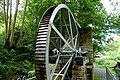
 Netherton Turbine, Cragside, Cartington - geograph.org.uk - 1891889.jpg 2,000 × 1,611; 721 KB
-
 Outcrop below trig point - geograph.org.uk - 1151135.jpg 640 × 360; 72 KB
-
 Primrose Cottage - geograph.org.uk - 1151396.jpg 640 × 480; 103 KB
-
 Primrose Wood - geograph.org.uk - 1151336.jpg 640 × 360; 79 KB
-
 Ruined trailer, Primrose Wood - geograph.org.uk - 1151345.jpg 480 × 640; 132 KB
-
 Sandylands Farm - geograph.org.uk - 979634.jpg 640 × 427; 74 KB
-
 Snake^ - geograph.org.uk - 1935097.jpg 1,944 × 2,592; 1.24 MB
-
 St Helen's Well, Cartington - geograph.org.uk - 1151294.jpg 640 × 480; 120 KB
-
 Stationary squirrels - geograph.org.uk - 2678317.jpg 2,000 × 1,500; 474 KB
-
 The Lone Rowan tree - geograph.org.uk - 1843601.jpg 3,000 × 4,000; 3.97 MB
-
 The road over the moor - geograph.org.uk - 1847212.jpg 4,000 × 3,000; 4.32 MB
-
 The visitor centre, Cragside - geograph.org.uk - 1892148.jpg 2,000 × 1,483; 968 KB
-
 Towards Cartington Hill - geograph.org.uk - 1513434.jpg 427 × 640; 202 KB
-
 Track near Crocky's Heugh - geograph.org.uk - 1151326.jpg 640 × 480; 90 KB
-
 Track south-east of Cartington - geograph.org.uk - 1151309.jpg 640 × 480; 126 KB
-
 Tumbleton Lake - geograph.org.uk - 1954232.jpg 640 × 480; 157 KB
-
 Valley of the Debdon Burn - geograph.org.uk - 1151416.jpg 640 × 360; 85 KB
-

-
 Visitor Information Point - geograph.org.uk - 1935201.jpg 1,548 × 1,119; 483 KB
-
 Wagtail Farm, Rothbury - geograph.org.uk - 1425899.jpg 640 × 480; 115 KB
-
 Waterpowered Pump - geograph.org.uk - 441336.jpg 640 × 480; 173 KB
-

-
 Whittle Farm and Cottages - geograph.org.uk - 979625.jpg 640 × 427; 73 KB
-
 Bridleway approaching Chapel Hill - geograph.org.uk - 303344.jpg 640 × 480; 112 KB
-
 Cartington Hill - geograph.org.uk - 304148.jpg 640 × 480; 92 KB
-

-
 Target Plantation trig - geograph.org.uk - 350173.jpg 640 × 480; 83 KB
-
 Tree stump - geograph.org.uk - 350166.jpg 640 × 480; 100 KB


_-_geograph.org.uk_-_1151125.jpg)


.jpg)
.jpg)
.jpg)
.jpg)
.jpg)


_-_geograph.org.uk_-_2183435.jpg)


