Category:Cartes Naudin par Gallica
Jump to navigation
Jump to search
Media in category "Cartes Naudin par Gallica"
The following 17 files are in this category, out of 17 total.
-
 Carte des Flandres par (...)Naudin (18 btv1b525052643.jpg 1,024 × 1,455; 515 KB
-
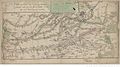
 Carte des Postes que l'Armée (...)Naudin Jean-Baptiste btv1b8495253x.jpg 1,536 × 711; 410 KB
-
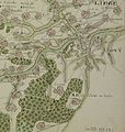
 Landrecies Camp des Ennemis aux (...)Naudin Jean-Baptiste btv1b84941998.jpg 1,536 × 854; 424 KB
-
 Naudin carte Huy.jpg 3,899 × 4,110; 1.55 MB
-
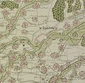 Naudin carte tilmont.jpg 3,531 × 3,457; 1.37 MB
-
 Naudin plaine d'acoche.jpg 4,801 × 3,534; 1.78 MB
-
 Nerwinden 1693 nuadin.jpg 4,293 × 3,632; 2.3 MB
-
 Nerwinden français 1693 naudin.jpg 5,291 × 2,595; 2.03 MB
-
 Plan de Furnes 1700.jpg 8,548 × 6,383; 6.72 MB
-
 Plan de la Kenoque Eschelle (...)Naudin Jean-Baptiste btv1b8492809n.jpg 1,347 × 1,054; 250 KB
-
 Plan du champ de bataille (...)Pennier (16 btv1b8493310w.jpg 1,024 × 1,330; 361 KB
-
 Plan du Siege de Landau (...)Naudin Jean-Baptiste btv1b8492679m.jpg 1,464 × 1,054; 315 KB
-
 Plan du siège du Quesnoy en 1712.jpg 4,021 × 5,180; 2.57 MB
-
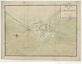
 Plan général des ville et (...)Naudin Jean-Baptiste btv1b8446022m.jpg 1,024 × 1,464; 490 KB
-
 Siege de landrecies naudin détail.jpg 2,301 × 2,203; 939 KB
-
 Siège Douay naudin.jpg 2,072 × 1,996; 816 KB
-
 Siège du fort de Kell (...)Naudin C btv1b8592056s.jpg 7,904 × 6,286; 6.56 MB
Naudin_(18_btv1b525052643.jpg)
Naudin_Jean-Baptiste_btv1b8495253x.jpg)
Naudin_Jean-Baptiste_btv1b84941998.jpg)


Naudin_Jean-Baptiste_btv1b8492809n.jpg)
Pennier_(16_btv1b8493310w.jpg)
Naudin_Jean-Baptiste_btv1b8492679m.jpg)

Naudin_Jean-Baptiste_btv1b8446022m.jpg)


Naudin_C_btv1b8592056s.jpg)