Category:Carsphairn
Jump to navigation
Jump to search
village in Dumfries and Galloway, Scotland, UK  | |||||
| Upload media | |||||
| Instance of | |||||
|---|---|---|---|---|---|
| Location |
| ||||
 | |||||

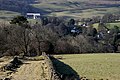
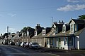
English: Carsphairn ( Gaelic: An Còrsa Feàrna) is a village in the District
Council Region of Dumfries and Galloway, Scotland. It is located about half way between Dalmellington and St. John's Town of Dalry, next to the A713 road.
Gàidhlig: 'S e baile ann an Dùn Phris is Gall-Ghaidhealaibh a tha anns a' Chòrsa Feàrna (Beurla: Carsphairn). Tha am baile suidhichte eadar Dalmellington agus
Subcategories
This category has the following 12 subcategories, out of 12 total.
B
C
- Carsphairn Parish Church (23 F)
E
- Ewe Hill, Carsphairn (6 F)
G
- Gala Lane (16 F)
- Garryhorn, Dumfries and Galloway (17 F)
M
- Loch Minnoch (4 F)
P
- Polifferie Burn (2 F)
- Polmaddy Burn (3 F)
Media in category "Carsphairn"
The following 200 files are in this category, out of 230 total.
(previous page) (next page)-

-
 A clear fell survivor. - geograph.org.uk - 526727.jpg 480 × 640; 85 KB
-

-
 A walking route on Bardennoch Hill - geograph.org.uk - 1707482.jpg 640 × 427; 127 KB
-
 Access Road - geograph.org.uk - 730041.jpg 640 × 480; 123 KB
-
 Across Loch Doon to Portmark - geograph.org.uk - 201751.jpg 640 × 480; 99 KB
-
 An Còrsa Feàrna.jpg 2,418 × 1,745; 644 KB
-

-

-
 B729 in Smittons Forest - geograph.org.uk - 375023.jpg 640 × 480; 61 KB
-
 B729 road near Knockgray. - geograph.org.uk - 517856.jpg 640 × 480; 131 KB
-
 Bardennoch Farmhouse. - geograph.org.uk - 517865.jpg 640 × 480; 109 KB
-
 Bridge over Gala Lane - geograph.org.uk - 201733.jpg 640 × 480; 68 KB
-
 Bridge over Polmaddy Burn, Polmaddie - geograph.org.uk - 259734.jpg 640 × 480; 152 KB
-
 Bronze Age Cairn - geograph.org.uk - 513197.jpg 640 × 480; 93 KB
-
 Cairn near Goat Craigs. - geograph.org.uk - 514246.jpg 640 × 480; 80 KB
-
 Carnavel track towards Carsphairn - geograph.org.uk - 204133.jpg 640 × 480; 94 KB
-
 Carsphairn - geograph.org.uk - 938904.jpg 640 × 428; 57 KB
-
 Carsphairn - geograph.org.uk - 938935.jpg 640 × 428; 62 KB
-
 Carsphairn - geograph.org.uk - 993816.jpg 640 × 480; 48 KB
-
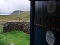
 Carsphairn Heritage Centre - geograph.org.uk - 938895.jpg 640 × 428; 112 KB
-
 Carsphairn Heritage Centre.jpg 640 × 480; 100 KB
-

-
 Carsphairn War Memorial - geograph.org.uk - 938991.jpg 640 × 428; 66 KB
-
 Castlemaddy Outdoor Centre - geograph.org.uk - 537227.jpg 640 × 470; 97 KB
-

-
 Clear Fell in Smittons Forest. - geograph.org.uk - 524501.jpg 640 × 480; 116 KB
-
 Cornharrow, Carsphairn - geograph.org.uk - 534381.jpg 640 × 480; 113 KB
-
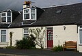
 Cottage in Carsphairn - geograph.org.uk - 938927.jpg 640 × 428; 73 KB
-
 Cottages in Carsphairn - geograph.org.uk - 938965.jpg 640 × 428; 84 KB
-
 Craig of Knockgray - Western Slopes - geograph.org.uk - 725729.jpg 640 × 480; 124 KB
-
 Cross on the top of Dodd Hill Carsphairn hills.jpg 900 × 598; 138 KB
-
 Cross Slab, Braidenoch Hill - geograph.org.uk - 939085.jpg 428 × 640; 128 KB
-
 Cross Slab, Braidenoch Hill - geograph.org.uk - 939092.jpg 428 × 640; 139 KB
-
 Cross Slabs - geograph.org.uk - 513184.jpg 640 × 480; 122 KB
-
 Cup and Ring marked Rocks. - geograph.org.uk - 518526.jpg 640 × 480; 109 KB
-
 Dalshangan Lodge. - geograph.org.uk - 517876.jpg 640 × 480; 136 KB
-
 Driveway at Brockloch, Carsphairn - geograph.org.uk - 541576.jpg 480 × 640; 151 KB
-
 Dry Burn, Smittons Forest. - geograph.org.uk - 524488.jpg 480 × 640; 125 KB
-
 Dumfries and Galloway-22-Carsphairn-2009-gje.jpg 2,991 × 1,761; 1.7 MB
-
 Dumfries and Galloway-24-Carsphairn-2009-gje.jpg 2,805 × 1,915; 1.9 MB
-
 Dumfries and Galloway-26-Carsphairn-2009-gje.jpg 3,030 × 1,984; 1.91 MB
-

-

-
 End of the Road. - geograph.org.uk - 524456.jpg 640 × 480; 125 KB
-
 Entrance sign at Knockgray. - geograph.org.uk - 517859.jpg 480 × 640; 133 KB
-

-
 Firebreak in Smittons Forest - geograph.org.uk - 267176.jpg 640 × 480; 78 KB
-
 Firebreak leading to Bow Burn - geograph.org.uk - 1600895.jpg 640 × 480; 79 KB
-
 Flooding on road to Dundeugh Hill - geograph.org.uk - 95466.jpg 640 × 430; 210 KB
-
 Forest burn below Craigchessie - geograph.org.uk - 537279.jpg 640 × 480; 131 KB
-
 Forest ride near Moorbrock - geograph.org.uk - 536360.jpg 480 × 640; 106 KB
-
 Forest road near Drumness - geograph.org.uk - 537215.jpg 640 × 480; 89 KB
-

-
 Forest track - geograph.org.uk - 201742.jpg 640 × 480; 99 KB
-
 Forest Track - geograph.org.uk - 730192.jpg 640 × 439; 101 KB
-
 Forest track leading to Castlemaddy - geograph.org.uk - 537211.jpg 640 × 480; 79 KB
-
 Forest track near Darnaw, Forrest Estate. - geograph.org.uk - 526717.jpg 480 × 640; 117 KB
-
 Forest wall near Braidenoch - geograph.org.uk - 537313.jpg 480 × 640; 117 KB
-
 Furmiston Sign. - geograph.org.uk - 518893.jpg 640 × 480; 84 KB
-
 Grazing land north of Polquhanity - geograph.org.uk - 541495.jpg 640 × 480; 93 KB
-
 Halfmark Burn - geograph.org.uk - 204118.jpg 640 × 480; 118 KB
-
 Headwaters of the Polshagg Burn - geograph.org.uk - 183435.jpg 480 × 640; 114 KB
-
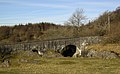 High Bridge of Ken - geograph.org.uk - 730076.jpg 640 × 397; 68 KB
-
 John MacMillan of Brockloch. Covenanter. Carsphairn churchyard, Dumfries and Galloway.jpg 2,686 × 2,734; 2.39 MB
-
 Junction Road signs. - geograph.org.uk - 518860.jpg 640 × 480; 114 KB
-
 Kendoon Youth Hostel - geograph.org.uk - 227360.jpg 640 × 480; 78 KB
-
 Liggat clachan, Carsphairn, East Ayrshire.jpg 4,896 × 2,752; 5.64 MB
-
 Loch Doon Hydro - geograph.org.uk - 41326.jpg 640 × 480; 102 KB
-
 Loch Dungeon dam. - geograph.org.uk - 515924.jpg 640 × 480; 106 KB
-
 Looking down the Hawse Burn - geograph.org.uk - 207504.jpg 640 × 480; 76 KB
-
 Marbrack Burn after a wet night. - geograph.org.uk - 517854.jpg 480 × 640; 126 KB
-
 Marscalloch. - geograph.org.uk - 517847.jpg 640 × 480; 132 KB
-
 McAdams of Waterhead Burial Ground. Carsphairn Churchyard, Dumfries and Galloway.jpg 4,037 × 2,728; 2.63 MB
-
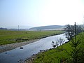
 Meander on the Water of Ken - geograph.org.uk - 375022.jpg 640 × 480; 73 KB
-
 Meanders on the Benloch Burn - geograph.org.uk - 183476.jpg 640 × 480; 78 KB
-
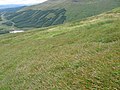
 Moorland near Stroanpatrick - geograph.org.uk - 267191.jpg 640 × 480; 77 KB
-
 Old pack road , Polmaddy Settlement - geograph.org.uk - 259740.jpg 640 × 480; 65 KB
-
 Old Quarry Remains, Smittons Forest. - geograph.org.uk - 524547.jpg 640 × 480; 162 KB
-
 Old sheepfold beside the lead mine track - geograph.org.uk - 204122.jpg 640 × 480; 123 KB
-
 On Craigmawhannal - geograph.org.uk - 201736.jpg 640 × 480; 69 KB
-
 Overgrown Forest Track. - geograph.org.uk - 524448.jpg 640 × 480; 141 KB
-
 Poldores Brig, Moorbrock - geograph.org.uk - 536375.jpg 480 × 640; 127 KB
-
 Polifferie Burn at Craigengillan Bridge - geograph.org.uk - 225447.jpg 640 × 480; 108 KB
-
 Polmaddy Burn near Castlemaddy - geograph.org.uk - 537564.jpg 480 × 640; 135 KB
-
 Polmaddy Historic Settlement - geograph.org.uk - 940202.jpg 640 × 428; 66 KB
-
 Rough Strand - geograph.org.uk - 100784.jpg 640 × 429; 86 KB
-
 Scrubby farmland on Bardennoch Hill - geograph.org.uk - 726531.jpg 640 × 480; 93 KB
-

-
 Sheepfold above Water of Ken - geograph.org.uk - 227379.jpg 640 × 480; 94 KB
-
 Sheepfold below Round Craigs - geograph.org.uk - 227389.jpg 640 × 480; 87 KB
-
 Shooting Hide, Smittons Forest. - geograph.org.uk - 524562.jpg 480 × 640; 122 KB
-
 Short Forest Track, Smittons Forest. - geograph.org.uk - 524579.jpg 640 × 480; 140 KB
-
 Signs at Knock Gray Farm. - geograph.org.uk - 518872.jpg 480 × 640; 100 KB
-

-
 Sluice Gate, Bow Burn - geograph.org.uk - 378641.jpg 640 × 426; 68 KB
-
 Smittons Bridge - geograph.org.uk - 267183.jpg 640 × 480; 62 KB
-
 Smittons Bridge - geograph.org.uk - 553963.jpg 640 × 480; 105 KB
-
 Solar power at Marbrack - geograph.org.uk - 1756167.jpg 640 × 480; 84 KB
-
 Summit of Dunool - geograph.org.uk - 183310.jpg 640 × 480; 79 KB
-
 The Benloch Burn - geograph.org.uk - 183437.jpg 480 × 640; 110 KB
-
 The Benloch Burn - geograph.org.uk - 183474.jpg 480 × 640; 135 KB
-
 The Deugh Dam on Kendoon Loch - geograph.org.uk - 280225.jpg 640 × 480; 101 KB
-
 The Ken Dam on Kendoon Loch - geograph.org.uk - 280231.jpg 640 × 480; 99 KB
-
 The Knotty Burn near Lukes Stone - geograph.org.uk - 225442.jpg 640 × 480; 78 KB
-
 The Road to Carsphairn - geograph.org.uk - 321500.jpg 640 × 475; 115 KB
-

-
 Towards Knockgray - geograph.org.uk - 321489.jpg 640 × 456; 119 KB
-
 Track by the Marbrack Burn - geograph.org.uk - 1756160.jpg 640 × 480; 78 KB
-
 Trees on Ewe Hill from Alhang - geograph.org.uk - 221947.jpg 640 × 480; 89 KB
-
 View from bridge over A713 - geograph.org.uk - 101811.jpg 627 × 640; 255 KB
-
 View from Clennoch Bothy - geograph.org.uk - 1518617.jpg 640 × 480; 52 KB
-

-
 Wall by the Marbrack Burn - geograph.org.uk - 1756132.jpg 640 × 480; 89 KB
-
 Wall by the Marbrack Burn - geograph.org.uk - 1756140.jpg 640 × 480; 89 KB
-
 War Memorial. - geograph.org.uk - 517864.jpg 480 × 640; 61 KB
-
 Water of Deugh - geograph.org.uk - 464965.jpg 640 × 480; 101 KB
-
 Water of Deugh - geograph.org.uk - 464976.jpg 640 × 480; 144 KB
-
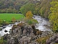
 Water of Deugh at Carsphairn - geograph.org.uk - 464929.jpg 640 × 480; 103 KB
-
 Water of Ken - geograph.org.uk - 267155.jpg 640 × 480; 96 KB
-
 Water of Ken - geograph.org.uk - 37584.jpg 640 × 427; 116 KB
-
 Water of Ken and Kendoon Loch - geograph.org.uk - 375019.jpg 640 × 480; 64 KB
-
 Windy Standard from Alhang summit - geograph.org.uk - 101984.jpg 640 × 480; 73 KB
-
 A forest road in Forrest Estate - geograph.org.uk - 1147656.jpg 640 × 480; 80 KB
-
 A small pond beside the forest track - geograph.org.uk - 204113.jpg 640 × 480; 103 KB
-
 Acquaintance Hill - geograph.org.uk - 111509.jpg 480 × 640; 84 KB
-
 Across water of Ken to Glenhead Rig - geograph.org.uk - 225453.jpg 640 × 480; 86 KB
-
 Allwhannie Knowes - geograph.org.uk - 512957.jpg 480 × 640; 64 KB
-

-
 Aqueduct at Drumjohn Power Station - geograph.org.uk - 541533.jpg 480 × 640; 102 KB
-
 Backhill of Bush - geograph.org.uk - 14237.jpg 600 × 450; 35 KB
-
 Below Bawnhead - geograph.org.uk - 225446.jpg 640 × 480; 116 KB
-
 Below Green Hill to Poldores Burn - geograph.org.uk - 225439.jpg 640 × 480; 76 KB
-
 Below Mid Hill of Glenhead - geograph.org.uk - 225450.jpg 640 × 480; 71 KB
-
 Blue Peter Memorial - geograph.org.uk - 1518599.jpg 640 × 480; 113 KB
-
 Boathouse on Kendoon Loch. - geograph.org.uk - 517878.jpg 640 × 480; 131 KB
-
 Bridge over Deugh - geograph.org.uk - 461214.jpg 640 × 480; 160 KB
-
 Bridge over Kendoon Loch - geograph.org.uk - 211579.jpg 640 × 426; 115 KB
-
 Bridge over Kendoon Loch. - geograph.org.uk - 517888.jpg 640 × 480; 83 KB
-
 Brockloch Cottage, Carsphairn. - geograph.org.uk - 528250.jpg 640 × 480; 103 KB
-
 Burn south of Lamford - geograph.org.uk - 464917.jpg 640 × 480; 69 KB
-
 Burnhead bridge - geograph.org.uk - 209986.jpg 640 × 480; 109 KB
-
 Cairn at Stroanfreggan Craig - geograph.org.uk - 227377.jpg 640 × 480; 99 KB
-
 Cairn Avel Neolithic long cairn - geograph.org.uk - 204127.jpg 640 × 480; 108 KB
-
 Carsphairn - geograph.org.uk - 162163.jpg 640 × 219; 45 KB
-
 Carsphairn Telephone Exchange - geograph.org.uk - 748320.jpg 640 × 480; 71 KB
-

-
 Clear fell near Drumjohn, Carsphairn - geograph.org.uk - 541551.jpg 640 × 480; 116 KB
-
 Corlae on the Water of Ken road - geograph.org.uk - 225458.jpg 640 × 480; 98 KB
-
 Corner of forest dyke near Drumjohn - geograph.org.uk - 541539.jpg 640 × 480; 109 KB
-
 Cottages at Moorbrock - geograph.org.uk - 225443.jpg 640 × 480; 85 KB
-

-
 Curling Pond on top of Dodd Hill - geograph.org.uk - 225455.jpg 640 × 480; 72 KB
-
 Disused lead mines - geograph.org.uk - 39715.jpg 640 × 480; 123 KB
-
 Disused pit south of Meikle Craigtarson - geograph.org.uk - 545336.jpg 640 × 480; 118 KB
-
 Drumjohn Valve - geograph.org.uk - 280219.jpg 640 × 480; 126 KB
-
 Dundeugh Hill Police Tower - geograph.org.uk - 307563.jpg 450 × 600; 182 KB
-
 End of the forest track below Goat Craigs - geograph.org.uk - 537271.jpg 640 × 480; 144 KB
-
-

-
 Footbridge and ford - geograph.org.uk - 183197.jpg 640 × 480; 117 KB
-
 Forest Glade, Near Burnhead - geograph.org.uk - 271351.jpg 640 × 383; 79 KB
-
-
 Forest Ride, Near Burnhead - geograph.org.uk - 274530.jpg 640 × 480; 132 KB
-
 Forest road near Riders Rig - geograph.org.uk - 545349.jpg 640 × 480; 113 KB
-
 Forest road near Riders Rig - geograph.org.uk - 545353.jpg 640 × 480; 115 KB
-

-
 Forest track and the Dungeon Hills - geograph.org.uk - 545361.jpg 640 × 480; 111 KB
-
 Forest track at bridge over Kirreoch Burn - geograph.org.uk - 201739.jpg 640 × 480; 108 KB
-
 Forest track below Black Craig - geograph.org.uk - 204106.jpg 640 × 480; 108 KB
-
 Forest track below Craigenwallie - geograph.org.uk - 204120.jpg 640 × 480; 86 KB
-
 Forest track junction west of Drumjohn - geograph.org.uk - 541541.jpg 640 × 480; 139 KB
-

-
 Green Hill hillside - geograph.org.uk - 225440.jpg 640 × 480; 87 KB
-
 Hemispherical hill - geograph.org.uk - 465035.jpg 640 × 480; 68 KB
-
 Hillside below Bawnhead - geograph.org.uk - 225438.jpg 640 × 480; 71 KB
-
 Holm Burn from Mid Hill of Glenhead - geograph.org.uk - 225456.jpg 640 × 480; 81 KB
-
 In the forest near Castlemaddy - geograph.org.uk - 14235.jpg 600 × 450; 40 KB
-
 Ingathering of sheep - geograph.org.uk - 465054.jpg 640 × 480; 86 KB
-
 Intake Weir on the Water of Deugh - geograph.org.uk - 280221.jpg 640 × 480; 90 KB
-
 Kendoon Loch - geograph.org.uk - 267154.jpg 640 × 480; 66 KB
-
 Kendoon Loch at Furmiston Bridge. - geograph.org.uk - 518882.jpg 480 × 640; 68 KB
-
 Knockower - geograph.org.uk - 204105.jpg 640 × 480; 85 KB
-
 Lamloch - geograph.org.uk - 204115.jpg 640 × 480; 133 KB
-
 Lamloch Bridge north of Carsphairn - geograph.org.uk - 541555.jpg 640 × 480; 103 KB
-
 Lay-by on the A713 - geograph.org.uk - 748296.jpg 640 × 480; 77 KB
-

-
 Marshland Around Polharrow Burn - geograph.org.uk - 274536.jpg 640 × 480; 110 KB
-
 Memorial - geograph.org.uk - 57902.jpg 640 × 480; 157 KB
-
 Mid Hill of Glenhead - geograph.org.uk - 225451.jpg 640 × 480; 69 KB
-
 Offices, Low Pennyturn - geograph.org.uk - 270387.jpg 640 × 383; 50 KB
-
 Old boundary dyke near Lamloch - geograph.org.uk - 541568.jpg 480 × 640; 134 KB
-
 Old Bridge - geograph.org.uk - 351492.jpg 640 × 428; 368 KB
-
 Old Bridge - geograph.org.uk - 351499.jpg 640 × 428; 412 KB
-
 Old sheep shelter. - geograph.org.uk - 514867.jpg 640 × 480; 144 KB
-
-

-
 Parting of the ways - geograph.org.uk - 464926.jpg 640 × 480; 68 KB
-
 Pine wood - geograph.org.uk - 112052.jpg 640 × 460; 89 KB
-
 Polmaddy Gairy, NE ridge of Corserine - geograph.org.uk - 207510.jpg 640 × 480; 64 KB
_-_geograph.org.uk_-_258877.jpg)


