Category:Carnach, Glen Coe
Jump to navigation
Jump to search

settlement in Glen Coe, Highland, Scotland | |||||
| Upload media | |||||
| Instance of | |||||
|---|---|---|---|---|---|
| Location | Highland, Scottish Highlands, Scotland | ||||
 | |||||
Carnach is a small village in Glen Coe, Scotland.
Media in category "Carnach, Glen Coe"
The following 71 files are in this category, out of 71 total.
-
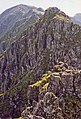
 Aonach Eagach - geograph.org.uk - 1011123.jpg 640 × 373; 66 KB
-
 Aonach Eagach - geograph.org.uk - 1011143.jpg 435 × 640; 154 KB
-
 B863 on North side of Loch Leven - geograph.org.uk - 21923.jpg 640 × 462; 126 KB
-
 B863 on North side of Loch Leven - geograph.org.uk - 21926.jpg 640 × 472; 126 KB
-
 B863 on North side of Loch Leven - geograph.org.uk - 21927.jpg 640 × 463; 118 KB
-
 B863 on North side of Loch Leven - geograph.org.uk - 21928.jpg 640 × 493; 108 KB
-
 B863 on South Side of Loch Leven - geograph.org.uk - 21971.jpg 640 × 476; 136 KB
-
 B863 on South Side of Loch Leven - geograph.org.uk - 21972.jpg 640 × 467; 148 KB
-
 Clachaig and the gully - geograph.org.uk - 221482.jpg 640 × 480; 109 KB
-
 Dinner Time Buttress , Glencoe - geograph.org.uk - 84749.jpg 429 × 640; 146 KB
-
 Entering Glencoe from the south. - geograph.org.uk - 222869.jpg 541 × 640; 68 KB
-
 Glen Coe - geograph.org.uk - 13893.jpg 640 × 339; 145 KB
-
 Glen Coe - geograph.org.uk - 645844.jpg 427 × 640; 63 KB
-
 Glen Coe and Loch Leven - geograph.org.uk - 693355.jpg 640 × 427; 30 KB
-
 Glencoe Hostel - geograph.org.uk - 307981.jpg 640 × 480; 84 KB
-
 Lairigmor - geograph.org.uk - 22200.jpg 640 × 480; 83 KB
-

-
 Loch Achtriochtan in Glencoe - geograph.org.uk - 107435.jpg 640 × 480; 140 KB
-
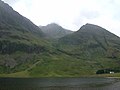 Loch Achtriochtan, Pass of Glen Coe. - geograph.org.uk - 18792.jpg 640 × 480; 83 KB
-

-
 Loch Leven, The Narrows - geograph.org.uk - 97088.jpg 640 × 424; 65 KB
-
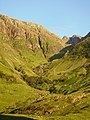
 Looking into 'The Pass of Glencoe' - geograph.org.uk - 503.jpg 640 × 480; 54 KB
-
 Office view of the Pap of Glenoce - geograph.org.uk - 107029.jpg 640 × 480; 58 KB
-
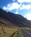
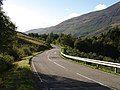
 Old Road, Glen Coe - geograph.org.uk - 221495.jpg 640 × 480; 58 KB
-

-
 River Coe by Red Squirrel camp-site - geograph.org.uk - 27375.jpg 640 × 480; 52 KB
-
 Upper reaches of Loch Leven - geograph.org.uk - 362330.jpg 640 × 458; 58 KB
-
 West face of Aonach Dubh - geograph.org.uk - 221487.jpg 640 × 429; 74 KB
-
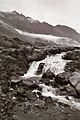
 Allt na Lairige Mòire - geograph.org.uk - 509827.jpg 640 × 480; 50 KB
-
 Approach to Coire nam Beithach - geograph.org.uk - 1057092.jpg 800 × 600; 240 KB
-
 B863 near Caolasnacon - geograph.org.uk - 559599.jpg 640 × 480; 85 KB
-
 B863 on North side of Loch Leven - geograph.org.uk - 21925.jpg 640 × 480; 162 KB
-
 B863 on South Side of Loch Leven - geograph.org.uk - 21973.jpg 640 × 468; 172 KB
-
 B863 on South Side of Loch Leven - geograph.org.uk - 21974.jpg 640 × 474; 184 KB
-
 Beinn a' Bheithir - geograph.org.uk - 267872.jpg 640 × 454; 72 KB
-
 Burial ground near Kinlochleven - geograph.org.uk - 21922.jpg 640 × 465; 124 KB
-
 Coire a' Mhuilinn - geograph.org.uk - 728128.jpg 640 × 480; 73 KB
-
 Coire Dearg - geograph.org.uk - 735776.jpg 480 × 640; 91 KB
-
 Coire nam Beitheach - geograph.org.uk - 106401.jpg 640 × 440; 64 KB
-
 Coire nam Beithteach - geograph.org.uk - 221494.jpg 480 × 640; 102 KB
-
 Crags, Coire a' Mhuillin - geograph.org.uk - 737660.jpg 640 × 480; 52 KB
-
 From Pap of Glencoe - geograph.org.uk - 230716.jpg 640 × 480; 86 KB
-
 Glen coe - geograph.org.uk - 275935.jpg 640 × 480; 95 KB
-
 Glencoe - geograph.org.uk - 292848.jpg 640 × 425; 71 KB
-
 Glencoe - geograph.org.uk - 335816.jpg 422 × 640; 48 KB
-
 Glencoe and River Coe - geograph.org.uk - 37733.jpg 640 × 433; 74 KB
-
 Glencoe Camping Club Campsite - geograph.org.uk - 38616.jpg 360 × 480; 34 KB
-
 Head of Coire Carach - geograph.org.uk - 735750.jpg 640 × 480; 68 KB
-
 Headwall of Coire Dearg - geograph.org.uk - 735761.jpg 640 × 480; 72 KB
-
 Lairig Mòr - geograph.org.uk - 736526.jpg 640 × 480; 85 KB
-
 Lairig Mòr - geograph.org.uk - 736540.jpg 640 × 480; 94 KB
-
 Lairig Mòr - geograph.org.uk - 737644.jpg 640 × 480; 69 KB
-
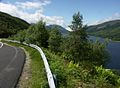
 Loch Leven - geograph.org.uk - 677120.jpg 1,000 × 667; 334 KB
-
 Meall a' Chaorainn - geograph.org.uk - 238826.jpg 640 × 480; 95 KB
-
 Mullach nan Coirean - geograph.org.uk - 267877.jpg 640 × 448; 78 KB
-

-
 Passing place with a heart - geograph.org.uk - 418418.jpg 640 × 507; 115 KB
-
 River Coe - geograph.org.uk - 221490.jpg 640 × 480; 112 KB
-
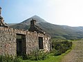
 Ruined croft - geograph.org.uk - 40795.jpg 640 × 480; 138 KB
-
 Setting Sun on Mullach nan Coirean - geograph.org.uk - 565502.jpg 640 × 427; 268 KB
-
 Setting Sun on Mullach nan Coirean - geograph.org.uk - 565511.jpg 640 × 427; 336 KB
-

-
 Summit Cairn. - geograph.org.uk - 267880.jpg 640 × 448; 89 KB
-
 The summit of Mam na Gualinn - geograph.org.uk - 87443.jpg 640 × 457; 113 KB
-
 Track at Achnacon - geograph.org.uk - 259250.jpg 640 × 480; 56 KB
-
 View East from Mam na Gualainn - geograph.org.uk - 364356.jpg 640 × 447; 82 KB
-
 View North West from Mam na Gualainn - geograph.org.uk - 364535.jpg 640 × 445; 75 KB
-

-
 View over Kinlochleven. - geograph.org.uk - 364588.jpg 640 × 448; 72 KB
-
 View South from Mam na Gualainn - geograph.org.uk - 364604.jpg 640 × 440; 57 KB
-
 View West from Mam na Gualainn - geograph.org.uk - 364488.jpg 640 × 454; 78 KB


