Category:Carmyllie
Jump to navigation
Jump to search

village in Angus, Scotland, UK  | |||||
| Upload media | |||||
| Instance of | |||||
|---|---|---|---|---|---|
| Location |
| ||||
 | |||||
English: Carmyllie ( Gaelic: Càrn Mhoillidh) is a rural parish in Angus, Scotland. It is situated on high ground between Arbroath, on the coast, and the inland county town of Forfar. The main settlements in the parish are Redford, Greystone and Milton of Carmyllie. There is a Church of Scotland church and a primary school.
Gàidhlig: 'S e baile-beag ann an Aonghas a th' ann an Càrn Mhoillidh (Beurla: Carmyllie). 'S e seo na co-chomharran aige: 56° 34′ 6.11″ Tuath agus 2° 43′ 53.67″ Iar.
Subcategories
This category has the following 6 subcategories, out of 6 total.
C
- Carmyllie East Parish School (1 F)
- Carmyllie Parish Kirk (10 F)
G
- Greystone, Angus (7 F)
R
- Redford, Angus (30 F)
W
Media in category "Carmyllie"
The following 82 files are in this category, out of 82 total.
-
 At the End of Cairncortie Wood - geograph.org.uk - 763448.jpg 640 × 427; 181 KB
-
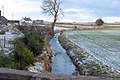
 B9127 near Carmyllie - geograph.org.uk - 3289722.jpg 1,200 × 797; 311 KB
-
 B9128 - geograph.org.uk - 1437591.jpg 640 × 480; 87 KB
-
 B9128 passing Pitlivie Wood - geograph.org.uk - 121119.jpg 424 × 640; 129 KB
-
 Backboath Farm - geograph.org.uk - 148578.jpg 640 × 475; 72 KB
-
 Barley harvest, Carmyllie - geograph.org.uk - 5907474.jpg 1,024 × 683; 325 KB
-
 Barley, Carmyllie - geograph.org.uk - 3610291.jpg 640 × 480; 284 KB
-
 Barley, Carmyllie - geograph.org.uk - 3610298.jpg 640 × 480; 261 KB
-
 Blackden Bridge near Denhead of Arbirlot - geograph.org.uk - 1165995.jpg 640 × 434; 106 KB
-
 Cairncortie Farm Road - geograph.org.uk - 127333.jpg 640 × 475; 82 KB
-
 Cairncortie Wood - geograph.org.uk - 763459.jpg 640 × 427; 203 KB
-
 Carmyllie and District War Memorial - geograph.org.uk - 4603695.jpg 640 × 481; 40 KB
-
 Carmyllie Community Hall - geograph.org.uk - 155099.jpg 640 × 475; 62 KB
-
 Carmyllie farmland - geograph.org.uk - 5126131.jpg 640 × 480; 39 KB
-
 Carmyllie Hall - geograph.org.uk - 1048413.jpg 640 × 427; 77 KB
-
 Carmyllie Hall - geograph.org.uk - 5167875.jpg 640 × 480; 70 KB
-
 Carmyllie Hall, Carmyllie - geograph.org.uk - 5016398.jpg 4,587 × 3,439; 4.47 MB
-
 Carmyllie Moor - geograph.org.uk - 5907442.jpg 1,024 × 683; 156 KB
-
 Carmyllie Parish Church - geograph.org.uk - 6358965.jpg 5,184 × 3,888; 6.5 MB
-
 Carmyllie station geograph-3128783-by-Ben-Brooksbank.jpg 2,389 × 1,346; 2.97 MB
-
 Carmyllie War Memorial - geograph.org.uk - 6358961.jpg 5,184 × 3,888; 5.25 MB
-
 Combine, Carmyllie Moor - geograph.org.uk - 5907428.jpg 1,024 × 683; 337 KB
-
 Combine, Carmyllie Moor - geograph.org.uk - 5907433.jpg 1,024 × 683; 349 KB
-
 Cononsyth Crossroads, Angus - geograph.org.uk - 669638.jpg 640 × 475; 52 KB
-

-

-
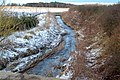
 Drainage stream near Carmyllie - geograph.org.uk - 3289724.jpg 1,200 × 797; 385 KB
-

-
 Dusty Drum - geograph.org.uk - 763474.jpg 640 × 427; 293 KB
-
 East Hills - geograph.org.uk - 701191.jpg 640 × 372; 188 KB
-
 Farm diversification, Milton of Carmyllie - geograph.org.uk - 11459.jpg 640 × 480; 108 KB
-
 Farm sign, Mains of Carmyllie - geograph.org.uk - 5907997.jpg 1,024 × 1,024; 437 KB
-
 Farm track to Dusty Drum and Goats - geograph.org.uk - 5125999.jpg 640 × 480; 38 KB
-
 Farm track to Muirhead - geograph.org.uk - 11461.jpg 640 × 480; 130 KB
-
 Farmland at Carmyllie - geograph.org.uk - 4509694.jpg 640 × 480; 87 KB
-
 Farmland at Mains of Carmyllie - geograph.org.uk - 5126765.jpg 640 × 480; 40 KB
-
 Fields and Shed - geograph.org.uk - 148600.jpg 640 × 475; 72 KB
-
 Fields at the Guynd - geograph.org.uk - 763493.jpg 640 × 427; 296 KB
-
 Goats - geograph.org.uk - 763481.jpg 427 × 640; 326 KB
-
 Guynd Home Farm - geograph.org.uk - 1165090.jpg 640 × 428; 70 KB
-
 Harbour Den - geograph.org.uk - 763557.jpg 640 × 427; 286 KB
-
 Harvested barley, Carmyllie - geograph.org.uk - 5907459.jpg 1,024 × 683; 375 KB
-
 Harvesting at Mains of Carmyllie - geograph.org.uk - 5126766.jpg 640 × 480; 51 KB
-

-
 Mains of Carmyllie - geograph.org.uk - 5907987.jpg 1,024 × 683; 232 KB
-
 Milton Haugh - geograph.org.uk - 5126121.jpg 640 × 480; 51 KB
-
 Milton Haugh, Carmyllie - geograph.org.uk - 663557.jpg 640 × 480; 76 KB
-
 Montquhir - geograph.org.uk - 3610303.jpg 640 × 480; 288 KB
-
 Newton of Carmyllie Farm - geograph.org.uk - 5126602.jpg 640 × 480; 98 KB
-
 Road to Carmyllie Church - geograph.org.uk - 5126606.jpg 640 × 480; 44 KB
-
 Stubble, Carmyllie Hill - geograph.org.uk - 5907989.jpg 1,024 × 683; 334 KB
-
 The dreaded Rhododendron. - geograph.org.uk - 470544.jpg 640 × 589; 86 KB
-
 Unclassified road at Carmyllie - geograph.org.uk - 4509691.jpg 640 × 480; 79 KB
-
 View of Black Burn downstream - geograph.org.uk - 1165997.jpg 640 × 427; 119 KB
-
 View of Black Burn upstream - geograph.org.uk - 1165998.jpg 640 × 426; 114 KB
-
-
-
 View of Grampian Mountains - geograph.org.uk - 1152241.jpg 640 × 428; 70 KB
-
 View of Lochlair Farm - geograph.org.uk - 1048425.jpg 640 × 427; 68 KB
-
 Warning to actors - geograph.org.uk - 3610295.jpg 640 × 480; 309 KB
-
 Cabbages, Ruined Barn and Two Masts - geograph.org.uk - 127325.jpg 640 × 475; 91 KB
-
 Cairnconnon Hill - geograph.org.uk - 170916.jpg 640 × 480; 75 KB
-
 Carmyllie Moor - geograph.org.uk - 291738.jpg 640 × 481; 91 KB
-
 Carmyllie Slate Quarry - geograph.org.uk - 155100.jpg 475 × 640; 82 KB
-
 East Hills Farmhouse - geograph.org.uk - 291732.jpg 640 × 481; 83 KB
-
 Field of Brassicas - geograph.org.uk - 155080.jpg 640 × 475; 111 KB
-

-
-
 Grazing and Greenford - geograph.org.uk - 127324.jpg 640 × 475; 65 KB
-
 Guynd Den - geograph.org.uk - 763517.jpg 640 × 427; 318 KB
-
 Hassocks - geograph.org.uk - 228183.jpg 640 × 480; 74 KB
-
 Home Farm - geograph.org.uk - 291730.jpg 640 × 481; 100 KB
-
 Junction at Denhead of Arbirlot - geograph.org.uk - 85491.jpg 640 × 480; 111 KB
-
 Letham - Arbroath Road and Field - geograph.org.uk - 148593.jpg 640 × 475; 63 KB
-
 Looking north along the B961. - geograph.org.uk - 121195.jpg 640 × 424; 65 KB
-

-
-
 Park Conon - geograph.org.uk - 228180.jpg 640 × 480; 120 KB
-
 Road to Grange of Conon - geograph.org.uk - 228182.jpg 640 × 480; 77 KB
-
 Road to Redford - geograph.org.uk - 148610.jpg 640 × 475; 70 KB
-
 Track to Milton of Conon - geograph.org.uk - 155102.jpg 640 × 475; 67 KB
-
 Woodland and Ploughed Field - geograph.org.uk - 148606.jpg 640 × 475; 69 KB


_-_geograph.org.uk_-_1047847.jpg)


_-_geograph.org.uk_-_121203.jpg)


