Category:Carlton, County Durham
Jump to navigation
Jump to search
English: Carlton is a village and civil parish in the county of County Durham, England.
village in County Durham, England  | |||||
| Upload media | |||||
| Instance of | |||||
|---|---|---|---|---|---|
| Location | Stockton-on-Tees, Tees Valley, North East England, England | ||||
| Population |
| ||||
 | |||||
Media in category "Carlton, County Durham"
The following 18 files are in this category, out of 18 total.
-
 Bus shelter in Letch Lane - geograph.org.uk - 1748651.jpg 3,088 × 2,056; 2.84 MB
-
 Carlton Methodist Church - geograph.org.uk - 3293790.jpg 1,196 × 764; 221 KB
-
 Carlton Methodist Church.jpg 640 × 480; 68 KB
-
 Castle Eden Branch trackbed - geograph.org.uk - 5076893.jpg 1,024 × 683; 428 KB
-
 Chapel Gardens, Carlton - geograph.org.uk - 167258.jpg 640 × 480; 89 KB
-
 Coalgarth Farm - geograph.org.uk - 3293818.jpg 1,200 × 900; 265 KB
-
 Coalgarth Farm on Redmarshall Road - geograph.org.uk - 1748607.jpg 3,088 × 2,056; 3.58 MB
-
 Cottages on Thorpe Road, Carlton - geograph.org.uk - 3293800.jpg 1,200 × 900; 255 KB
-
 Farmland off Thorpe Road - geograph.org.uk - 3293797.jpg 1,200 × 900; 281 KB
-
 Field of pylons - geograph.org.uk - 3293789.jpg 1,200 × 900; 255 KB
-
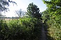
 Letch Lane - geograph.org.uk - 3293788.jpg 640 × 480; 56 KB
-
 Redmarshall station site geograph-3977023-by-Ben-Brooksbank.jpg 2,331 × 1,482; 4.82 MB
-
 Sheds at Hall Farm - geograph.org.uk - 6209863.jpg 2,000 × 1,333; 247 KB
-
 The Carrs Angling Lakes - geograph.org.uk - 1748603.jpg 3,088 × 2,056; 3.04 MB
-
 Thorpe Road leaving Carlton - geograph.org.uk - 3293798.jpg 640 × 480; 76 KB
-
 Thorpe Road, Carlton - geograph.org.uk - 3293796.jpg 1,200 × 900; 281 KB
-
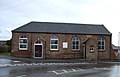
 W.I. Hall, Carlton - geograph.org.uk - 3293799.jpg 640 × 480; 58 KB
-
 Whitton Road at Hall Farm - geograph.org.uk - 6209869.jpg 2,000 × 1,333; 391 KB


