Category:Carliol House, Newcastle upon Tyne
Jump to navigation
Jump to search
| Object location | | View all coordinates using: OpenStreetMap |
|---|
Office building in Newcastle upon Tyne, Tyne and Wear, England, UK .jpg) | |||||
| Upload media | |||||
| Instance of | |||||
|---|---|---|---|---|---|
| Location | Newcastle upon Tyne, Tyne and Wear, North East England, England | ||||
| Heritage designation |
| ||||
 | |||||
Media in category "Carliol House, Newcastle upon Tyne"
The following 4 files are in this category, out of 4 total.
-
 Carliol House (geograph 2848296).jpg 768 × 1,024; 170 KB
-
 Carliol House monogram (geograph 2848303).jpg 640 × 480; 62 KB
-
 Carliol house.JPG 2,592 × 3,888; 3.6 MB
-
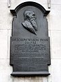 Commemorative plaque to Sir Joseph Swan (geograph 1679617).jpg 768 × 1,024; 185 KB
.jpg)

.jpg)