Category:Carlecotes
Jump to navigation
Jump to search
English: Carlecotes is a village in the metropolitan borough of Barnsley in South Yorkshire, England, on the edge of the Peak District National Park. It is situated about 5 miles west of Penistone, in the township of Thurlstone.
village in South Yorkshire, England, UK  | |||||
| Upload media | |||||
| Instance of | |||||
|---|---|---|---|---|---|
| Location | Dunford, Barnsley, South Yorkshire, Yorkshire and the Humber, England | ||||
 | |||||
Subcategories
This category has only the following subcategory.
A
Media in category "Carlecotes"
The following 7 files are in this category, out of 7 total.
-
 Cote Bank Bridge, Soughley, Dunford - geograph.org.uk - 1270138.jpg 640 × 480; 188 KB
-
 Footpath to Thurlstone Moors - geograph.org.uk - 1764103.jpg 640 × 480; 164 KB
-
 Sheepfolds near Lower Cat Clough - geograph.org.uk - 1764099.jpg 640 × 480; 146 KB
-
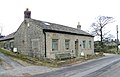 The old school, Carlecotes, Dunford - geograph.org.uk - 716922.jpg 640 × 410; 59 KB
-

-
 Bridleway, Carlecotes, Dunford - geograph.org.uk - 751319.jpg 640 × 371; 49 KB
-
 Brook Hill Lane - geograph.org.uk - 1462779.jpg 640 × 480; 79 KB


